


What can you do to protect yourself during a tornado?
The U.S. has more tornadoes a year than any other country and approximately 60 related deaths on average per year. Here are some tips that could keep you safe during twisters.
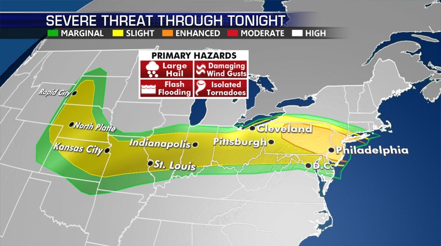
Tens of millions of Americans are under the threat of severe storms Wednesday, from the Ohio Valley into the Northeast and Mid-Atlantic.
The National Weather Service's (NWS) Storm Prediction Center (SPC) highlighted a corridor where violent weather is possible from the central Plains through the Midwest, to the East Coast
Large hail, damaging winds and isolated tornadoes could come throughout the day, so residents in those areas should remain on alert to potential watches and warnings.
TORNADO COUNT IN MAY THE LOWEST IN DECADES AFTER BUSY AND DEADLY APRIL
The SPC said that more than 83 million are at risk of seeing severe weather, with an enhanced risk for parts of Pennsylvania into New Jersey and the New York City metro area.
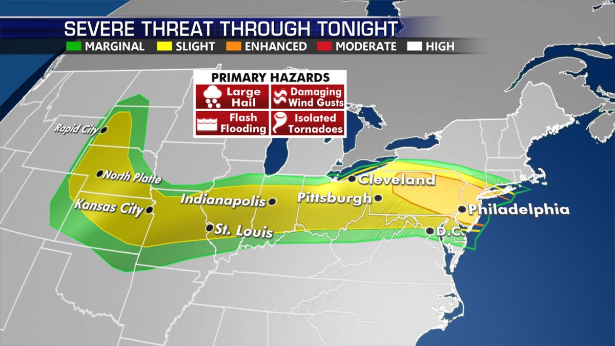
An enhanced risk of severe weather on Wednesday extends from Pennsylvania into New Jersey and the New York City metro area. (Fox News)
Storms are expected from the early afternoon into the evening hours in the New York City area, with damaging winds forecast to develop.
Across the Midwest, "briefly intense" thunderstorms capable of strong downburst winds and hail are expected in the afternoon hours.
WHERE DO TORNADOES HIT THE MOST IN THE US? HERE ARE THE TOP 5 STATES
Cities that likely will see strong storms include Kansas City, St. Louis, Indianapolis, Columbus, Pittsburgh, Philadelphia. A stray strong storm is also possible in Washington.
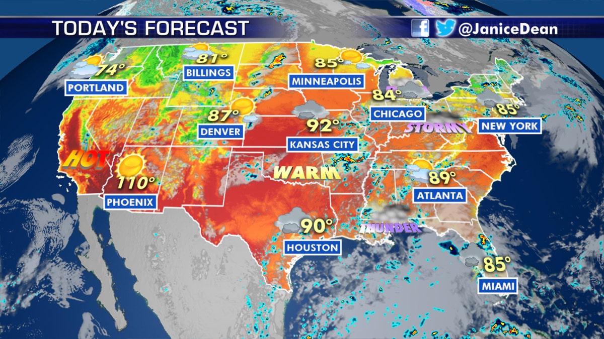
Severe thunderstorms are possible on Wednesday in the Plains, Midwest, and into the Mid-Atlantic and Northeast. (Fox News)
Thunderstorms are expected to develop across parts of Nebraska and northern Kansas will present a damaging wind threat, forecasters at the SPC advise.
CLICK HERE FOR MORE WEATHER COVERAGE FROM FOX NEWS
Scattered severe thunderstorms are also possible in the Plains Thursday.