


National forecast for Friday, September 4
Fox News senior meteorologist Janice Dean has your FoxCast.
Computer models are showing Friday that at least one of the several systems coming off the coast of Africa have the potential to get close the U.S. later next week — something we will have to closely monitor as we are heading into peak hurricane season.
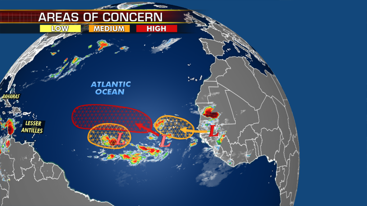
At least one of these storm systems could get near the U.S., according to computer models. (Fox News)
Record-setting heat will be dangerous for much of the U.S. today through the weekend.
Temperatures will soar 20-25 degrees above average over California and parts of the Southwest, while excessive heat warnings are in effect for the next several days.
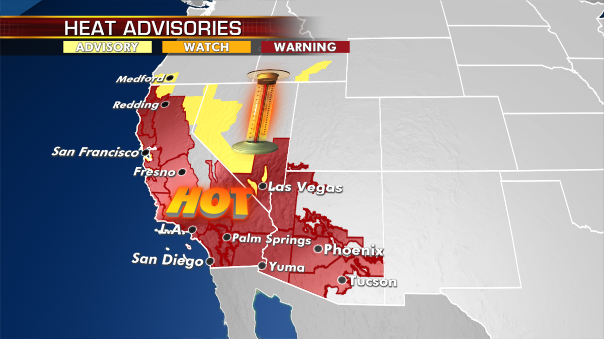
Temperatures are expected to soar across California and parts of the southwestern U.S. (Fox News)
Red flag warnings are also up as the hot and dry conditions will bring the potential for fire danger.
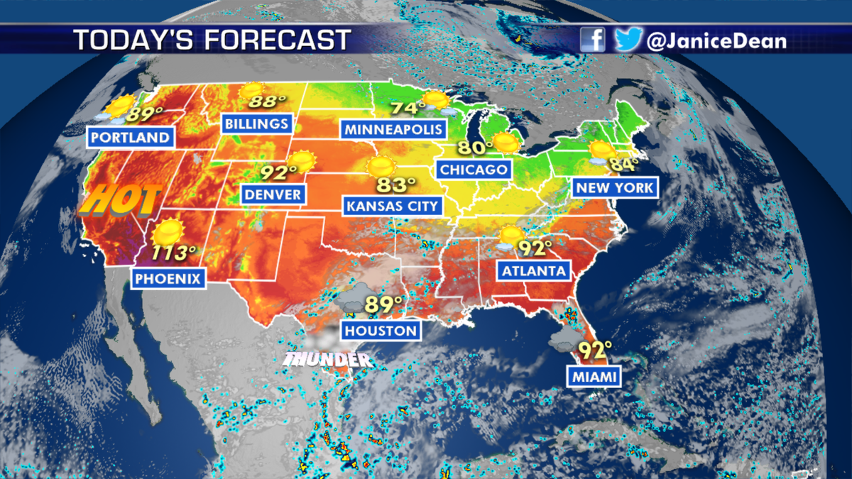
The national forecast for Sep. 4, 2020. (Fox News)
A frontal boundary draped from the Northeast down into the southern Plains will be the focus for showers, thunderstorms and the risk of flash flooding through the weekend. Cooler, drier air will dip into the Midwest, Great Lakes and parts of the Eastern U.S.
CLICK HERE TO GET THE FOX NEWS APP
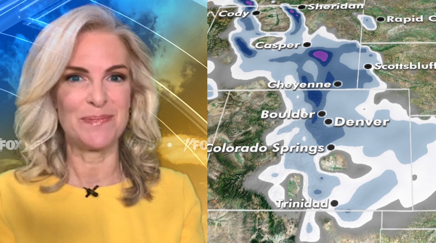
Speaking of cooler air, we’ve got an amazing turnaround over the northern and central Rockies over the next few days. The first measurable snow is forecast next week. Denver will go from 99 degrees on Saturday to 37 degrees overnight into Tuesday morning, with snow in the forecast.
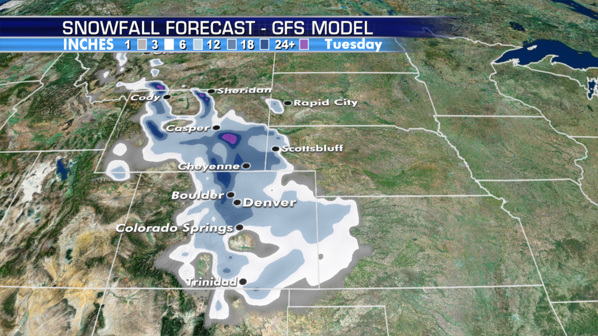
Denver is forecast to see snowfall next week. (Fox News)
Kentucky Derby weather will be spectacular, with post time temperatures in the upper 70s on Saturday and sunshine all day long.

True Crime
The hottest stories ripped from the headlines, from crime to courts, legal and scandal.
By entering your email and clicking the Subscribe button, you agree to the Fox News Privacy Policy and Terms of Use, and agree to receive content and promotional communications from Fox News. You understand that you can opt-out at any time.
