


The week begins with another day of potentially record-breaking warmth across the Southwest and parts of the Central U.S.
Temperatures will approach 100 degrees in the Southwest and get into the 80s as far north as South Dakota and Minnesota. That warmth continues and shifts slightly to the east on Tuesday.
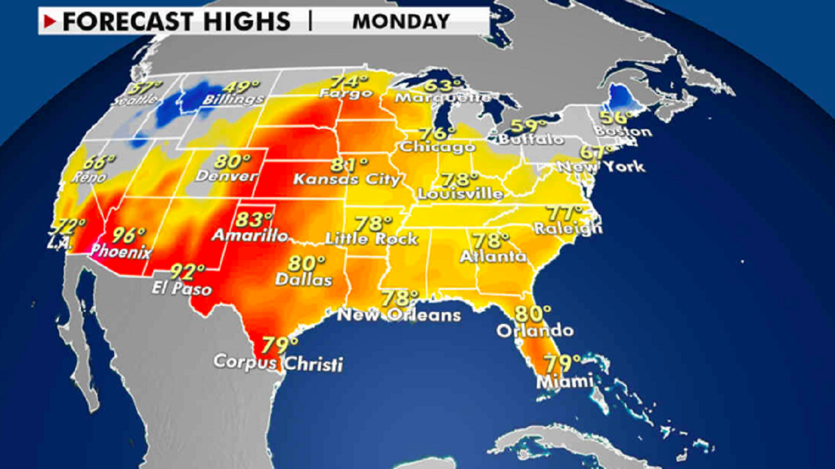
High temperatures for Monday, April 5. (Fox News)
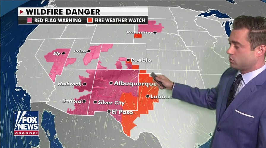
Otherwise, the heat combined with dry conditions and gusty winds brings potential fire danger.
FLORIDA WORKS TO AVOID ‘CATASTROPHIC’ POND COLLAPSE
An elevated risk for fires is in place across Nevada, Arizona, New Mexico and into west Texas. Some additional Red Flag warnings have been issued as far north as South Dakota.
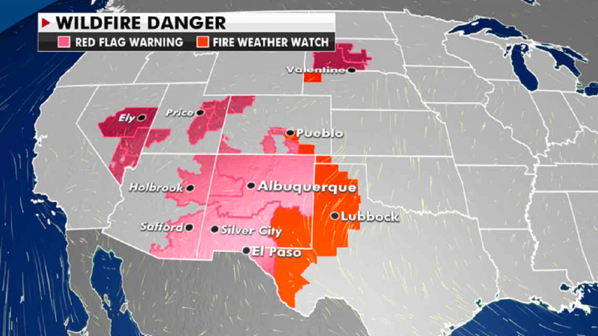
Current wildfire danger in the Southwestern U.S. (Fox News)
The next best chance for severe weather arrives on Tuesday when a storm system will move into the Central U.S.
CLICK HERE TO GET THE FOX NEWS APP
This will lead to a pattern of heavy rain and thunderstorms across portions of the Plains and Mississippi Valley into the middle of the week.
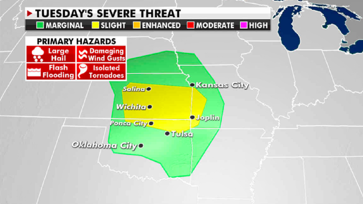
Potential severe weather is forecast for Tuesday. (Fox News)
For Tuesday, the National Weather Service’s Storm Prediction Center has issued a slight risk for severe weather over most of Kansas. Severe thunderstorms with heavy rain, strong winds and hail are the main threats.