


Fox News Flash top headlines for September 22
Fox News Flash top headlines are here. Check out what's clicking on Foxnews.com.
It’s not every day that a small hamlet in the Missouri Ozarks is in the middle of everything, but that was the case for tiny Wright County on Wednesday as officials from the nation’s capital unveiled a marker designating a spot there as the center of population in the United States.
Dignitaries from the National Oceanic and Atmospheric Administration and the U.S. Census Bureau, including the agency’s director, Robert Santos, celebrated the debut of the red granite marker in Hartville. With a population of 594 in 2020, the county seat is 14.6 miles (23.5 kilometers) from the actual spot calculated following the 2020 census.
DEMS VOTE TO BOOST CENSUS BUREAU POWERS IN BID TO BLOCK CITIZENSHIP QUESTIONS
"You’ll be famous for this wonderful designation for the rest of our nation’s history," Santos told local officials at a ceremony. "And you will have bragging rights for the rest of this decade! Not bad."
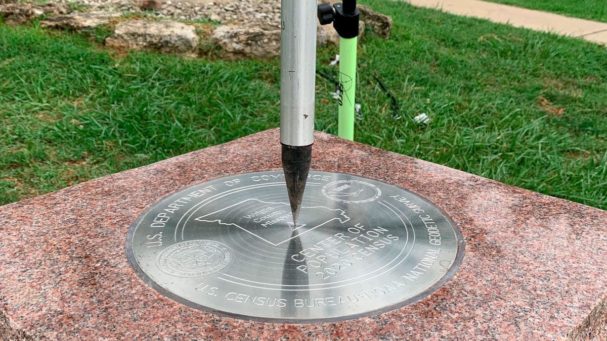
The tip of a tripod rests on the center of the 2020 Center of Population Commemorative Survey mark on Sept. 14, 2022, in Hartville, Missouri. (NOAA via AP)
Bypassed by interstate highways and railroads, Hartville doesn’t have a big tax base or large industry. The local school, a nursing home, a gas station and the Dollar General store are the largest employers.
MISSOURI MAN IN PRISON CHARGED IN 'PACKAGE KILLER' MURDERS FROM DECADES AGO: REPORT
The nation’s population center is calculated every 10 years after the once-a-decade census shows where people are living. The heart of America has been in Missouri since 1980. Previously located in Plato, in the neighboring county, it moved only 11.8 miles (19 kilometers) southwest from 2010 to 2020. It is the smallest distance shift in 100 years and the second-smallest in U.S. history.
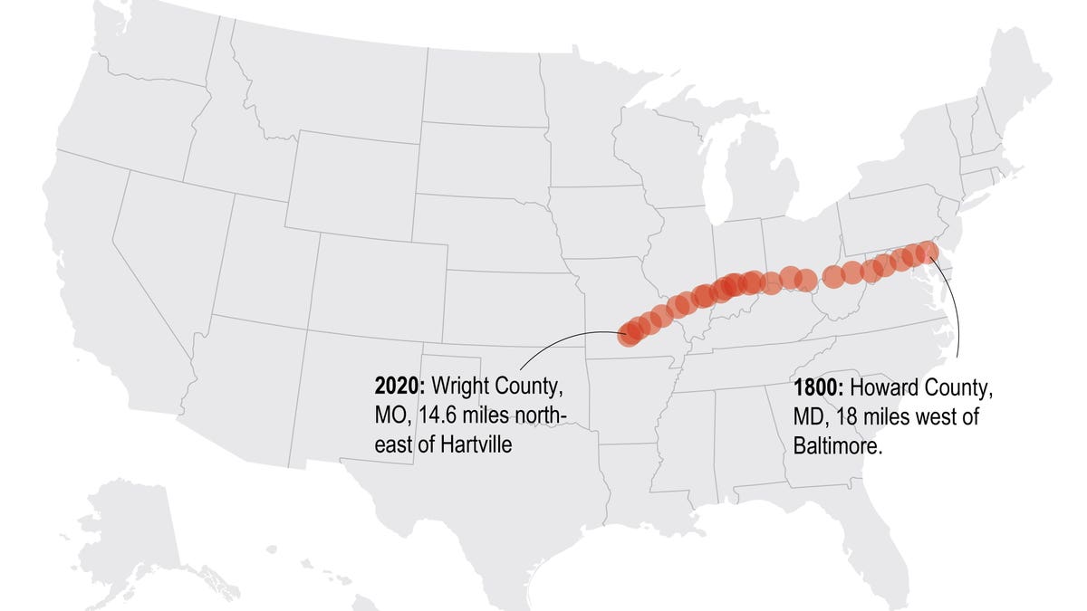
The Census has calculated the mean center of the population of the United States every decade since 1790. (Associated Press)
To calculate the center of the U.S., the Census Bureau figures out which spot would be "the balance point" if the 50 states were located on an imaginary, flat surface with weights of identical size – each representing the location of one person – placed on it.