


Get all the latest news on coronavirus and more delivered daily to your inbox. Sign up here.
After days of unseasonable cold across the eastern half of the U.S. thanks to an appearance by the polar vortex, a warm change is on the way while the threat for severe weather returns to the central part of the country.
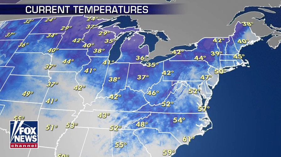
Widespread freeze warnings and frost advisories still stretch from the Great Lakes to the interior Northeast, with one more cold night on tap for inland locations after places such as New York City saw a chilly morning on Tuesday
"A little bit of warmer weather is on the way," Fox News meteorologist Adam Klotz said Monday on "Fox & Friends."
Several locations in the Great Lakes, upstate New York, and northern New England reported temperatures in the low 40s and upper 30s to start the day on Tuesday.
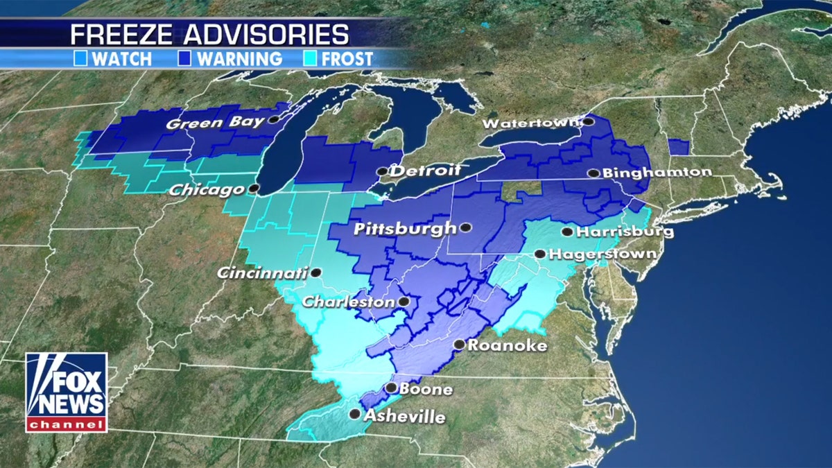
Freeze warnings and advisories are still in the Great Lakes and Northeast due to persistent cold conditions. (Fox News)
"That cold air that's hung around over the last four or five days, finally beginning to break down," Klotz said Tuesday. "This morning, our last really cold morning, temperatures getting more seasonal in the next couple of days."

Freeze warnings and advisories are still in the Great Lakes and Northeast due to persistent cold conditions. (Fox News)
High temperatures on Tuesday are forecast for the upper 50s into the low 60s across the region.
ALASKA SEES 80-DEGREE HEAT WHILE EAST BLASTED WITH RECORD COLD AND SNOW: HERE'S WHY
The National Weather Service (NWS) Weather Prediction Center (WPC) said that temperatures will remain chilly for mid-May until a warm front moves north by Thursday, allowing temperatures to rebound.
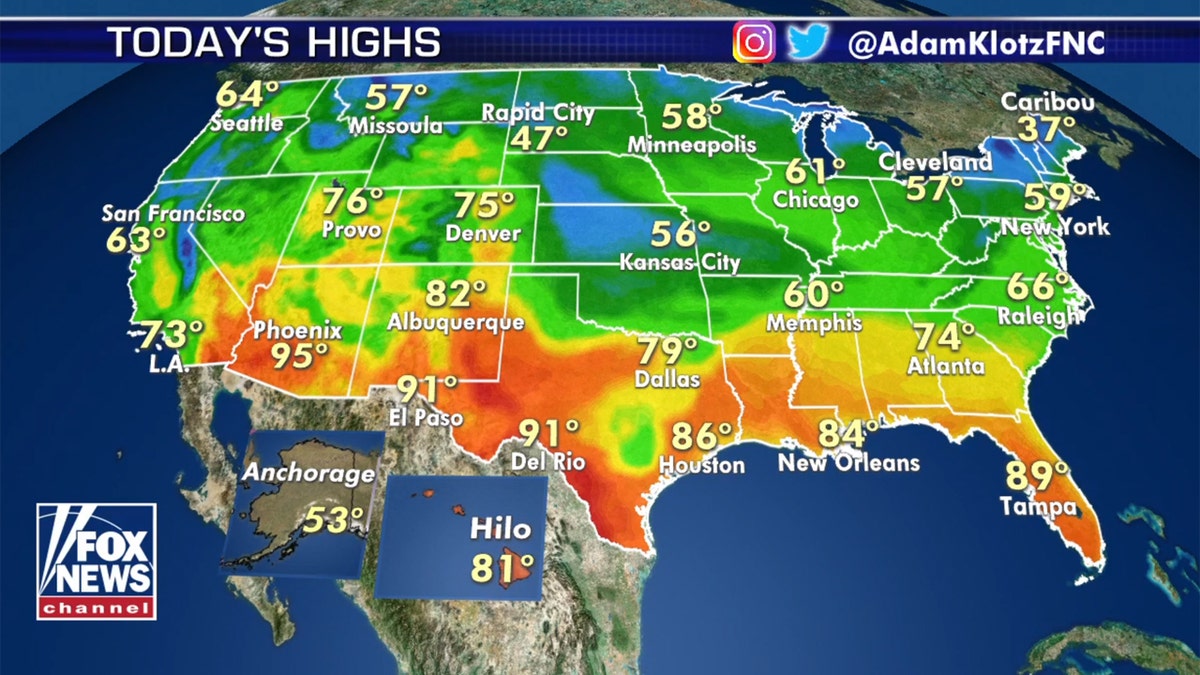
Temperatures will moderate in the Northeast started midweek. (Fox News)
"In addition to the warmer temperatures, much of the East Coast can expect little in the way of precipitation thanks to the influence of high-pressure overhead," forecasters said.
Severe thunderstorm threat returns to the Plains on Wednesday

The threat for severe weather for the Plains returns on Tuesday. (Fox News)
As temperatures finally begin to moderate in the East, a system moving into the Plains midweek will bring a new threat for severe weather across the Central and Southern Plains.
"So the focus on this Tuesday becomes the potential for some severe weather right across the Plains states," Klotz said. "We're looking at an area from North Texas up into Oklahoma, running all the way through Kansas."
WHERE DO TORNADOES HIT THE MOST IN THE US? HERE ARE THE TOP 5 STATES
On Tuesday, the NWS Storm Prediction Center (SPC) said a slight risk exists for areas such as Austin and San Antonio.
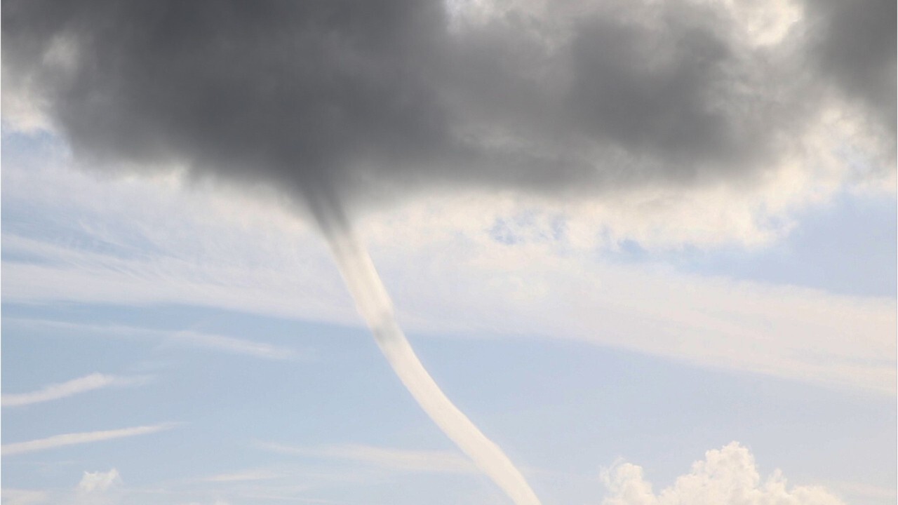
What can you do to protect yourself during a tornado?
The U.S. has more tornadoes a year than any other country and approximately 60 related deaths on average per year. Here are some tips that could keep you safe during twisters.
"You could be talking about some big thunderstorms by this afternoon," Klotz said on "Fox & Friends First."
The main threats for isolated storms on Tuesday include isolated large hail, heavy rain and damaging wind gusts from the afternoon into the evening hours. Isolated tornadoes are also possible.
So far in May, there have only been nine reported tornadoes after a busy April.
CLICK HERE FOR MORE WEATHER COVERAGE FROM FOX NEWS
A greater threat exists on Wednesday, where some 26 million Americans may see severe storms, with an enhanced risk for places such as Wichita Falls, Texas, and Lawton, Okla.

A greater threat of severe weather arrives in the region on Wednesday. (Fox News)
Large hail, damaging winds and isolated tornadoes are all likely on Wednesday.
CLICK HERE FOR THE FOX NEWS APP
"Maybe our best chance for severe weather just outside of Oklahoma City, portions of north Texas," Klotz said.
Fox News' Adam Klotz contributed to this report.