


3 killed, dozens injured in Texas tornado, a ‘terrible disaster’: Brian Murnahan
North Texas Red Cross’ Brian Murnahan describes the ‘devastation’ in the region and their clean-up efforts following the deadly Texas tornado.
Severe weather will bring associated threats in the Midwest and Northeast over the weekend.
Forecasters said thunderstorms with heavy rain will impact parts of the Dakotas, Minnesota and Wisconsin.
The National Weather Service's Weather Prediction Center issued a slight risk of excessive rainfall over parts of the northern Plains and upper Mississippi Valley through Sunday morning.
The rain there is projected to create localized areas of flash flooding.
FEMA DENIES ADDITIONAL AID FOR GEORGIA COUNTY HIT BY EF-3 TORNADO
Iowa and Missouri will see showers and severe thunderstorms, with a slight risk of severe storms issued over parts of the middle Mississippi Valley.
That area could see hazards, including frequent lightning, hail, severe thunderstorm wind gusts, hail and a few tornadoes.

In this aerial view, tornado damage to homes is seen on Country Road 16142 on June 19, 2023, in Louin, Mississippi. (Michael DeMocker/Getty Images)
Tornadoes in Mississippi killed one person and injured nearly two dozen others at the start of last week, leaving a trail of devastation.
There is also a threat of severe thunderstorm wind gusts of 65 knots or greater over parts of the region through Sunday morning.
The Weather Prediction Center also issued a marginal risk of excessive rainfall over parts of the Great Lakes, Ohio Valley, Tennessee Valley and lower Mississippi Valley from Sunday into Monday morning, also cautioning residents about localized flash flooding.
The threat of severe thunderstorms moves eastward, continuing over parts of Indiana, Ohio, Kentucky and Tennessee on Sunday.

Two boats go north on the Mississippi River as heavy smoke blankets downtown St. Paul, Minn., Wednesday June 14, 2023. (Jerry Holt/Star Tribune via Getty Images)
GALE WINDS, TORRENTIAL RAIN WREAK HAVOC ON PARTS OF NORTH DAKOTA
The Storm Prediction Center issued a slight risk of severe thunderstorms over parts of the Ohio and Tennessee Valley from Sunday and through Monday morning, with dangers including frequent lightning, a few tornadoes, hail and severe thunderstorm wind gusts.
There is also a threat of severe thunderstorm wind gusts of 65 knots or greater there through Monday morning.
Canadian wildfire smoke over parts of the upper Midwest and the Ohio Valley is prompting air quality warnings.
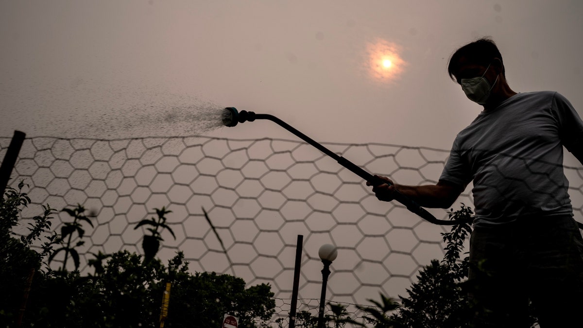
Nick Cobbett, wearing a mask waters vegetables at the Capital View communal garden as heavy smoke blankets nearby downtown St. Paul, Wednesday June 14, 2023, in St. Paul Minn. (Jerry Holt/Star Tribune via Getty Images)
While the Ohio Valley, Mid-Atlantic, Central Appalachians and Northeast are forecast to see showers and thunderstorms through late Saturday night, showers and thunderstorms are forecast Sunday over parts of the Northeast and Mid-Atlantic.
Heat continues for the southern U.S., including western Texas and New Mexico.

This photo taken on June 21, 2023, shows a temperature display reading 99 degrees Fahrenheit about 37.2 degrees Celsius in late afternoon in Houston, Texas. (Chen Chen/Xinhua via Getty Images)
CLICK HERE TO GET THE FOX NEWS APP
There are excessive heat warnings and heat advisories over southern nonwestern Texas, southern New Mexico, eastern Oklahoma and southwestern Louisiana.
Extreme heat in southern states has sent temperatures soaring into the triple digits.
Texas residents were asked by the state's power grid operator Tuesday to voluntarily cut back on electricity due to anticipated record demand on the system.