


Coming Up on 'Fox News Sunday': November 29
This week on 'Fox News Sunday,' President Trump says coronavirus vaccines could be distributed as early as next week and U.S. Surgeon General Dr. Jerome Adams weighs in on what we can expect heading into the new year.
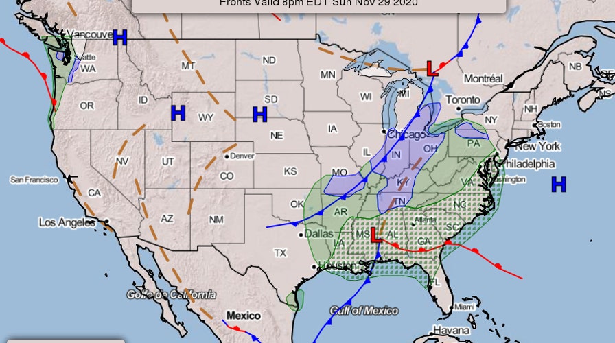
As the U.S. approaches the end of the Thanksgiving weekend, forecasters are eyeing a developing storm system along the northern Gulf Coast.
“A developing storm system tracking along the northern Gulf Coast Sunday will bring locally heavy rainfall, potential for flash flooding, and a few strong to severe thunderstorms across the south and southeast states,” the National Weather Service tweeted.
"Ample wind shear and a conditionally unstable atmosphere will create conditions for scattered severe weather today and this evening across the Gulf Coast and Southeast," added the National Weather Service, in a subsequent tweet. "Damaging winds and a few tornadoes are possible."
In a note released early Sunday, forecasters said that moderate to heavy rain will spread from the Deep South to the entire East Coast over the next couple of days. Severe thunderstorms are possible across the southeast and the mid-Atlantic coast, they added.
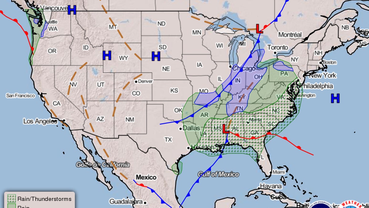
Weather map showing the developing storm system. (NOAA/NWS)
“Accumulating snow expected for parts of the Ohio Valley into the central and southern Appalachians later on Monday into Tuesday,” the National Weather Service said.
In the West, a wave of moisture is expected to reach the Pacific Northwest later on Sunday. “Rain and wind will be on the increase near the coast while snow is forecast to reach into the interior mountains today and into Monday as the front arrives,” the National Weather Service explained. “By Tuesday morning, some of the snow should move into the central Rockies.”
CLICK HERE TO GET THE FOX NEWS APP
Forecasters warned that an elevated risk of fire weather continues in Southern California. “The fire risk will remain elevated for much of the Coastal Ranges of southern California through Monday under a continued dry and breezy wind from the north and northeast,” they said.
Follow James Rogers on Twitter @jamesjrogers