


A stationary front extending from the Mississippi Valley westward to the Central and Southern Plains will bring rounds of sometimes severe storms to those regions through Wednesday morning.
Moisture from the Gulf of Mexico flowing north will help produce the daily showers and thunderstorms.
As a result, the Storm Prediction Center has issued a moderate risk of severe weather over parts of the Southern Plains until Tuesday morning.
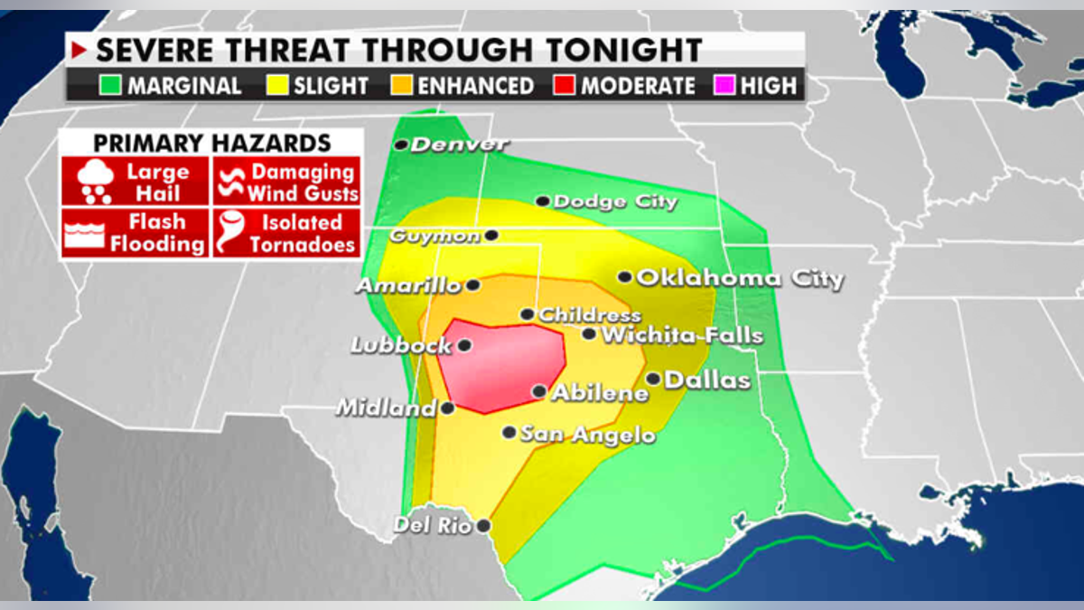
The severe weather risk for Monday. (Fox News)
HOW ‘STRAIGHT’ LIGHTNING COULD PROVE THE EXISTENCE OF DARK MATTER
The threats include frequent lightning, wind gusts, hail and a few tornados.
Additionally, there is a slight risk of excessive rainfall over parts of the Plains and Central Gulf Coast.
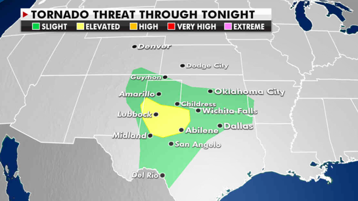
The current risk of tornados. (Fox News)
CLICK HERE TO GET THE FOX NEWS APP
The heavy rain associated with thunderstorms will produce areas of flash flooding. The flood threat continues across that region through Tuesday.
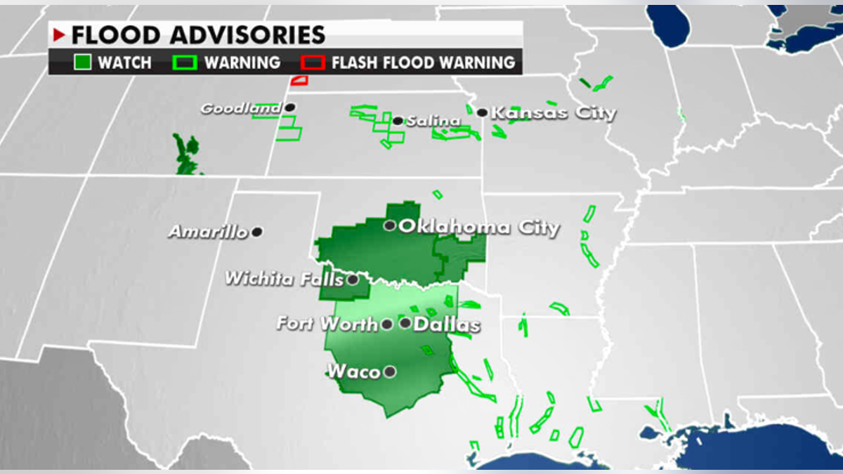
Flood advisories currently in effect. (Fox News)
In the Pacific Northwest, a front is moving onshore. Light rain will develop in the Northwest with wet snow at the highest elevations through Wednesday morning.