


National forecast for Friday, August 28
Fox News senior meteorologist Janice Dean has your FoxCast.
Tropical Depression Laura is weakening as it moves through the Mid-Mississippi Valley, Tennessee Valley and into the Ohio Valley on Friday.
On Saturday, what’s left of the system will move into the Mid-Atlantic. Heavy rain, strong winds and the risk of isolated severe storms will continue along its path until it exits the East Coast on Sunday.
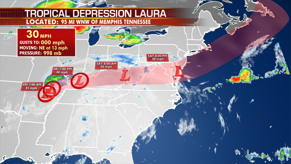
Where Laura is heading today and tomorrow. (Fox News)
Looking ahead, there are a couple of areas that need to be monitored out in the Atlantic going into peak season, but the weekend, at least, seems quiet.
LIVE UPDATES: LAURA FLOOD THREAT CONTINUES
In other weather news, showers, thunderstorms and the risk of severe weather will be possible over the Upper Midwest and lower Great Lakes.

Threats of severe weather in the U.S. today. (Fox News)
Hot and humid conditions are expected for the Midwest into the Mid-Atlantic states, but after what’s left of Laura moves though, a cooler air mass will dip in this weekend.
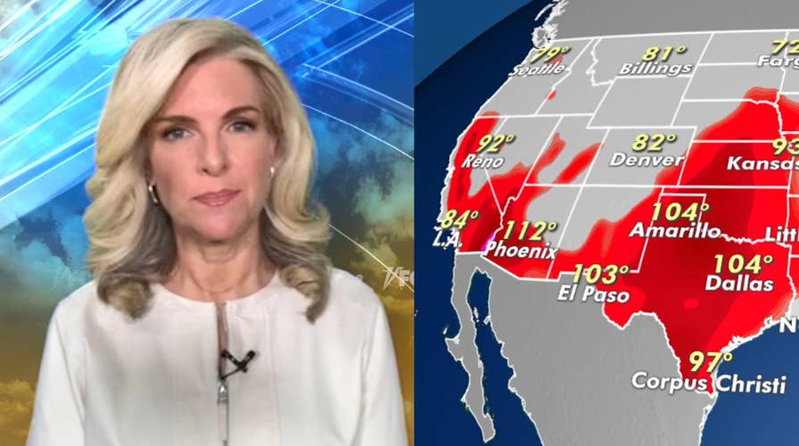
North and Central Texas will remain hot with 100-degree temperatures.

The national forecast for Friday, Aug. 28. (Fox News)
CLICK HERE TO GET THE FOX NEWS APP
And fire danger is ramping up again for the Northwest with wind, heat and dry thunderstorms this weekend.
Parts of Oregon and Central California are still very smoky with recent wildfires leading to air quality alerts.

True Crime
The hottest stories ripped from the headlines, from crime to courts, legal and scandal.
By entering your email and clicking the Subscribe button, you agree to the Fox News Privacy Policy and Terms of Use, and agree to receive content and promotional communications from Fox News. You understand that you can opt-out at any time.
