


National forecast for Monday, June 15
Fox News senior meteorologist Janice Dean has your FoxCast.
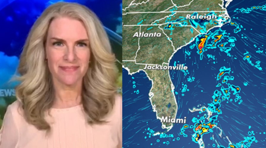
A stalled front along with a slow-moving area of low pressure is bringing heavy rain to parts of the Southeast and the Mid-Atlantic through Wednesday.
Several inches of rain and flash flooding will be a risk for North Carolina.
The heaviest amount of rain is expected over the eastern part of the state, where 3 to 5 inches could fall.
CRITICAL WILDFIRE CONDITIONS FOR SOUTHWEST, PLAINS AS SEVERE WEATHER THREAT RETURNS
According to the National Weather Service's (NWS) Weather Prediction Center (WPC), a risk of flash flooding exists in the area.
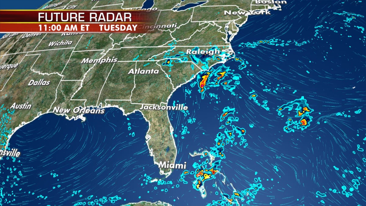
A stalled front and slow-moving low-pressure system are forecast to bring several inches of rain to parts of the Southeast this week. (Fox News)
Another system known as a cut-off low over the Ohio Valley will work in tandem with the stalled front to allow for soaking rainfall in the region.
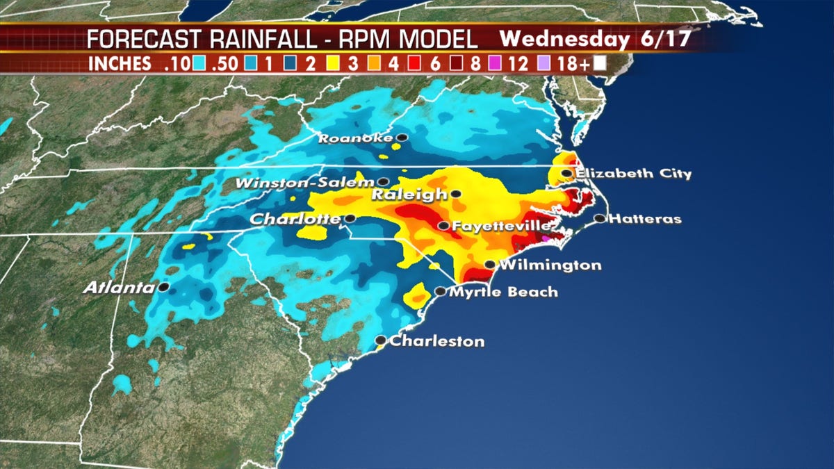
The highest amounts of rain are across portions of Eastern North Carolina through Wednesday. (Fox News)
In addition to the soaking rain, temperatures in the East will struggle to get into the low 70s on Monday.
SOUTHEAST FACING HEAVY THUNDERSTORMS, FLASH FLOOD THREAT
On the other side of the country, cool and dreary conditions will stick around in the Northwest as more coastal rain and even some pockets of snow are expected in the higher elevations.
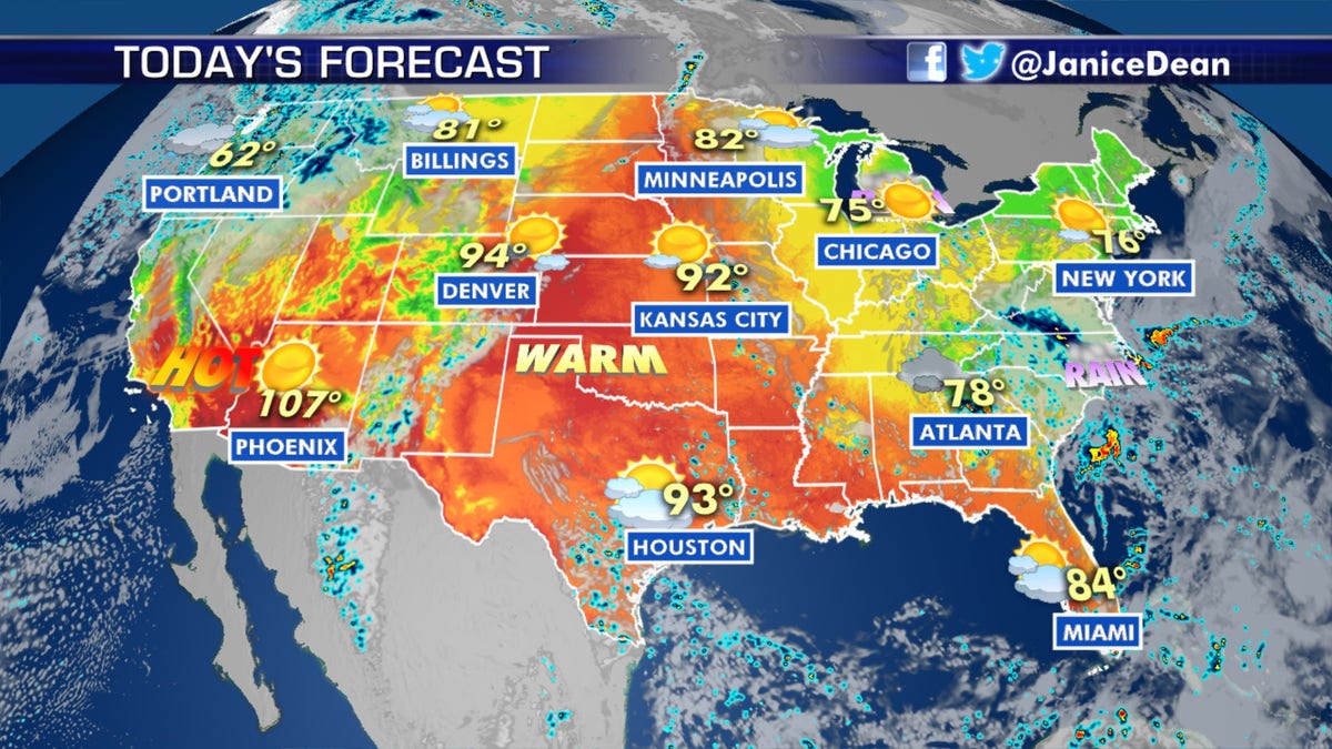
The national forecast for June 15, 2020. (Fox News)
In between the disturbed areas of cool and damp weather, the heat is forecast to build into the Midwest this week.
CLICK HERE FOR MORE WEATHER COVERAGE FROM FOX NEWS
The threat of severe weather exists Monday across the Upper Midwest before shifting into the northern Plains on Tuesday.
Fire weather threat out West
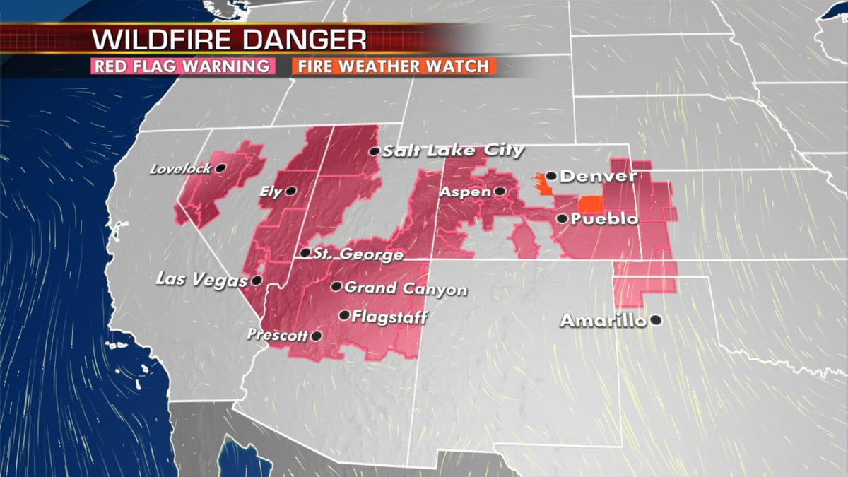
Fire danger remains out West, from California's Sierra Nevada to the Plains. (Fox News)
Fire danger remains critical for the Great Basin and Southwest on Monday, as temperatures are hot with dry and breezy conditions.
Some thunderstorms are possible across the Southern Rockies, but they are not expected to bring any beneficial rainfall, just the threat of lightning that could trigger more wildfires.
A long stretch of red-flag warnings is up from California's central Sierra Nevada to the central High Plains, according to the WPC.
CLICK HERE FOR THE FOX NEWS APP
Elevated to critical fire conditions are expected to stick around through the middle of the week, especially over the Four Corners region.