


Tens of thousands of people are without power Wednesday across the Midwest as a potent storm system brought severe weather and several inches of snow that caused hundreds of crashes across Minnesota.
The National Weather Service (NWS) said that between 3 to 6 inches of snow fell across central Minnesota on Tuesday, with higher amounts seen northwest of the Minneapolis/St. Paul area.
"Roads are slick, so take it slow this morning," the NWS Twin Cities tweeted Wednesday morning.
HEAVY SNOW IMPACTS ROCKIES, UPPER MIDWEST AS RECORD WARMTH ROASTS EASTERN THIRD OF US
A new daily record for snow was reported on Tuesday at Minneapolis-St. Paul International Airport, where 5.5 inches of snow fell.
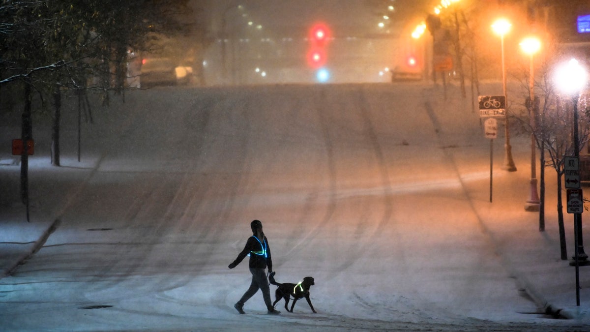
A dog walker crosses a street during Tuesday night's snow storm in downtown Minneapolis, Nov. 10, 2020. (Aaron Lavinsky/Star Tribune via AP) (Aaron Lavinsky/Star Tribune via AP)
The Minnesota State Patrol said at least 357 vehicle accidents were reported statewide between 7 a.m. on Tuesday and 7:30 a.m. on Wednesday due to the snowstorm.
Officials told FOX9 that 27 of the crashes involved injuries and one of them, in Todd County, was fatal.

Hundreds of crashes were reported across Minnesota on Tuesday as a snowstorm impacted the state. (Minnesota State Patrol/Sgt. Jesse Grabow)
The snowstorm was part of a frontal system heading eastward, which caused severe weather for locations to the south. Tornado warnings were issued across portions of Wisconsin and Illinois as a line of severe thunderstorms roared through the region.
Major damage was reported in Racine County in Wisconsin, where downed trees and power lines littered neighborhoods.

Damage in Racine County, Wisconsin after severe weather moved through on Tuesday, Nov. 10, 2020. (FOX6)
Scottie Walden told FOX6 the storms sounded like a large freight train passing as the weather blasted through.
"It sounded like a train, like a 'woo, woo, woo.' And very loud, very loud. And when it hit the house, it sounded like bricks were hitting the house," she said.
In the Chicago area, the powerful line of storms toppled trees, destroyed roofs and knocked out power.
One gust of 73 mph was recorded by officials in Winnebago County.
AMERICA'S TOP 5 SNOWIEST CITIES
“I was sitting at my table working. I heard glass breaking and ran to the basement, grabbed my dog. I heard the glass breaking from that upper attic window,” Winnebago resident April Haeflinger told FOX32.
The powerful winds even caused the roof to collapse on an abandoned building in Chicago. Vivid lightning was also reported as the storms moved through.
Nearly 30,000 customers are without power across the Midwest, according to poweroutage.us.
The greatest number of outages are in Illinois, where some 11,548 were without power as of Wednesday morning. Some 11,092 customers in Michigan were also impacted, while numbers in Wisconsin dropped to 6,579.
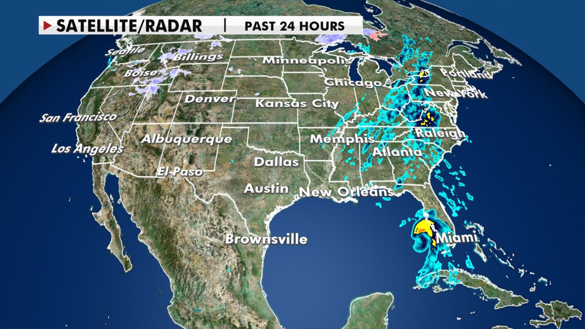
A strong cold front will bring heavy rain to the eastern half of the U.S. on Wedneday, Nov. 11, 2020. (Fox News)
The same front behind the severe weather and snow is sweeping East, bringing rain and thunderstorms over the eastern U.S.
CLICK HERE FOR MORE WEATHER COVERAGE FROM FOX NEWS
The cold front is also bringing cooler air to break the record-breaking warmth in recent days. Many places have seen temperatures running between 15 to 25 degrees above average.
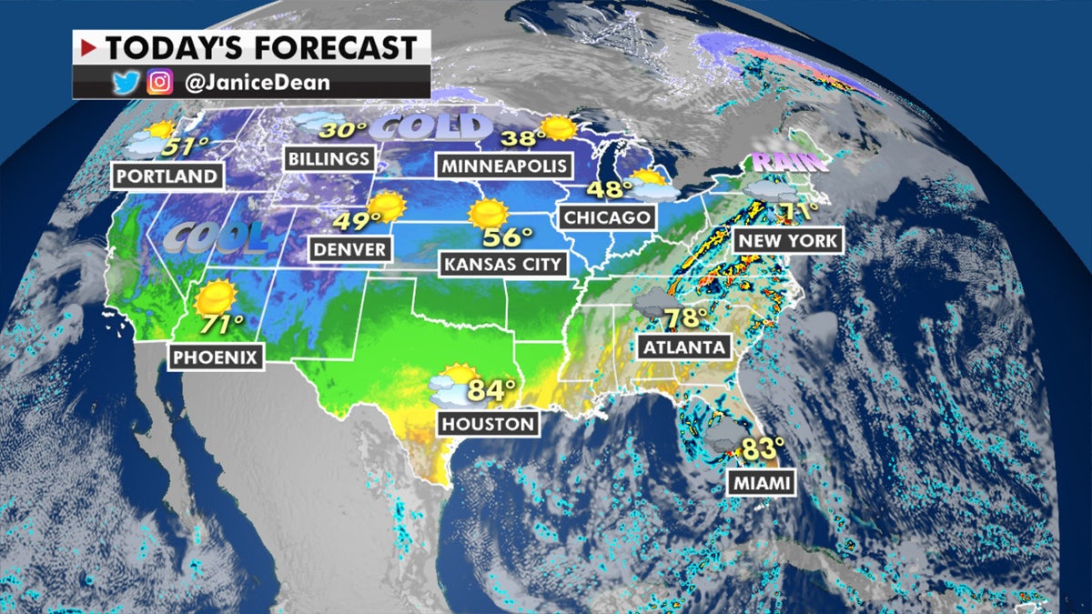
The national forecast for Nov. 11, 2020. (Fox News)
Between 1 and 3 inches of heavy rain will bring the risk of flash flooding over the Midatlantic and Carolinas over the next few days. Scattered to isolated thunderstorms are anticipated across the rest of the Southeast on Wednesday thanks to the approaching cold front.
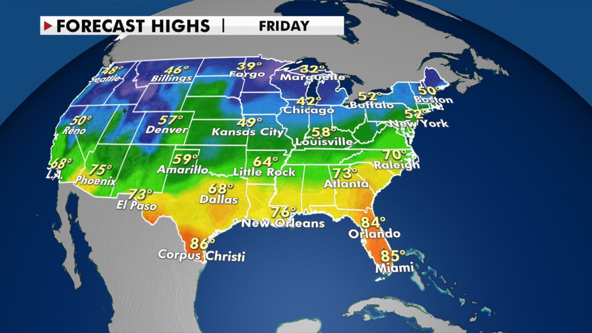
Forecast high temperatures for the end of the week. Temperatures will fall as a cold front moves eastward. (Fox News)
Elsewhere across the country, the Northwest remains busy with several systems impacting the region. Heavy rain, strong winds and plenty of snow can be expected for the mountains.