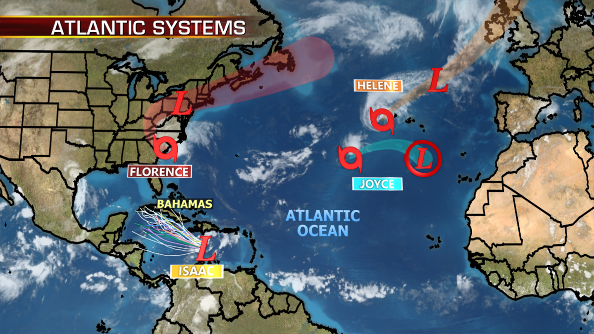
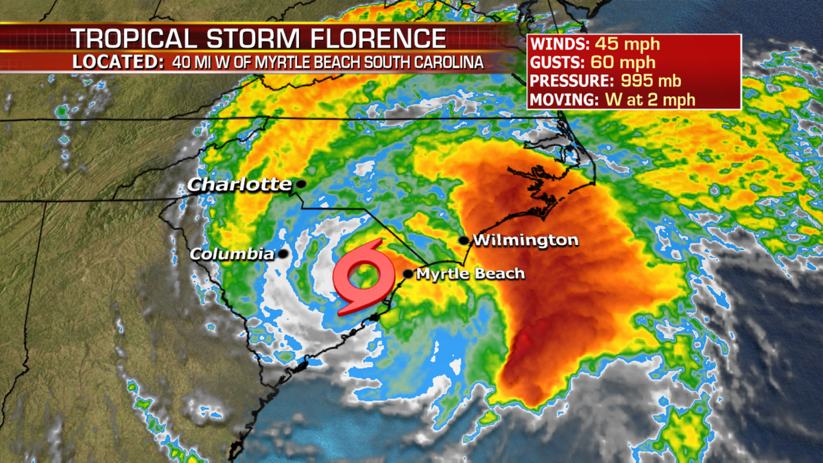
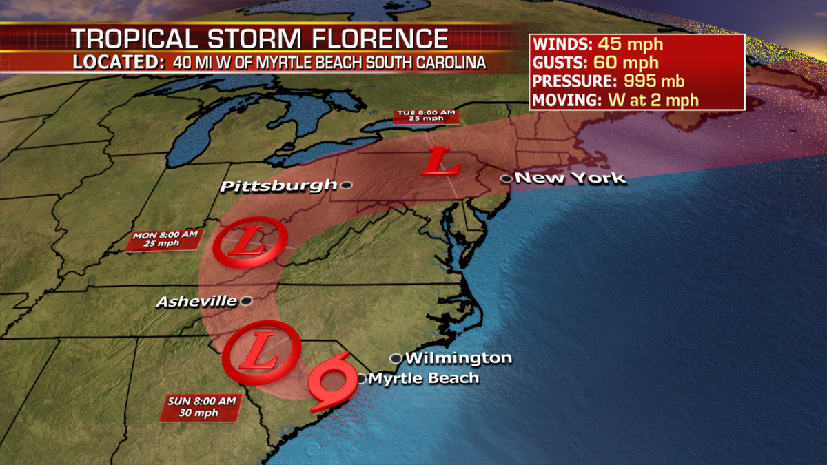
Tropical storm Florence will continue to crawl inland through the Carolinas this weekend.
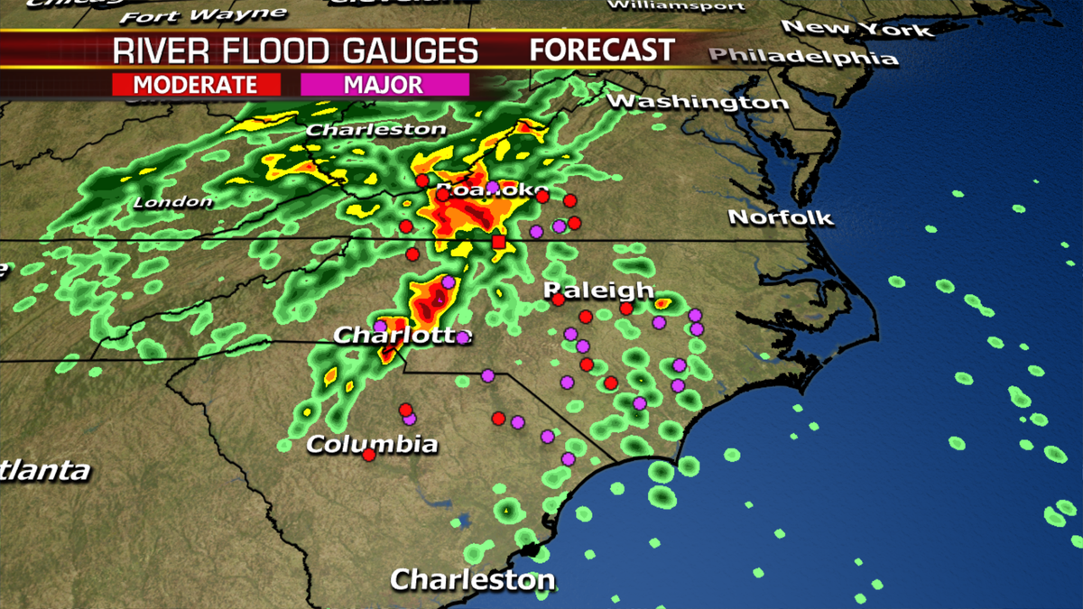
The forecast continues to be life threatening, catastrophic flash floods and historic river flooding for the Carolinas to through the Appalachians into Southwest Virginia.
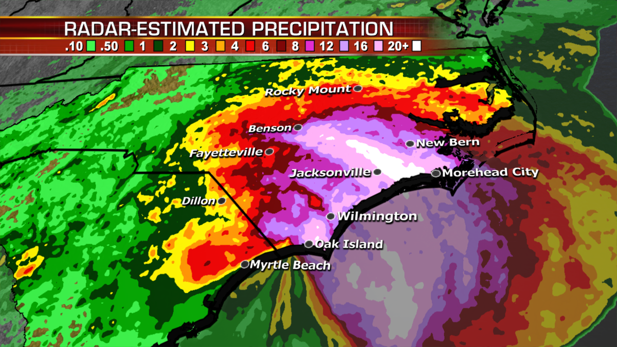
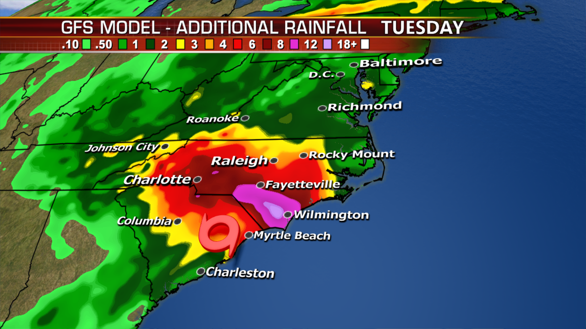
The rainfall totals have surpassed those experienced during Hurricane Floyd (24.06) in 1999 and now is the wettest tropical cyclone in North Carolina with numbers surpassing 30 inches if rainfall totals are accurate.
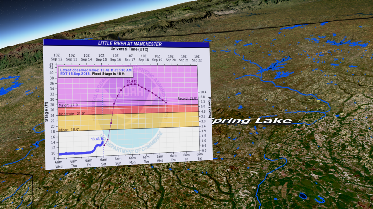
Inland flooding is perhaps the biggest continuing with many rivers fearing historic levels in the next few days.
Slow movement of the system will increase the duration of heavy rain and ongoing surge.
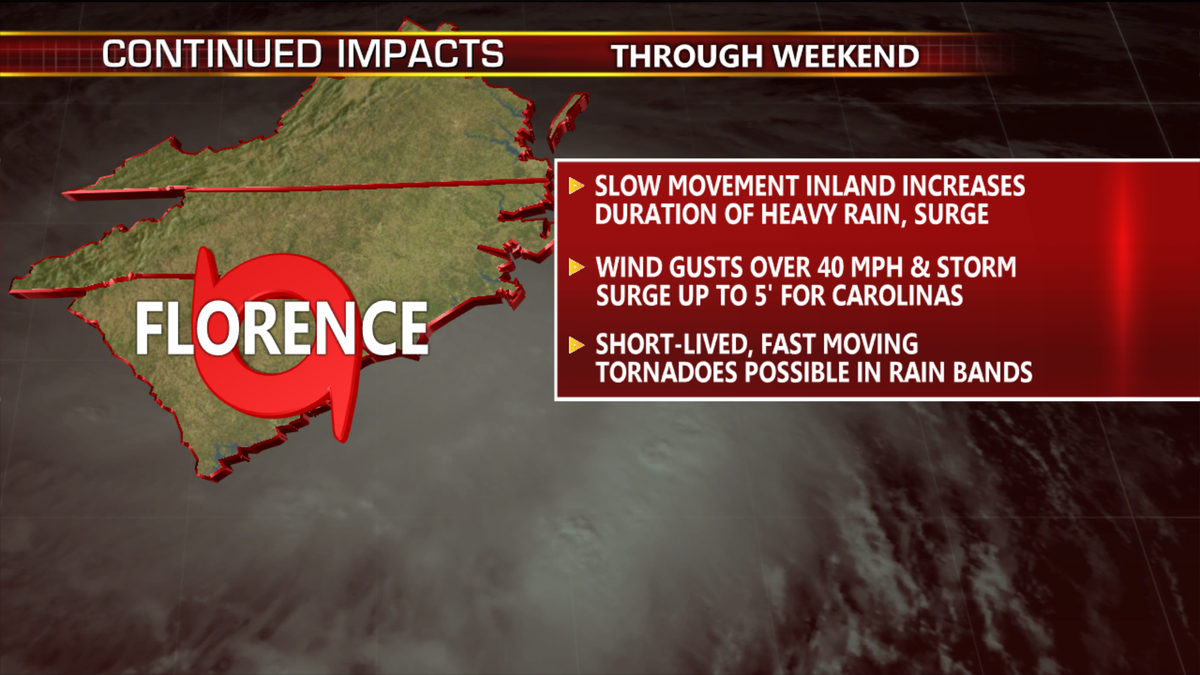
Wind gusts of over 40 mph and storm surge could surpass 5 feet.
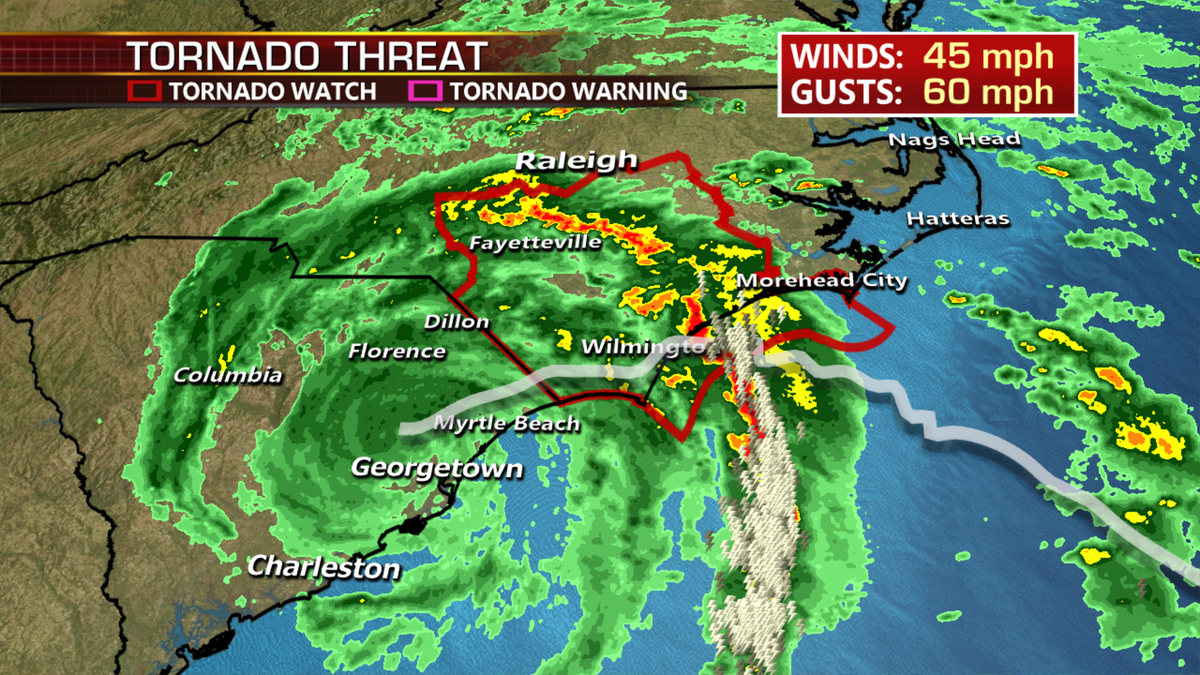
Short lived, fast moving tornadoes will be possible in the rain bands coming onshore.
Looking ahead, the storm will eventually pull north and then Northeast later this week.
The Atlantic is still very busy. We’ll have to watch the remnants of Isaac in the days to come moving into the Gulf of Mexico.
