


Hurricane Laura: National Hurricane Center director warns of areas that are ‘not survivable’ when hit
Ken Graham, director of the National Hurricane Center, walks through the latest forecasting of Hurricane Laura, set to wreak havoc in Texas and Louisiana Wednesday night through Thursday morning. He warns of the potentially devastating impact it could have on those along the Gulf Coast and urges residents in danger zones to evacuate before it’s too late.
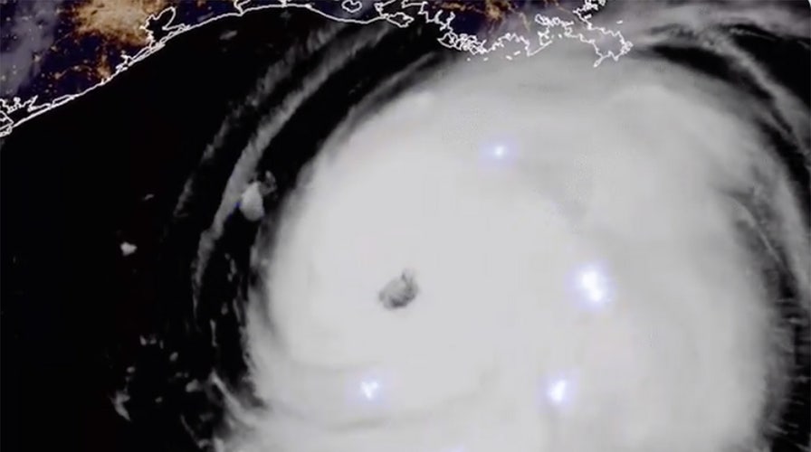
Bursts of lightning appeared, dotting the storm clouds of Hurricane Laura, in satellite imagery posted to Twitter by the National Oceanic and Atmospheric Administration Wednesday morning.
The video was taken by NOAA’s GOES East weather satellite before sunrise Wednesday, according to the agency.
At the time, the storm’s winds were around 115 mph – but it was rapidly intensifying and has since grown into a Category 4 hurricane with sustained winds of 150 mph.
The hurricane was about 95 miles south of Lake Charles, La., moving north-northwest at 15 mph as of 9 p.m. ET Wednesday, according to the weather service. It was expected to make landfall on the Louisiana-Texas state line late Wednesday night or early Thursday morning.
Wind, rain and lightning are not the only threats associated with the storm.
HURRICANE LAURA LIVE UPDATES: GET THE LATEST DEVELOPMENTS HERE
“The storm surge is going to be a huge threat to life,” Louisiana Gov. John Bel Edwards said on “Your World” Wednesday evening. “And, in fact, the National Weather Service took the unprecedented step of saying the storm surge is going to be unsurvivable.”

A cemetery along Privateer Blvd. in Barataria, La. is inundated in water as water levels surge before Hurricane Laura, Aug. 26, in Barataria, La. (Max Becherer/The Advocate via AP)
Hurricane Laura was expected to carry an overwhelming, “catastrophic” storm surge of up to 20 feet in some areas, according to government officials. And the storm was approaching as the tide shifted and began to rush in, leaving low-lying areas vulnerable to flooding across parts of southeastern Texas and most of the Louisiana coastline, as well as inland areas up for 40 miles from the shore.
And the National Weather Service reported Wednesday evening that there were possible tornadoes in the storms outer bands over southeastern Louisiana and the southwestern corner of Mississippi. The weather service issued a tornado warning until 10:15 p.m. ET for Cameron and Vermillion parishes in Louisiana.
HURRICANE LAURA, NOW CATEGORY 4, MAY BRING 'UNSURVIVABLE' STORM SURGE TO TEXAS-LOUISIANA BORDER
Category 4 hurricanes bring sustained winds of 130 to 156 mph, according to the Saffir-Simpson Hurricane Wind Scale. They are associated with catastrophic damage, even to well-built homes, and are known to blow down trees and utility poles.
If the storm’s sustained winds remain above 157 mph, it would become a Category 5 hurricane that could render areas uninhabitable for weeks or months.
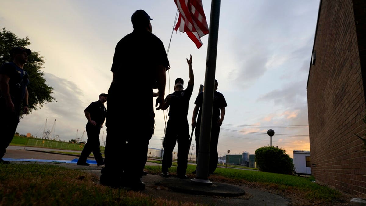
Port Arthur firefighters lower a U.S. flag at a post office at sunset as they wait for Hurricane Laura to make landfall, Aug. 26, in Port Arthur, Texas. (AP Photo/Eric Gay)
CLICK HERE FOR MORE WEATHER COVERAGE FROM FOX NEWS
Texas Gov. Greg Abbott also warned of the storm’s potentially devastating impact and urged all residents in Laura’s path to evacuate earlier in the day Wednesday.
CLICK HERE FOR THE FOX NEWS APP
National Guard units from both Texas and Louisiana have already begun mobilizing with vehicles and supplies to help with the storm response.