


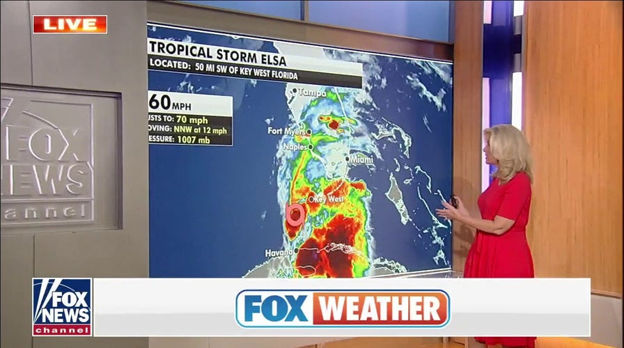
Tropical Storm Elsa eyes Florida, Hurricane Watch issued for Tampa
Elsa pushes past Cuba, nears the Florida Keys. Fox News senior meteorologist Janice Dean has your Foxcast.
Tropical Storm Elsa has moved over Cuba and is now into the warm waters of the Florida Straits.
The system has time to strengthen a bit as it parallels the west coast of Florida in the next 24 hours before making landfall north of Tampa on Wednesday morning.
The latest National Hurricane Center advisory has upped Elsa’s winds to 70 mph before moving inland, which is just shy of a hurricane (74 mph). So there is now a hurricane watch issued for Florida’s west central and Big Bend Coast.

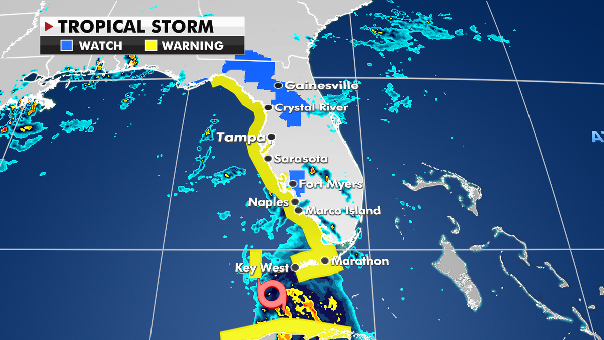
The current projected path of Tropical Storm Elsa. (Fox News)
Tropical storm warnings are still in effect from the Florida Keys to the Big Bend Coast, while tropical storm conditions will likely continue across the Keys through Tuesday night.
Once Elsa makes landfall, it will weaken, however, heavy rain and wind and the risk for tropical tornadoes will continue.
Tropical storm advisories currently in effect. (Fox News)
A general 3 to 5 inches of rain will fall across Florida and the Southeast Coast, with isolated amounts over 8 inches, especially across the Keys, southwestern, and western Florida, where localized flooding is possible.
A few brief tornadoes are also possible Tuesday across the Florida Peninsula.

The national forecast for Tuesday, July 6. (Fox News)
CLICK HERE TO GET THE FOX NEWS APP
Meanwhile, a dangerous heat wave continues for the West.
Excessive heat warnings are in effect for parts of the Great Basin and Desert Southwest.

True Crime
The hottest stories ripped from the headlines, from crime to courts, legal and scandal.
By entering your email and clicking the Subscribe button, you agree to the Fox News Privacy Policy and Terms of Use, and agree to receive content and promotional communications from Fox News. You understand that you can opt-out at any time.
