Storm strengthens to a tropical depression
Storm intensifies as it closes in on Gulf of Mexico
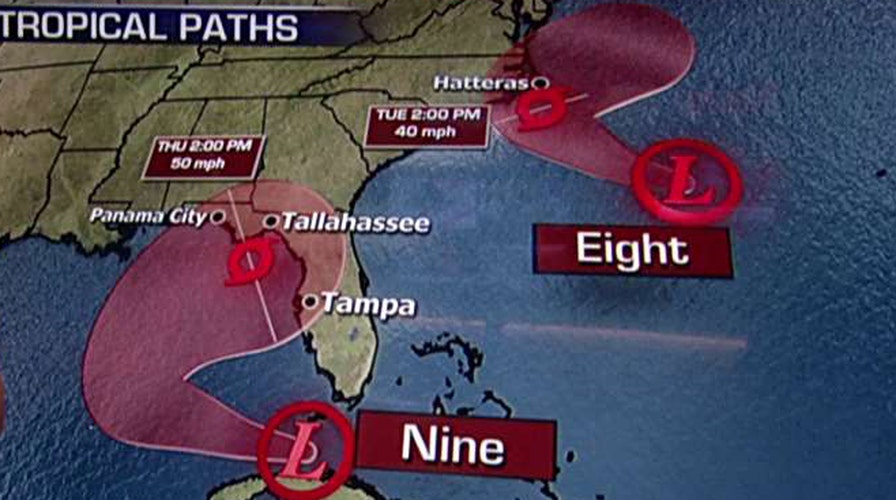
A tropical depression that formed in the Florida Straits was moving into the southeastern Gulf of Mexico early Monday and the U.S. National Hurricane Center said it could soon become a tropical storm.
The depression's maximum sustained winds were near 35 mph with some strengthening expected during the next two days. Forecasters said it could become a tropical storm later in the day or overnight.
As of 5 a.m. EDT, the depression was centered about 155 miles west-southwest of Key West, Florida, and was moving west near 9 mph.
The depression was expected to bring 3 to 5 inches of rain over the southern Florida peninsula and the Florida Keys through Wednesday that could cause flooding and flash flooding.
Meanwhile, another tropical depression that formed west of Bermuda was moving toward the coast of North Carolina. That depression is expected to become a tropical storm overnight and threatens to bring wind and rain to eastern North Carolina.
The depression was centered about 230 miles southeast of Cape Hatteras, North Carolina, and was moving west-northwest near 10 mph.
A tropical storm watch was in effect for North Carolina's coast from Cape Lookout to Oregon Inlet.
Farther east, Hurricane Gaston has weakened a little as it drifted northward in the middle of the Atlantic.


