The Latest on Tropical Storm Gordon on Monday (all times local):
7:10 p.m.
Louisiana Gov. John Bel Edwards has declared a state of emergency as Tropical Storm Gordon approaches the U.S. Gulf Coast.
Edwards announced at a news conference Monday evening that 200 National Guard troops will be deployed to southeastern Louisiana, where heavy rains and strong winds are anticipated Tuesday.
The storm's predicted track had shifted slightly east as of Monday evening, meaning Louisiana is currently just outside the area under the hurricane warning. Still, southeastern Louisiana is under a tropical storm warning and Edwards says residents need to be prepared for the storm to shift west.
Edwards says much of southeastern Louisiana could see 4 to 6 inches (10 to 15 centimeters) of rain and storm surges of 3 to 5 feet (0.9 to 1.5 meters).
___
5:20 p.m.
A hurricane warning has been issued for portions of the central U.S. Gulf Coast as Tropical Storm Gordon approaches.
The National Hurricane Center in Miami said in its 5 p.m. EDT advisory that it expects Gordon to be a hurricane when it reaches coastal Mississippi and Louisiana sometime late Tuesday.
A hurricane warning is in effect for the area stretching from the mouth of the Pearl River in Mississippi to the Alabama-Florida border.
The storm is centered about 50 miles (85 kilometers) west-southwest of Fort Myers, Florida, and moving west-northwest at 17 mph (28 kph). After making landfall, it is expected to move inland over the lower Mississippi Valley on Wednesday.
Officials say maximum sustained winds are near 50 mph (85 kph) with higher gusts.
___
4:35 p.m.
New Orleans Mayor LaToya Cantrell says the city has "the pumps and the power" needed to protect residents from Tropical Storm Gordon.
However authorities issued a voluntary evacuation order for residents outside the levee protection system, including the Venetian Isles, Lake Saint Catherine and Irish Bayou areas.
The National Hurricane Center in Miami said the storm is expected to move away from the southwestern Florida coast and reach coastal Mississippi and Louisiana by late Tuesday.
At a press conference Monday afternoon, Cantrell urged residents within the levee protection area to stock up on supplies and shelter in place.
New Orleans director of emergency preparedness Collin Arnold says the storm has the potential to turn into a "low-level hurricane" with potential winds of up to 70 mph (113 kph).
The Louisiana coastal town of Grand Isle has also issued a voluntary evacuation order.
___
4 p.m.
Tropical Storm Gordon has left many businesses on Florida's Gulf Coast feeling shortchanged by the holiday weekend.
The Naples Daily News reports that Naples beachfront stores were getting hardly any foot traffic Monday as the storm approached.
The southern Gulf Coast has already been heavily impacted by this summer's so-called "red tide," in which massive algae blooms have caused waves of dead marine life to wash up along the coast, driving people from the water.
At Lowdermilk Park, the beach was nearly empty despite there being no signs of red tide.
Beach Cafe manager Fred Macolino tells the newspaper that business over the holiday weekend had been "horrible."
The storm is expected to move away from the southwestern Florida coast and reach coastal Mississippi and Louisiana by late Tuesday.
___
2:20 p.m.
A hurricane watch remains in effects for portions of the central U.S. Gulf Coast as Tropical Storm Gordon approaches.
NOLA.com/The Times-Picayune reports that drivers around the metro New Orleans area are lining up to put sand bags in their trunks. In St. Tammany Parish, a line of cars reached between 20 and 25 vehicles long at times.
The storm was lashing South Florida on Monday with high winds and heavy rains as it moved west-northwest at 16 mph (26 kph).
The National Hurricane Center in Miami said in its 2 p.m. EDT advisory that the storm is expected to move away from the southwestern Florida coast and reach coastal Mississippi and Louisiana by late Tuesday and move inland over the lower Mississippi Valley on Wednesday.
A hurricane watch is in effect for the area stretching from the mouth of the Pearl River in Mississippi to the Alabama-Florida border. A hurricane watch means that hurricane conditions are possible.
___
12:30 p.m.
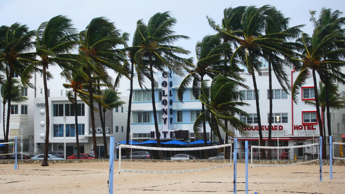
Rain has drenched the Miami area as Tropical Storm Gordon moved into the Gulf of Mexico on Monday.
In a tweet, Miami Beach Police advised residents and visitors that the Labor Day holiday was "NOT a beach day," with rough surf and potential rip currents.
Police advised beach-goers to stay indoors.
In Tallahassee, city officials offered sandbags to help homeowners prepare for potential flooding.
Red flags flew over Pensacola-area beaches in Florida's Panhandle, where swimming and wading in the Gulf of Mexico was prohibited.
The National Weather Service said Naples, Marco Island, and Everglades City also could expect hazardous weather on Monday.
___
11 a.m.
A hurricane watch has been issued for portions of the central U.S. Gulf Coast as Tropical Storm Gordon approaches.
The storm was lashing South Florida on Monday with high winds and heavy rains as it moved west-northwest at 16 mph (26 kph). The storm was expected to reach coastal Mississippi and Louisiana by late Tuesday and move inland over the lower Mississippi Valley on Wednesday.
The National Hurricane Center in Miami said in its 11 a.m. EDT advisory that the storm was centered 60 miles (95 kilometers) west-northwest of Key Largo and 50 miles (80 kilometers) south-southeast of Marco Island.
A hurricane watch - meaning that hurricane conditions are possible - was put into effect for the area stretching from the mouth of the Pearl River in Mississippi to the Alabama-Florida border.
A storm surge warning has been issued from Shell Beach, Louisiana, to the Mississippi-Alabama border.
___
9:30 a.m.
Residents in parts of South Florida, Mississippi, and Louisiana are being warned to prepare for tropical storm-force winds with the onset of Tropical Storm Gordon. Isolated tornadoes are possible.
The National Weather Service said Monday that Naples, Marco Island, and Everglades City in Florida were among the locations that could expect hazardous weather over the next 36 hours.
The storm is expected to cross from southwest Florida into the Gulf Coast later Monday afternoon.
Flooding was also a high risk for the areas affected by the storm, including portions of southeast Louisiana north of Interstate 10 and southwest Mississippi west of Interstate 55.
___
Weather forecasters have issued storm warnings for portions of South Florida and the Florida Keys.
The National Hurricane Center in Miami said Monday that Tropical Storm Gordon is likely to batter the region with heavy rains. A Storm Surge Watch is in effect for a portion of the Mississippi-Alabama border.
The center said in its 8:30 a.m. EDT advisory that the storm was centered 20 miles (30 kilometers) west of Key Largo and 85 miles (135 kilometers) southeast of Marco Island.
The storm was moving west-northwest at 17 mph (28 kph). Maximum sustained winds were clocked at 45 mph (75 kph).


