


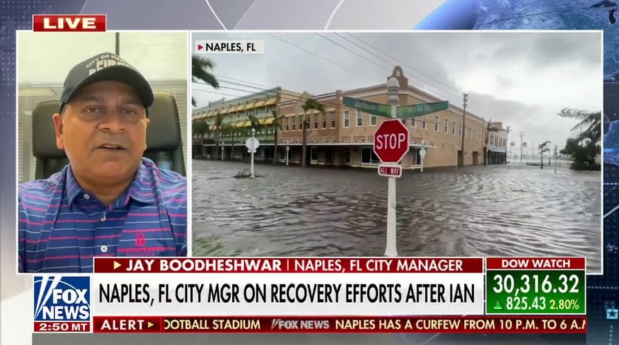
How does Naples community plan to build back their city after Hurricane Ian?
Jay Boodeshwar, city manager of Naples, Fla., breaks down his city's recovery efforts on 'Your World.'
The coastal storm that has some energy from Ian will finally begin to move away from the East Coast, but there will still be another day of unsettled, cool weather for the mid-Atlantic and Northeast.
NATIONAL GUARD BRINGS SUPPLIES TO ISLANDS CUT OFF FROM FLORIDA AFTER HURRICANE IAN
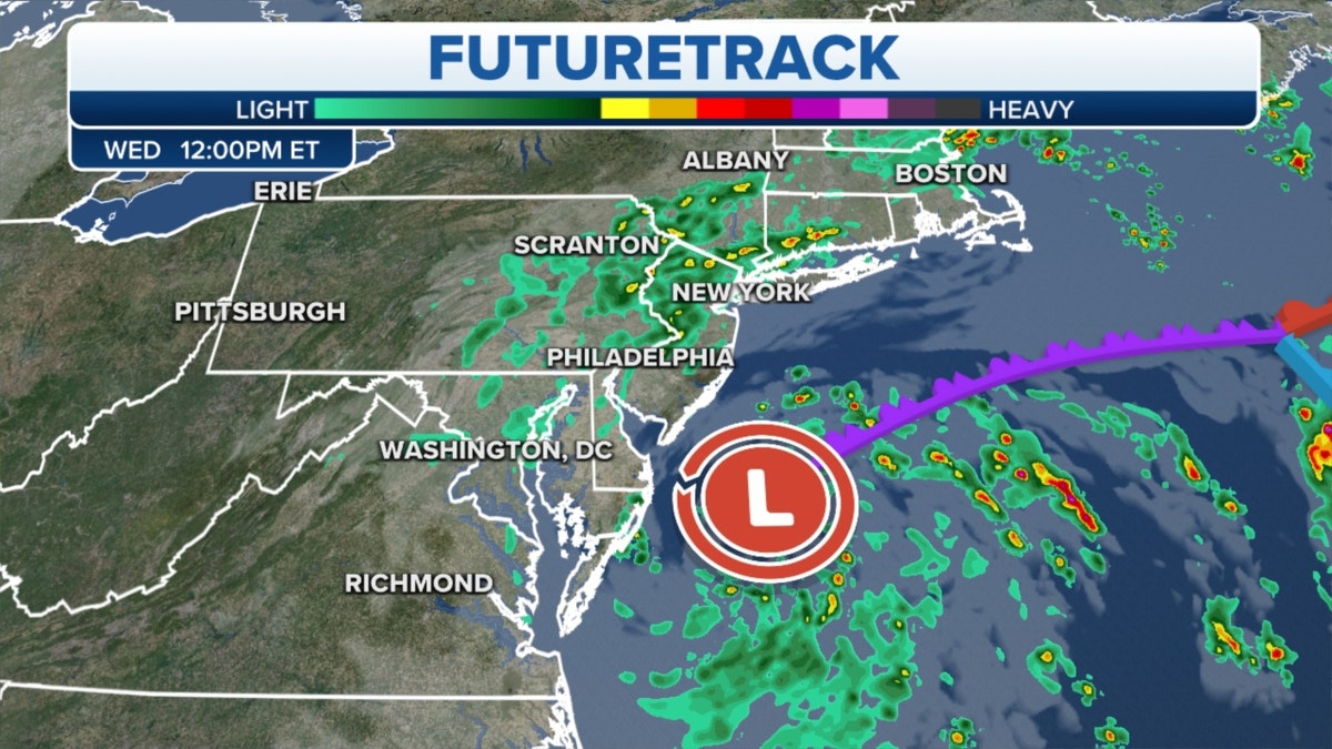
The futuretrack for the East Coast (Credit: Fox News)
The next big weather story will be the incredibly strong cold front that will push the coldest air of the season from the Plains all the way down to the Gulf Coast over the next few days, bringing temperatures down 20-25 degrees.
Widespread morning lows will sink into the low- to mid-20s for North Dakota and Minnesota.
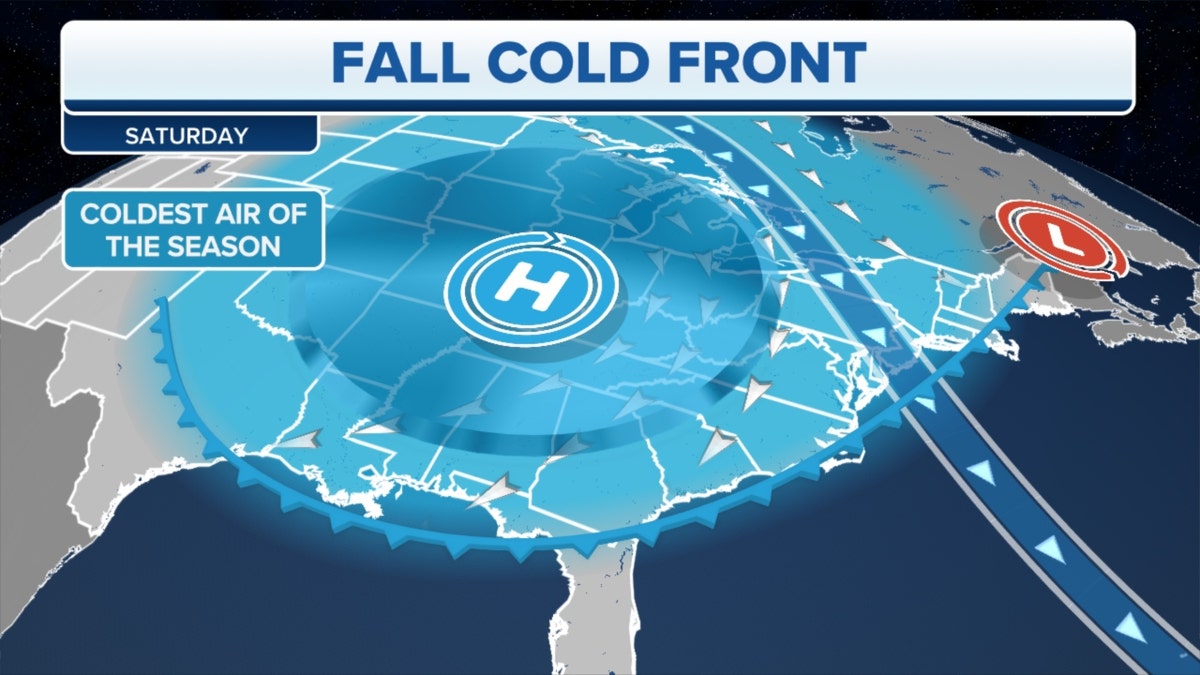
A fall cold front (Credit: Fox News)
Lake effect snow will fall, with some flurries for parts of Wisconsin and Michigan.
More showers and thunderstorms are slated for the Southwest and southern Rockies, bringing the risk of flash flooding – especially for the burn areas.
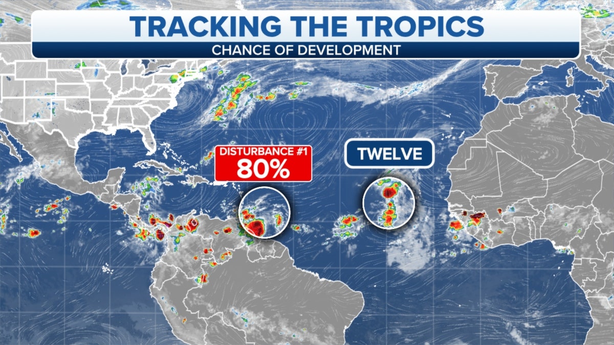
The chance of development in the Tropics (Credit: Fox News)
We’re watching two areas of disturbed weather in the tropics.
CLICK HERE TO GET THE FOX NEWS APP
There is nothing that will imminently affect the U.S.