


Google Maps can now take you inside the Mall of America. (Google)
After using Google Maps on our smartphones, many of us get to our destination and then put our phones away. But now we can use them to navigate inside airports, malls, Home Depots and even IKEA's blue palaces.
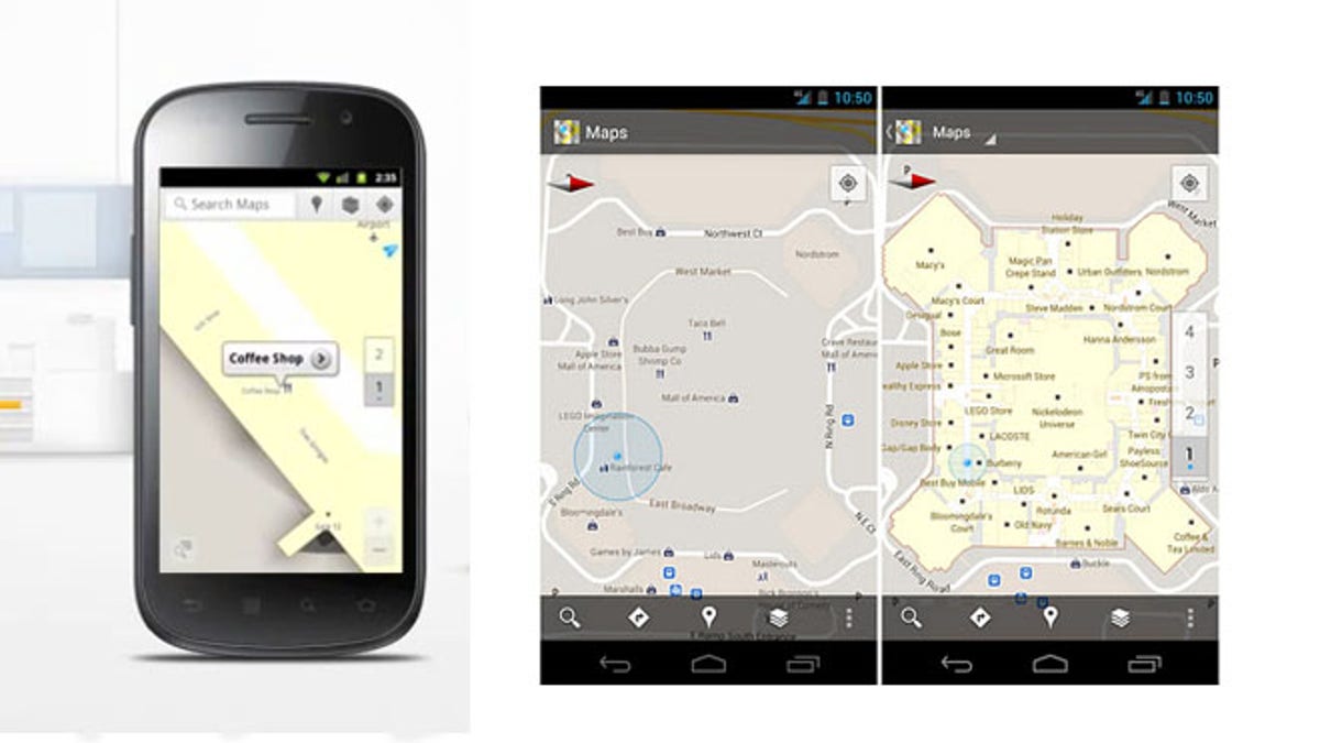
As the Official Google Blog puts it, "With the release of Google Maps 6.0 for Android, [the indoor] directory is brought to the palm of your hands, helping you determine where you are, what floor you're on and where to go."
NEWS: Google Maps Catches Mysterious Lines in China's Deserts
Google has partnered with, "some of the largest retailers, airports and transit stations in the United States and Japan." The full list is located on their help center and includes almost 20 airports, as well as various Macy's, Bloomingdale's, Home Depots and Ikeas around the country. It also includes specifically the Vallco Shopping mall in Cupertino, CA, Eagle Rock Plaza in Los Angeles, CA, and the Mall of America in Minnesota.
For the indoor project, Google parked their mapping cars and bikes and instead worked with local businesses to obtain a store layout. To add your layout, simply upload a picture of the blueprints, plans or directory and align it with the satellite map.
For now, this service is exclusive to the Android operating systems. IPhone users will be the ones wiping dust off the mall directory to find the nearest Apple Store.
BLOG: Google Street View to Map the Amazon
Wandering the gigantic malls of American suburbia might have been difficult before, but like Lewis and Clark you'll now have a reliable guide. Google Maps can show you the way from the main entrance to the Jay Crew on the third floor; all without looking up from your phone. But it won't help you ford the river of after-school teens or pass the sirens of Auntie Annies Pretzels.