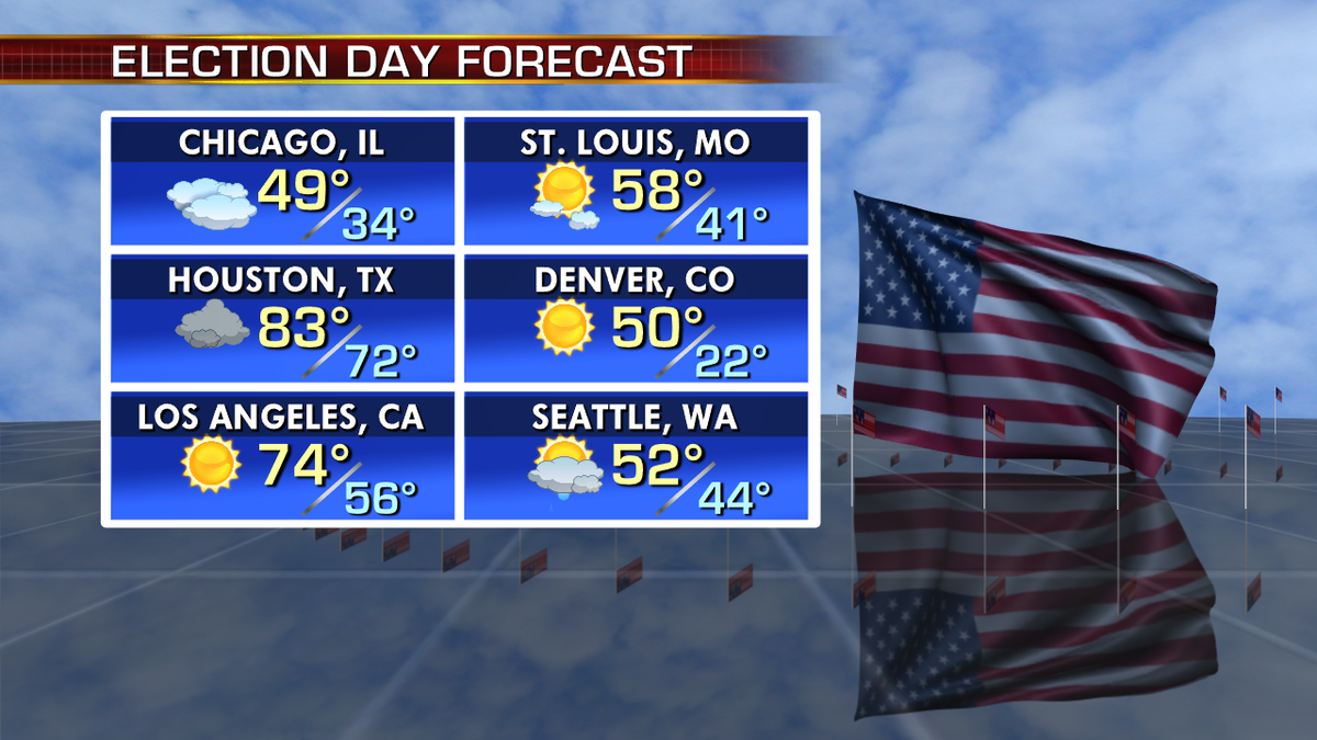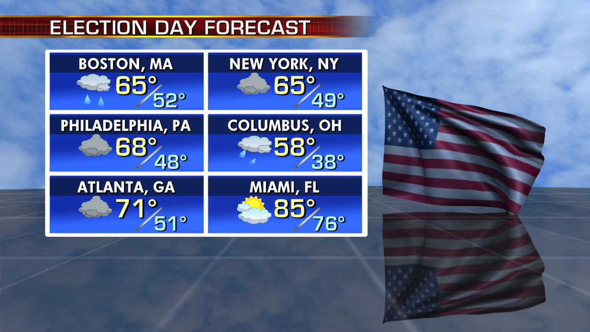


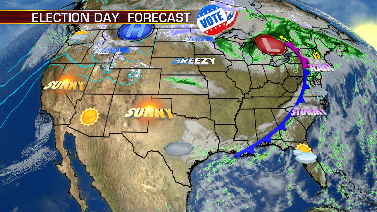
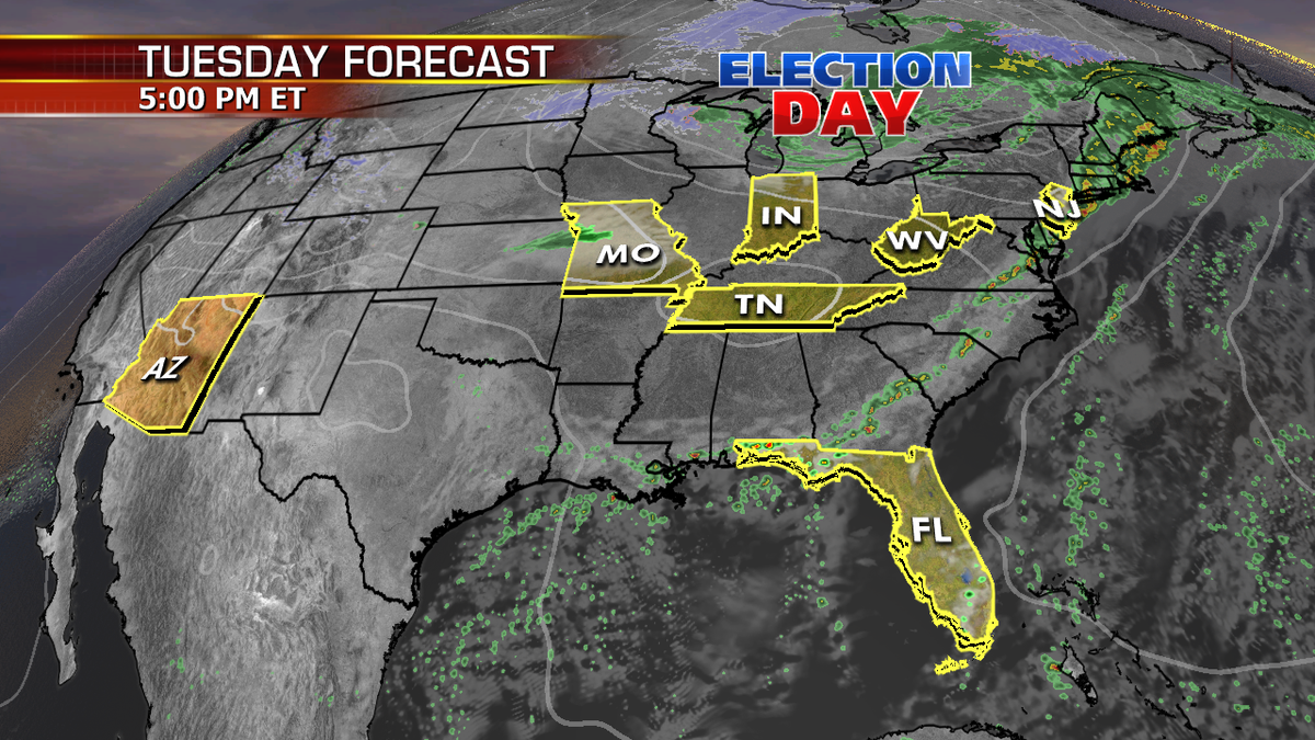
National forecast for Tuesday, November 6
Janice Dean has your Election Day FoxCast from Fox Square.
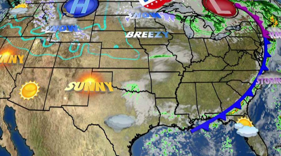
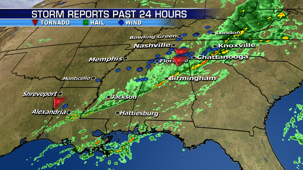
The same system that brought severe weather including tornadoes over parts of the South is now pushing past the Mississippi River Valley to the Tennessee River Valley.
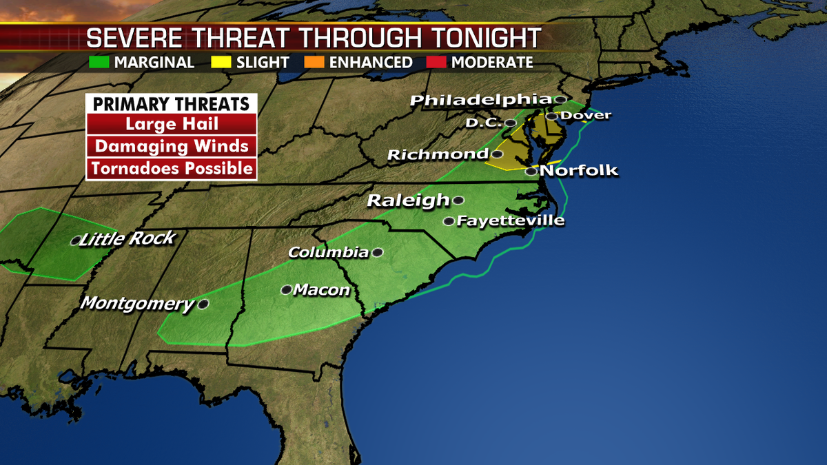
Thankfully the severe weather threat will weaken though the day, but a few strong storms are possible from the Southeast to the Mid-Atlantic as a cold front approaches.
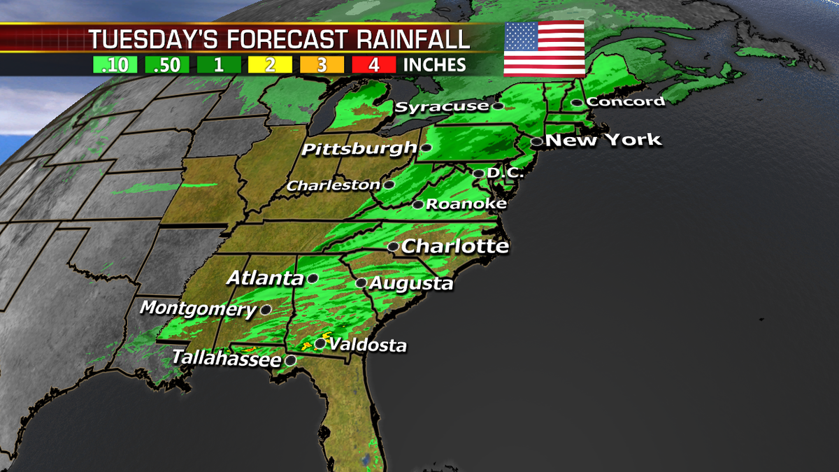
This front will clear much of the Northeast and Mid-Atlantic by the early evening, but the East Coast will be unsettled for much of Tuesday.
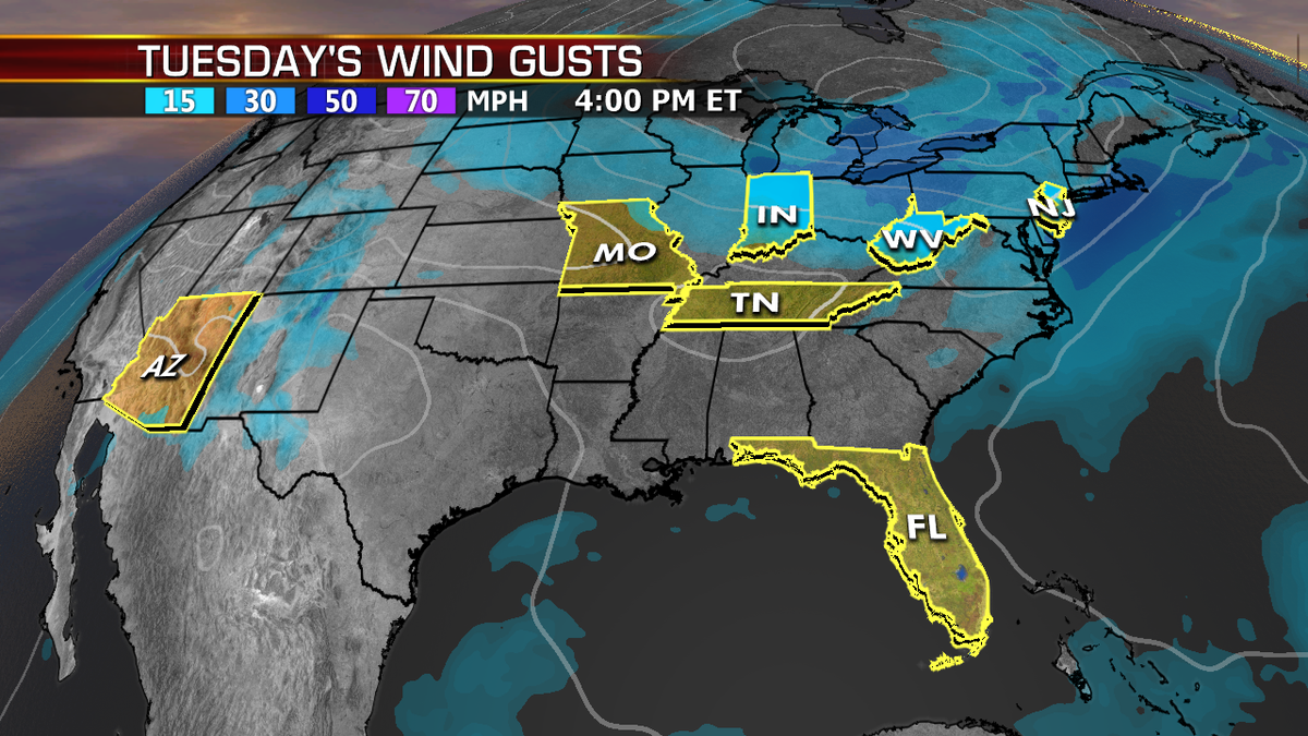
The Great Lakes and Upper Midwest will see rain and snow showers, while the Northern Rockies will also see snow move across the region.