


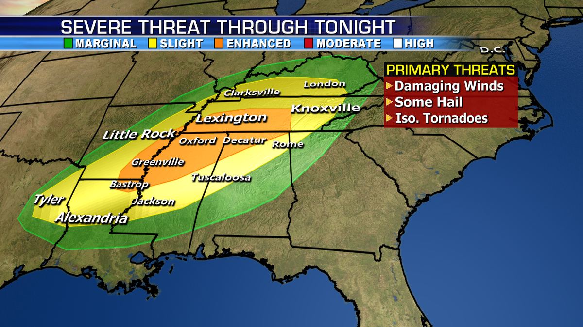
A system moving through the South and Mississippi River Valley will bring the threat for severe storms across the region Monday into Monday night/early Tuesday morning. The best chance for large hail, damaging winds, and tornadoes will be across southeastern Arkansas, northern Mississippi, northwestern Alabama, through Tennessee and Kentucky. Heavy rain could cause flooding over parts of the Ohio and Tennessee River Valley.
Meanwhile, heavy snow is possible over parts of the northern Rockies from the ranges of Northern Idaho and western Montana into western Wyoming.
Dry conditions continue over much of California, the Southwest and the Great Basin. Fire danger be elevated through the day.
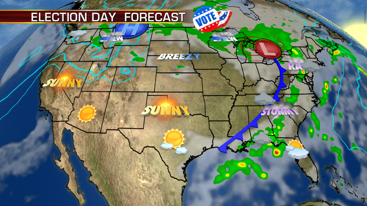
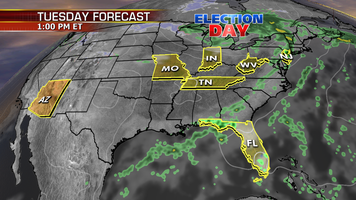
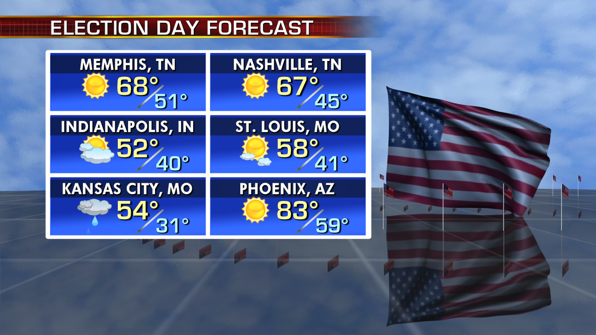
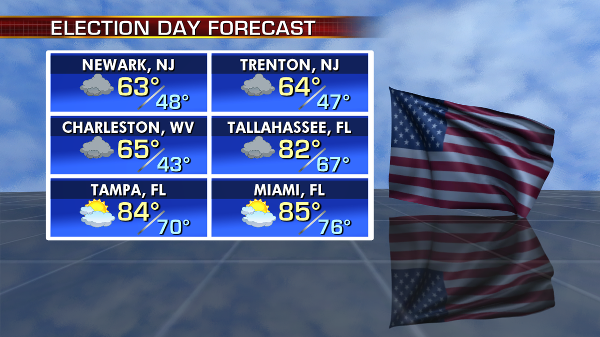
On Tuesday this area of low pressure will be over the Great Lakes, eventually moving into Canada. Rain and storms along the trailing cold front will keep the Northeast, Mid-Atlantic, and Southeast rainy and stormy for Election Day. There’s a risk of severe storms for parts of the Southeast and MidAtlanic.