


Winter is making an abrupt return that will see some of the coldest air this season across parts of the Midwest and Northeast for the end of the week.
The National Weather Service said a strong storm system threatening heavy rain and flooding across the South is also bringing the threat of accumulating snow from the Midwest to the interior Northeast.
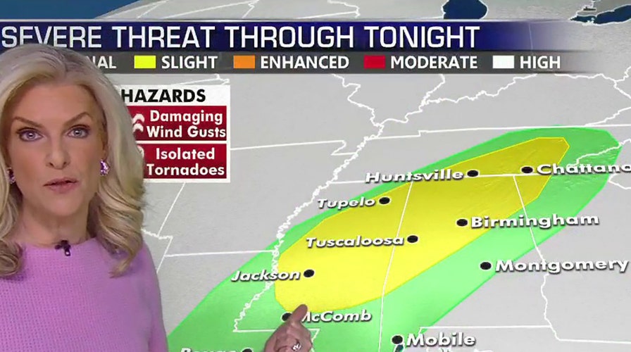
Blizzard conditions were reported Wednesday across parts of the Dakotas and into Minnesota, with winds gusting as high as 45 to 55 mph. In addition to blizzard conditions, the NWS said "a long stretch" of winter weather advisories stretch from Oklahoma to Maine.
CAN IT BE TOO COLD TO SNOW? WHY LIFTING OF AIR MATTERS
A narrow band of light wintry precipitation is forecast to fall in those areas, according to Fox News senior meteorologist Janice Dean.
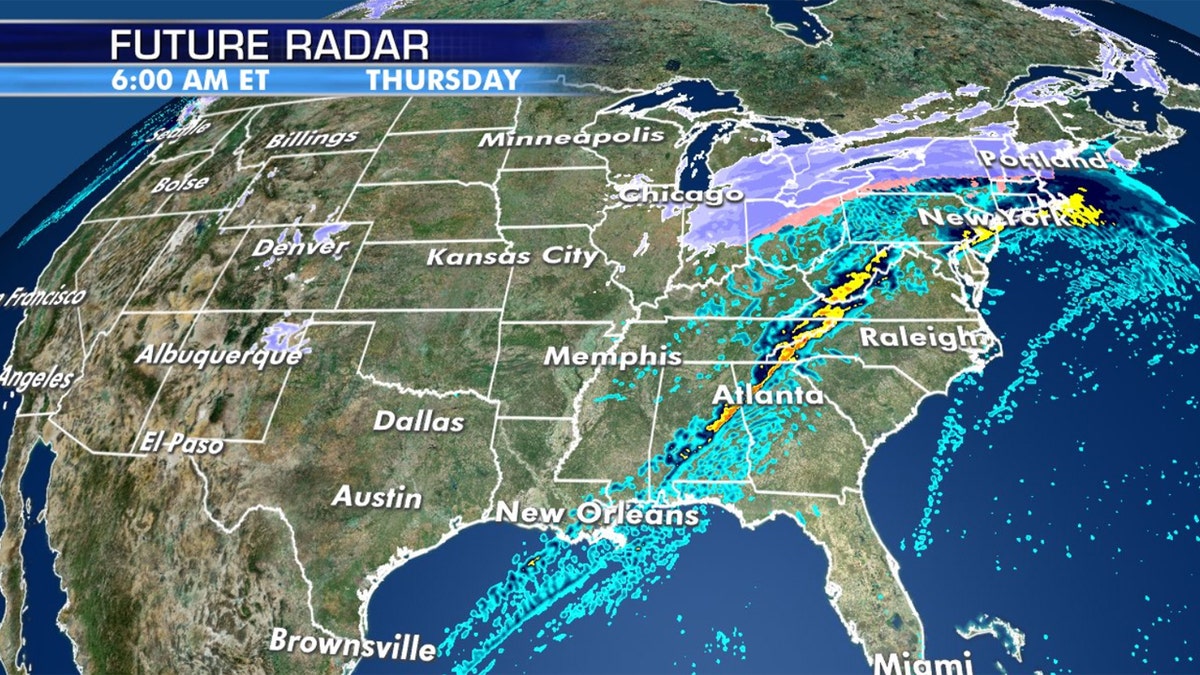
A light band of wintry precipitation is forecast to impact parts of the Midwest and interior Northeast. (Fox News)
"In general, for a band of 2-5 inches of snow along with some freezing drizzle," the NWS said.
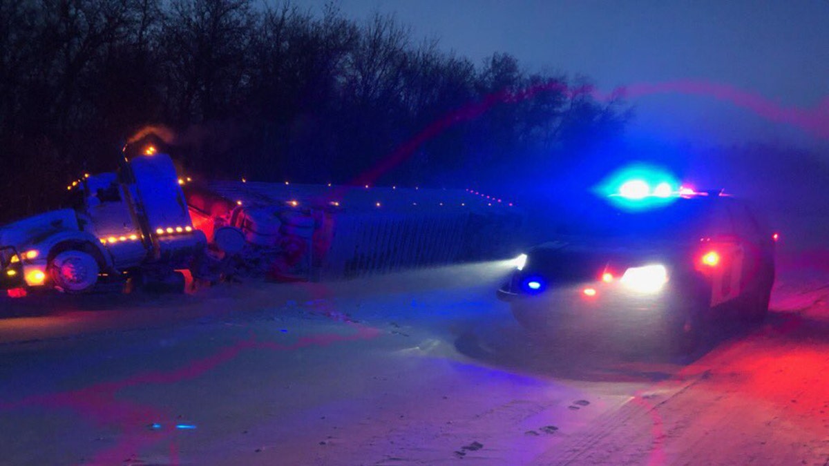
The storm system was creating travel headaches along the central and southern Red River Valley on Wednesday. In North Dakota, the state's Department of Transportation said Interstate 29 was closed from the South Dakota border to the Canadian border due to blizzard conditions.
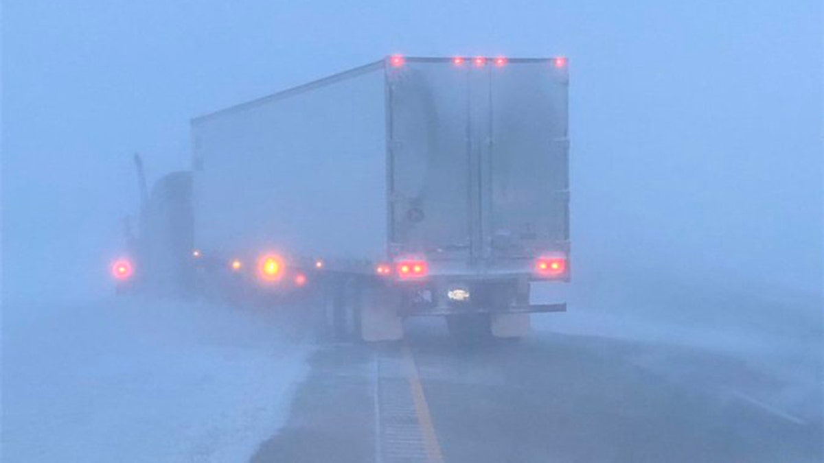
Whiteout conditions and accidents were reported Wednesday in North Dakota as a storm system brought blizzard conditions to parts of the state. (North Dakota Highway Patrol)
The North Dakota Highway Patrol urged motorists to delay traveling to later in the day after multiple incidents were reported of vehicles losing sight and crashing into the ditches on state highways.
"The storm will blow over later today," the highway patrol tweeted. "Don’t travel until then."
WHICH WERE THE WORST BLIZZARDS? HERE ARE THE DEADLIEST STORMS IN HISTORY
The Minnesota State Patrol said that a no-travel advisory was posted in the northwest part of the state and some roads were closed due to several crashes.
Multiple crashes were reported in northwest Minnesota as blizzard conditions slammed the region. (Minnesota State Patrol)
Another video by the state patrol showed blowing snow as troopers responded to several accidents.
"Troopers are responding to several vehicles that have slid off the road — high winds & blowing snow causing whiteout conditions," MSP Public Information Officer Sgt. Jesse Grabow tweeted. "The only reason we can see anything here is due to the shelter belt along the highway."
At least 37 schools across Minnesota are closed Wednesday morning due to the weather, FOX9 reported.
CLICK HERE FOR MORE WEATHER COVERAGE FROM FOX NEWS
The blizzard conditions are due to an Arctic air mass surging from the Northern Plains and Upper Mississippi Valley that will cause temperatures to drop 10 to 20 degrees below average, according to the NWS' Weather Prediction Center.
"Temperatures behind the Arctic cold front will expand across the Upper Midwest and into the Western Great Lakes by the end of the forecast period (Thursday night) with similar 10-20 degree below average values expected," the WPC said.
Temperatures may not reach above 0 degrees on Thursday in parts of Minnesota and the Dakotas, while single-digits will be expected in places such as Minneapolis. By Friday, the Arctic air mass will head east into the Northeast, with temperatures in the major cities dropping into the teens by Friday night.