


National forecast for Tuesday, July 7
Fox News senior meteorologist Janice Dean has your FoxCast.
Lightning lit up the skies over the nation's largest city on Monday when severe thunderstorms moved across the Northeast -- and more stormy conditions are expected this week.
The National Weather Service's (NWS) Storm Prediction Center (SPC) said it received dozens of reports of storm damage in New York, New Jersey and Pennsylvania.
The NWS said that the various storms combined to form a "very impressive large cold pool/outflow boundary" that expanded out in all directions.
ROCKSLIDE IN IDAHO SENDS BOULDERS CRASHING DOWN ON HIGHWAY
"This is perhaps the most impressive symmetrical cold pool/storm outflow we've ever witnessed," the NWS office in Mount Holly, N.J., said.
In New York City, severe thunderstorm and flash flood warnings were for parts of the city until 7 p.m.
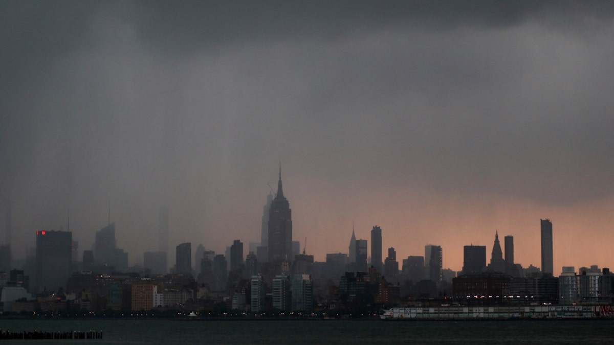
JERSEY CITY, NJ - JULY 6: A thunderstorm passes through midtown Manhattan in New York City on July 6, 2020 as seen from Jersey City, NJ. (Photo by Gary Hershorn/FOX News)
Video posted to Twitter by Sam E Antar from Pier 62 at Hudson River Park in Manhattan showed the storms moving in.
The severe thunderstorms also brought a lot of lightning, with stunning displays seen around the city.
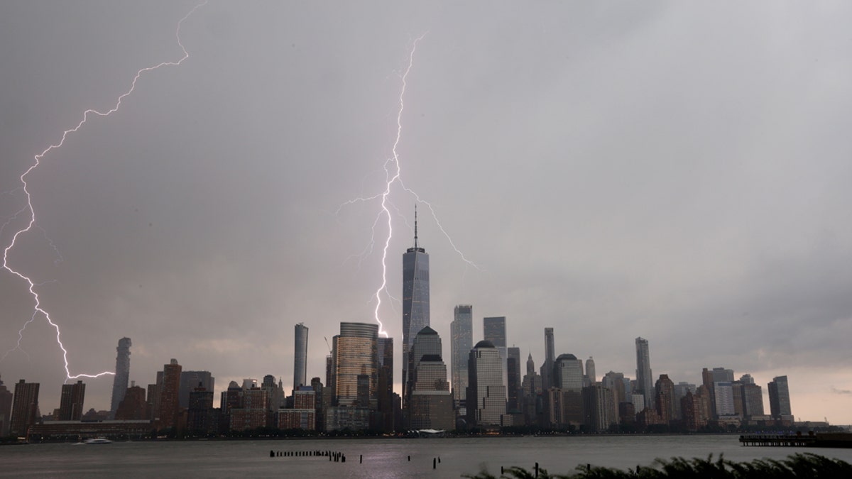
Lightning strikes behind the skyline of lower Manhattan and One World Trade Center in New York City during a thunderstorm on July 6, 2020, as seen from Jersey City, NJ. (Photo by Gary Hershorn/FOX News)
Two lightning bolts could be seen hitting the Hudson River in front of the skyline of lower Manhattan in photos taken by Fox News' Gary Hershorn.
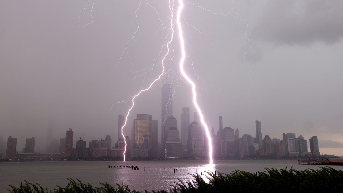
Two lightning bolts frame One World Trade Center as they hit the Hudson River in front of the skyline of lower Manhattan in New York City during a thunderstorm on July 6, 2020, as seen from Jersey City, N.J. (Photo by Gary Hershorn/FOX News)
In addition to the lightning, the storms also triggered major flash flooding in neighboring New Jersey.
LIGHTNING STRIKE IN GEORGIA KILLS 'SWEET' GIRL, 9, SERIOUSLY INJURES SISTER
The streets of Morristown were turned into rivers as thunderstorms dropped several inches of rain in a short amount of time.
“Worst storm I have ever seen in Morristown, NJ. Heavy wind, thunder lightning and heavy hail. Most rain in 30 minutes I have ever seen. Lightning strikes all over. And it’s not over,” Brian Mulligan posted to Twitter with videos showing the inclement weather.
The NWS had issued a flash flood warning for the Northern New Jersey community at the time.
A section of Interstate 287 in Morristown also flooded due to the heavy rains.
CLICK HERE FOR MORE WEATHER COVERAGE FROM FOX NEWS
The storms also caused damage across the Philadelphia metro area on Monday.
In Bensalem, Pa., one person got trapped inside a car after a large tree snapped during the storms and fell on two vehicles.
Officials told FOX29 the person was transported to a local hospital with minor injuries.
Heavy rain also caused flash flooding that stranded drivers throughout the area.
CLICK HERE FOR THE FOX NEWS APP
According to forecasters at the NWS, the region will see the lingering risk of more storms this week.
Scattered thunderstorms are possible from the mid-Atlantic into the Northeast on Wednesday. The greatest risk of severe thunderstorms is in New England, according to the SPC.
The biggest threat will be on Wednesday with hail and wind damage.
By the end of the week, the NWS says that thunderstorms across the Northeast could produce heavy rainfall on Friday that may lead to another risk of flash flooding.

True Crime
The hottest stories ripped from the headlines, from crime to courts, legal and scandal.
By entering your email and clicking the Subscribe button, you agree to the Fox News Privacy Policy and Terms of Use, and agree to receive content and promotional communications from Fox News. You understand that you can opt-out at any time.
