
Tropical Storm Humberto expected to drift away from US coast
Tropical Storm Humberto has hit part of the already devastated Bahamas by Hurricane Dorian. Parts of Florida could still see some of the effects of the storm.
The eighth-named storm of the Atlantic hurricane season is gathering strength Sunday, bringing gusting winds through portions of the devastated northwestern Bahamas as it prepares to turn away from the Southeast coast and possibly take aim at Bermuda.
The National Hurricane Center in Miami said that Tropical Storm Humberto is located about 165 miles east-northeast of Cape Canaveral, Fla., and 180 miles north-northwest of Great Abaco Island in the Bahamas as of 11 a.m. EDT.
The storm has maximum sustained winds of 65 mph and is currently moving north at 7 mph.
HUMBERTO DUMPS MORE RAIN ON DORIAN-BATTERED BAHAMAS
"Gusty winds in squalls are still affecting portions of the northwestern Bahamas. These winds should subside later today," the NHC said.
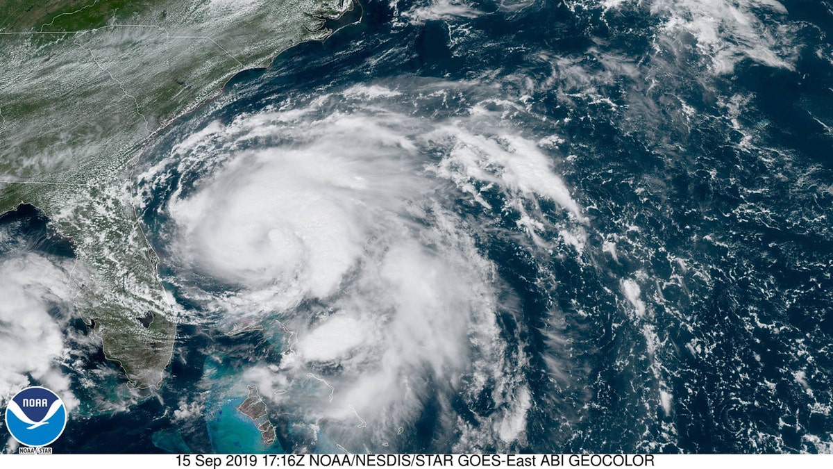
Tropical Storm Humberto can be seen swirling just north of the northwestern Bahamas and off the coast of Florida on Sunday. (NOAA/GOES East)
Outer band rainbands associated with the storm may bring up to 2 inches of rain in the central Bahamas through Sunday night, with isolated amounts of up to 6 inches.
Forecasters believe that Humberto will become a hurricane by Sunday night or Monday morning, but is moving far enough away from the northwestern Bahamas that were battered by Hurricane Dorian.
"A sharp turn to the northeast is forecast to occur Monday morning or afternoon, followed by a motion toward the northeast and east-northeast on Tuesday and Wednesday," the NHC said. "On the forecast track, the center of Humberto will continue to move away from the Bahamas and remain well offshore of the east coast of Florida through Wednesday."
As Humberto hovered near the northwestern Bahamas, the storm briefly shuttered a couple of small airports, sent people in damaged homes to seek shelter and threatened to interrupt the distribution of sorely needed supplies, including food and water.
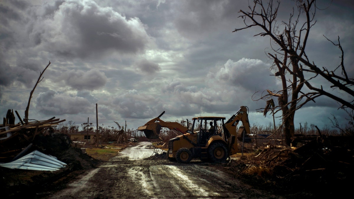
Mos Antenor, 42, drives a bulldozer while clearing the road after Hurricane Dorian Mclean's Town, Grand Bahama, Bahamas, Friday Sept. 13, 2019. (AP Photo/Ramon Espinosa)
The islands' official death toll from Hurricane Dorian remained at 50 and the number of missing at an alarming 1,300 people, although officials cautioned the list is preliminary and many people could just be unable to connect with loved ones. As the storm passed, however, cleanup and recovery efforts in communities were beginning to resume, according to the Associated Press.
TROPICAL STORM HUMBERTO FORMS EAST OF BATTERED BAHAMAS
No coastal watches or warnings are in effect, although forecasters say Humberto will bring large swells to the northwestern Bahamas and southeastern U.S. coast from east-central Florida to North Carolina over the next several days.
"The storm is moving away from the U.S. coast so we only expect an increased risk of riptides," Fox News Meteorologist Adam Klotz said Sunday.
CLICK HERE FOR THE FOX NEWS APP
After becoming a hurricane, Humberto is expected to keep strengthening through at least Wednesday, according to forecasters.
"Humberto is forecast to become a Cat 2 storm as it approaches Bermuda by midweek," Klotz said.
While the impacts on Bermuda are still several days away, the NHC said Humberto may bring periods of heavy rain to Bermuda beginning late Wednesday.
Tropical-storm-force winds may also arrive in Bermuda by Wednesday night.
The National Oceanic and Atmospheric Administration has said it expects 10-17 named storms this hurricane season, with winds of 39 mph or higher, of which five to nine could strengthen into hurricanes. Of those storms, there will be two to four major hurricanes, which are classified as Category 3, 4, and 5 with winds of 111 mph or higher.
The 2019 Atlantic Hurricane Season runs from June 1 to Nov. 30, and this year includes the names: Andrea, Barry, Chantal, Dorian, Erin, Fernand, Gabrielle, Humberto, Imelda, Jerry, Karen, Lorenzo, Melissa, Nestor, Olga, Pablo, Rebekah, Sebastien, Tanya, Van, and Wendy.
The Associated Press contributed to this report.

Fox News' "Antisemitism Exposed" newsletter brings you stories on the rising anti-Jewish prejudice across the U.S. and the world.