National forecast for Thursday, July 9
Fox News senior meteorologist Janice Dean has your FoxCast.
An area of disturbed weather located off the coast of the Carolinas on Thursday morning is setting the stage for a soaking rain event along the mid-Atlantic and along the Northeast coast through the end of the week.
The National Hurricane Center (NHC) in Miami said the area of low pressure located about 50 miles east of Wilmington, N.C., is becoming "better defined."
Associated showers and thunderstorms with the low pressure are still disorganized out over the ocean, but forecasters at the NHC said there's now an 80 percent chance the system develops into a tropical or subtropical cyclone by Friday.
TROPICAL SYSTEM MAY DEVELOP OFF CAROLINAS, MID-ATLANTIC; LIKELY TO BECOME FAY
If it develops into a named storm, it would be the sixth of the 2020 Atlantic hurricane season and have the name "Fay."

There's an 80 percent chance that a tropical system develops off the coast of the Carolinas. (Fox News)
Very warm sea-surface temperatures from the Gulf Stream should help with this development.
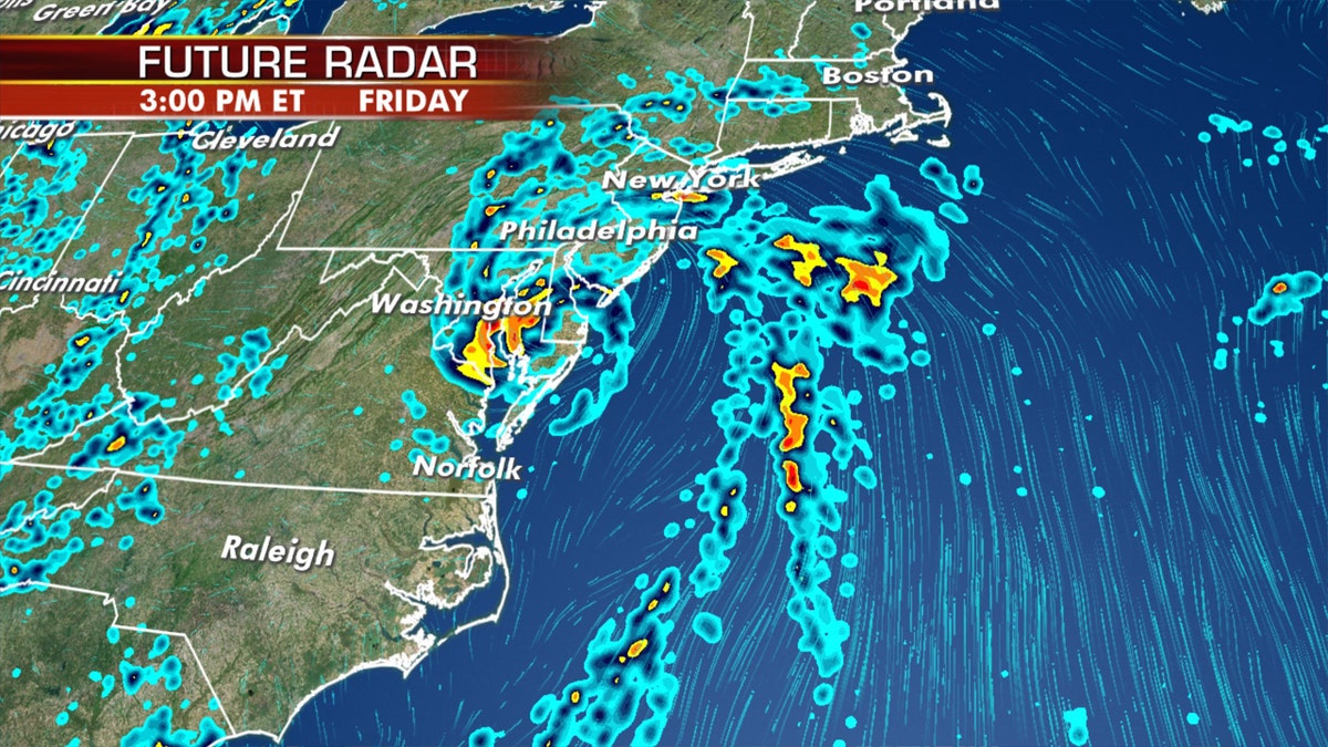
heavy rain and gusty winds will be the result near and north of the track as the system moves north. (Fox News)
Regardless of whether or not this becomes Fay, areas near and north of the track should prepare for soaking weather as the system moves north.
Heavy rain that could trigger flooding and gusty winds are likely along the East Coast from the mid-Atlantic to New England through Saturday.

Several inches of rain are possible through the end of the week across the mid-Atlantic and Northeast due to the system. (Fox News)
The NHC said an Air Force Reserve Hurricane Hunter aircraft is scheduled to investigate this system at some point on Thursday, if necessary.
First hurricane forecast in East Pacific

Tropical Storm Cristina is forecast to become the first hurricane of the East Pacific season on Thursday. (Fox News)
Meanwhile, well offshore from Mexico, Tropical Storm Cristina is forecast to become the first hurricane of the East Pacific season on Thursday.
CORONAVIRUS AND HURRICANE SEASON: HERE'S WHY THE RED CROSS SAYS NOW IS THE TIME TO PREPARE
While it may be the first hurricane in the Pacific this season, the storm will be no threat to land as it will move northwestward into the open ocean.
Active day of severe weather across Midwest

Dozens of storm reports across the Midwest on Wednesday, including several tornadoes. (Fox News)
Wednesday was an active day with severe storms, including tornadoes in several states.
More of the same is coming on Thursday to the central U.S. and the Midwest. Locally flash flooding will also be possible in isolated areas.

The areas that may see severe weather on Thursday. (Fox News)
This system will move into the Great Lakes and Midwest on Friday, bringing scattered showers and thunderstorms while cooling off the extreme heat that has been in place for several days.
CLICK HERE FOR MORE WEATHER COVERAGE FROM FOX NEWS
Scattered showers and thunderstorms will also pop up along a frontal boundary stretching from east Texas along the Gulf Coast and up into the Atlantic coast.
Hot and humid weather continues across East, West heats up
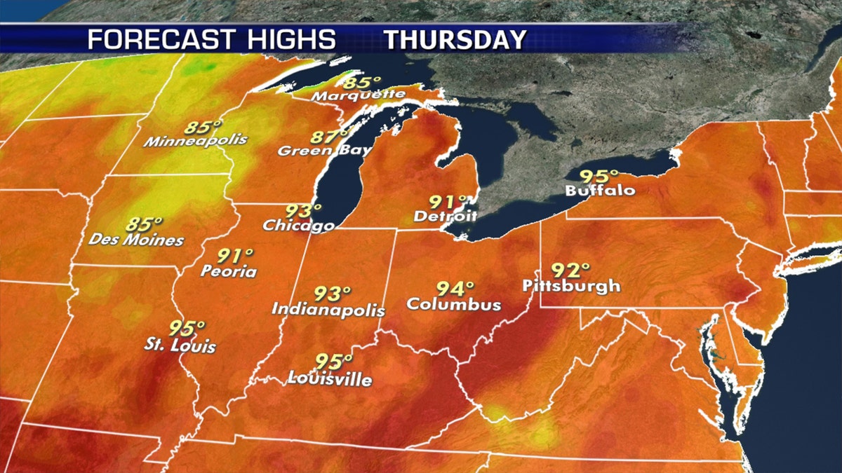
Hot conditions continue across the Midwest into the Northeast on Thursday.
While some cooler temperatures move into the Upper Midwest on Thursday, much of the eastern Great Lakes and interior Northeast will see another hot and humid afternoon.
Heat advisories stretch across the East, while excessive heat warnings are in place in the Southwest.
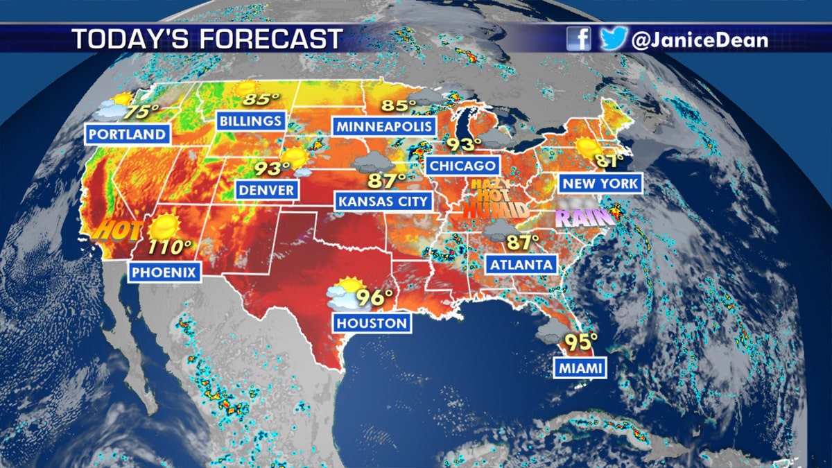
The national forecast for July 9, 2020. (Fox News)
Hot temperatures over west Texas and eastern New Mexico will approach record highs on Thursday.
CLICK HERE FOR THE FOX NEWS APP
The desert Southwest will see afternoon temperatures in the 110-degree range.
By Friday, we’ll see the Southwest begin another stretch of extreme heat that will continue into the weekend.

True Crime
The hottest stories ripped from the headlines, from crime to courts, legal and scandal.
By entering your email and clicking the Subscribe button, you agree to the Fox News Privacy Policy and Terms of Use, and agree to receive content and promotional communications from Fox News. You understand that you can opt-out at any time.
