


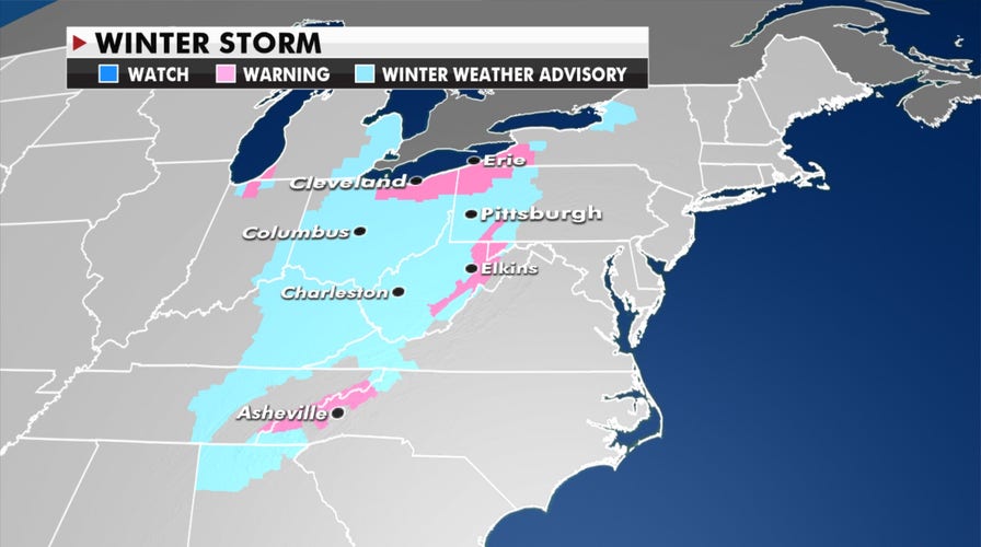
The storm system that brought heavy rain, strong winds, severe storms and snow will move offshore Tuesday, but colder air being pulled from Canada will still bring moderate to heavy snow for parts of the Great Lakes, Northeast and Ohio Valley.
“The powerful storm that impacted much of the East today will linger on Tuesday,” the National Weather Service tweeted late Monday. “Expect heavy snow in parts of Ohio into Pennsylvania and New York, locally heavy rain across eastern Maine and gusty winds for much of the East.”
TORNADO HITS FLORIDA COUNTY, DOWNING TREES AND POWER LINES
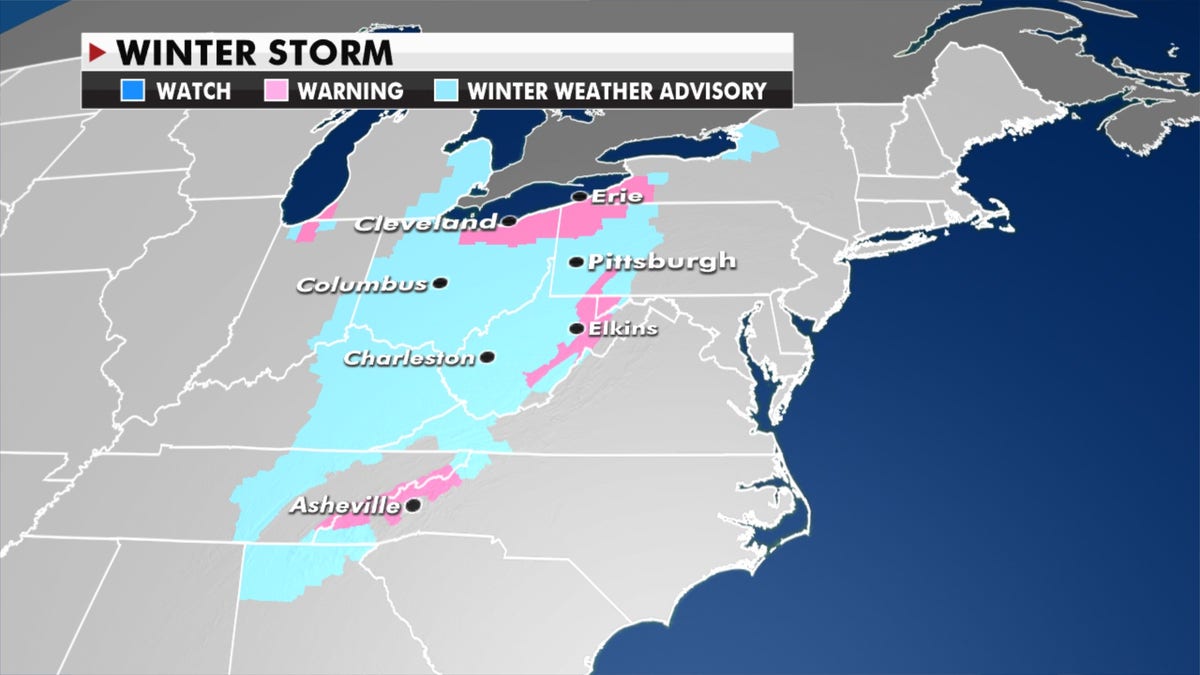
Colder air being pulled from Canada will bring moderate to heavy snow for parts of the Great Lakes, Northeast and Ohio Valley. (Fox News)
The much colder air will bring freeze advisories to parts of the Deep South and parts of Florida on Wednesday morning.
Meanwhile, the Pacific Northwest will see rain and some snow for the mountains, and rain will move into the Gulf Coast starting tomorrow.
CLICK HERE TO GET THE FOX NEWS APP

Forecast graphic (Fox News)
There’s still an elevated fire risk over southern California this week with breezy dry conditions persisting over the region.
Fox News’ James Rogers contributed to this article.
Follow James Rogers on Twitter @jamesjrogers