


Powerful coast-to-coast storms threaten Thanksgiving travel
Millions of Americans are keeping a close eye on two major storms forecasted to create travel nightmares across the country this Thanksgiving; Matt Finn reports from Chicago's O'Hare International Airport.
There may be no place like home for the holidays, but many Americans this year will have to weigh the Thanksgiving travel risks that come along with two major storms wreaking havoc over wide swaths of the country.
THANKSGIVING WINTER WEATHER THREATENS COAST-TO-COAST MISERY
The weather forecast on Wednesday for much of the U.S.—from the sunny beaches of Southern California to the wind-whipped streets of Chicago—calls for heavy snow, rain and powerful wind gusts. Some of the worst weather is expected at peak travel times in some of the largest cities. Some 55 million people are expected to travel over the next few days.
“This is not an ordinary storm,” the National Weather Service (NWS) warned.
California and the West Coast:
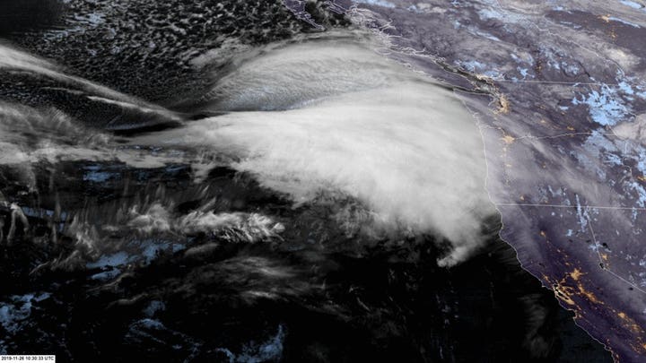
The NWS said a "bomb cyclone" is headed for Northern California and the southern tip of Oregon. The agency said the storm could be a weather event not seen in the area for 20 years. Mountains in the area may see up to two feet of snow along with 35-foot waves along the coast.
On Wednesday morning, California shut down Interstate 5 between the northern cities of Yreka and Redding because vehicles had begun spinning out in the blizzard conditions. It was unclear when the roadway would reopen.
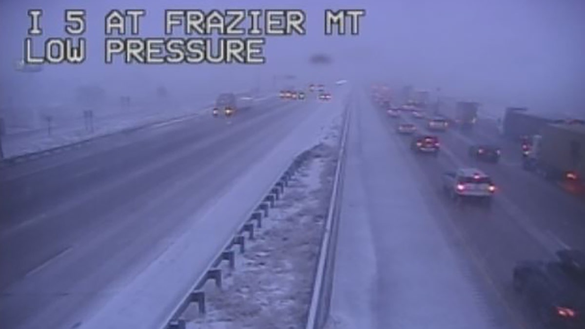
Interstate 5 between the northern California cities of Yreka and Redding experienced blizzard conditions early Wednesday. (California Department of Transportation)
If you travel south from there toward Los Angeles, you’ll be greeted with heavy rain on Wednesday, which could linger until the weekend. Kathy Hoxsie, an NWS meteorologist, told KTLA that the rainfall is expected during peak holiday travel, “of course.”
A flash flood watch remained in effect for parts of southwestern California, including San Diego and Orange Counties, until Thursday night, the NWS said. Rainfall of 1 to 3 inches was expected in some parts of the coast and valley regions.
Strong winds with potentially damaging gusts of 40 to 50 mph are also expected in the region, and dangerous snowfall on surrounding mountains. Las Vegas may also see snowflakes.
Rockies and Midwest:
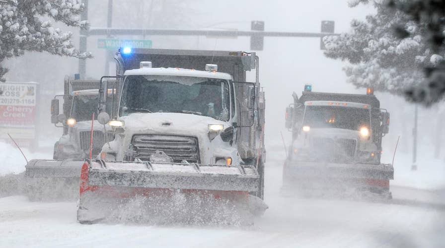
A separate yet historic snowstorm slammed Denver on Tuesday.
It dumped around 10 inches of snow at Denver International Airport, forcing the cancelation of over 450 flights and stranding more than 1,000 travelers.
DENVER AIRPORT CANCELS OVER 450 FLIGHTS AMID SNOWY WEATHER, URGES TRAVELERS TO CHECK WITH AIRLINES
Sonya Washington came close to taking off. Her plane was de-iced and she made it to the runway, she told the Denver Post. But it was there that she waited--and waited-- with her 2-year-old daughter. After two hours, the plane returned to the gate due to snow. She had hopes of making it to Atlanta, but the next flight won't be Thursday night.
"Thanksgiving is over then," she said.
The storm dumped nearly 3 feet of snow in parts of northern Colorado and closed long stretches of highways there and in Wyoming. One person was killed, and two others were injured when a tractor-trailer jackknifed and was hit by two other trucks on Interstate 70 near the Colorado ski town of Vail.
The system moved east, allowing Denver to begin returning to normal, but the storm is now expected to affect the Great Lakes.
Blizzard and wintry weather warnings extended into the Great Lakes states with the storm bringing high winds and snow to Michigan, Minnesota and Wisconsin.
The storm could dump 6 inches of snow in central and southern Minnesota, while some areas could see 9 to12 inches. Blinding snow was already falling fast in southern parts of the state as the busy holiday travel day got underway.
At Minneapolis-St. Paul International Airport, crews worked overnight to clear runways ahead of the busiest travel day before Thanksgiving. About 20 flights were delayed or canceled Wednesday morning. Many school districts and universities canceled Wednesday classes as travel conditions deteriorated.
In western and northern Wisconsin, the storm could dump 8 to 12 inches of snow, with 12 to 15 inches of lake-effect snow near Lake Superior.
Weather officials in Chicago said 35 to 45 mph wind gusts were already whipping across the city, warning that gusts may exceed 60 mph. ABC 7 Chicago reported that forecasters said the gusts will down power lines and delay flights.
There's also a chance of snow over the weekend for parts of New England, said Alex Lamers, an NWS meteorologist.
“That could be a coast-to-coast storm,” he said.

Pam Semmler walks her 10-year-old Golden retriever named Summit as a storm packing snow and high winds sweeps in over the region Tuesday, Nov. 26, 2019, in Denver. (AP)
Northeast:
After sweeping across the country, the system is expected to arrive on the eastern coast on Wednesday or Thursday -- just in time for the Macy’s Thanksgiving Day Parade in New York.
The storm system could mean disappointment for fans of the larger-than-life balloons flown during the parade. Organizers were preparing for the possibility of grounding the iconic balloon characters because of 40-50 mph gusts in the forecast.
Rules put in place after several people were injured by a balloon years ago require lower altitudes or full removal if sustained winds exceed 23 mph and gusts exceed 34 mph.
The decision will be made on parade day.
CLICK HERE FOR THE FOX NEWS APP
The Associated Press contributed to this report.