


National forecast for Wednesday, September 9
Fox News senior meteorologist Janice Dean has your FoxCast.
The latest named tropical system over the Atlantic Ocean restrengthened on Wednesday to a tropical storm and is expected to become a hurricane later this week, according to forecasters.
The U.S. National Hurricane Center (NHC) in Miami said that Rene is now a tropical storm again, after bringing heavy rain and gusty winds to the Cabo Verde Islands.
"Additional strengthening is forecast during the next 48 hours," the NHC said.
TROPICAL STORM RENE JOINS PAULETTE IN ATLANTIC AS 2020 HURRICANE SEASON STAYS ACTIVE
As of 11 a.m. EDT, the storm was located about 510 miles west-northwest of the islands, with maximum sustained winds of 40 mph as it moves west-northwest at 13 mph.
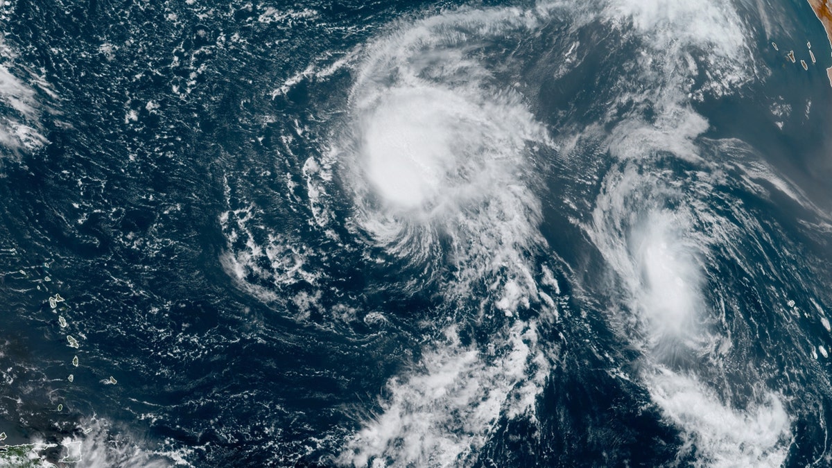
Tropical Storms Paulette (left) and Rene (right) are seen over the Atlantic on Sept. 9, 2020. (NOAA/GOES-East)
Rene is expected to become a hurricane this week but then weaken over the open waters of the Atlantic, according to the NHC.
Bermuda may need to keep an eye on Tropical Storm Paulette, the second system currently in the Atlantic.
The NHC's advisory at 11 a.m. EDT had the storm with 60 mph winds and located about 1,090 miles east of the Northern Leeward Islands, moving west-northwest at 9 mph.
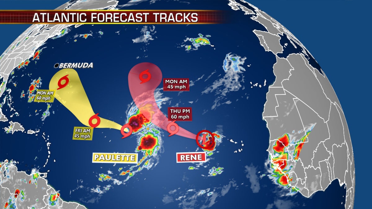
The forecast tracks of Paulette and Rene. (Fox News)
The storm is forecast to continue moving northwest through Friday night and Saturday.
"Some weakening is forecast during the next couple of days," the NHC said.
Bermuda needs to monitor Paulette early next week for possible impacts, but for now Paulette isn’t expected to strengthen significantly through the weekend. The storm is expected to generate rough surf that will reach the Greater Antilles, Bahamas and Bermuda into the weekend.
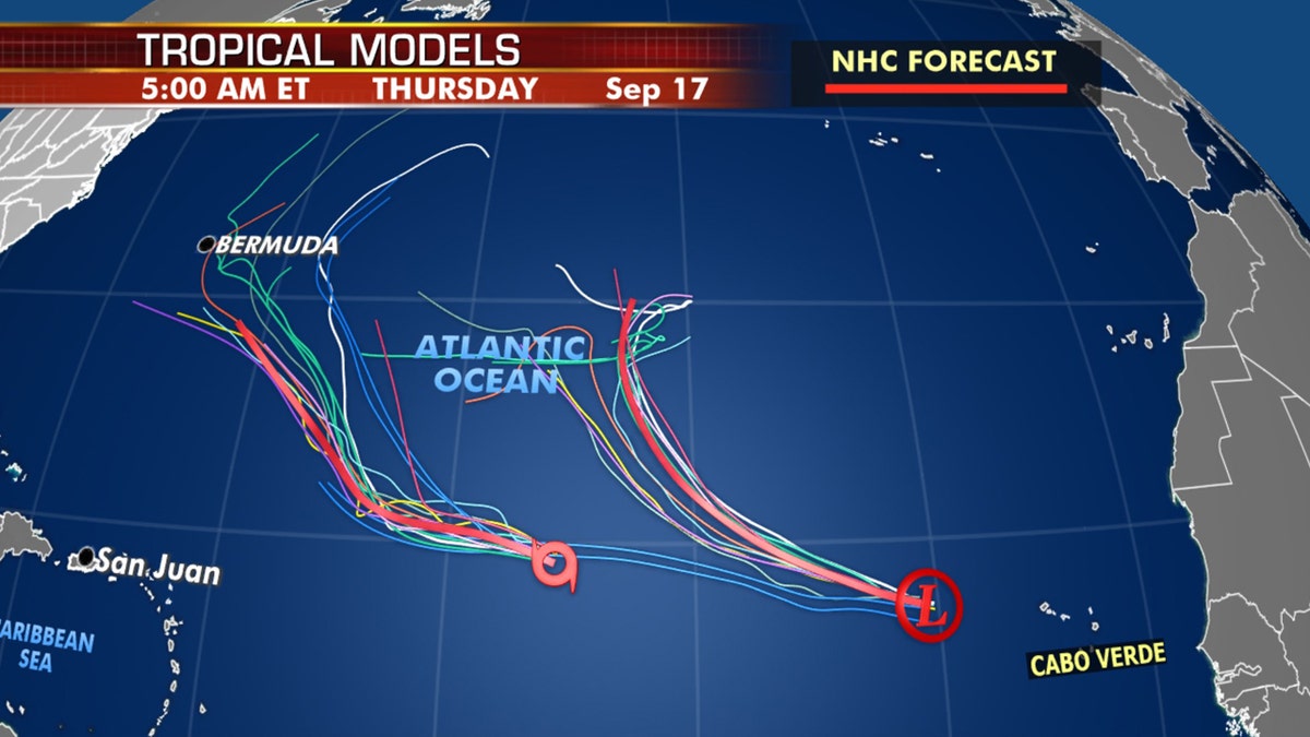
Forecast models for Paulette and Rene. Bermuda may need to keep an eye if Paulette draws closer. (Fox News)
Neither of these storms will have a direct impact on the U.S.
Another tropical disturbance southwest of Bermuda has a slight chance of gaining some tropical organization as it approaches the Carolinas by Friday. As of Wednesday, it's not a major concern, as environmental conditions are marginal at best.
A system is moving off Africa in the next couple of days and has the potential to become a tropical depression by the weekend.
Rene was one of two storms that formed Monday; Tropical Storm Paulette took shape earlier in the day in the central Atlantic, far from land.
Historically, September produces the most Atlantic Ocean basin tropical activity. The two current tropical storms are the earliest 16th and 17th named storms, continuing a trend during the 2020 Atlantic hurricane season.
CLICK HERE FOR MORE WEATHER COVERAGE FROM FOX NEWS
The two previous storms, Nana and Omar, were the earliest 14th and 15th named storms on record.
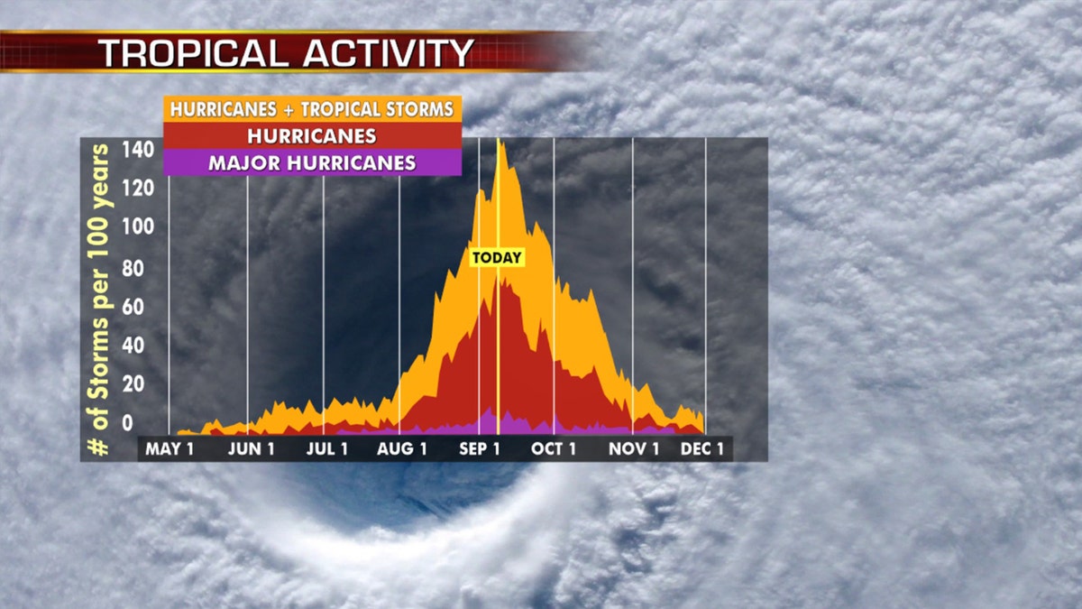
Hurricane season peaks on Sept. 10, and then starts to decrease. (Fox News)
Tropical activity historically climbs through Sept. 10, when it peaks and starts to slowly go back down.
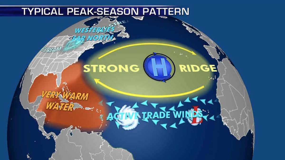
The patterns during the peak of hurricane season that influence where storms travel. (Fox News)
NOAA forecasters are now calling for up to 25 named storms with winds of 39 mph or higher; of those, seven to 10 could become hurricanes. Among those hurricanes, three to six will be major, classified as Category 3, 4 and 5 with winds of 111 mph or higher.

The names of the 2020 Atlantic hurricane season. (Fox News)
That's far above an average year. Based on 1981-to-2010 data, that is 12 named storms, six hurricanes and three major hurricanes. So far this year, there have been 17 named storms, including five hurricanes.
CLICK HERE FOR THE FOX NEWS APP
The 2020 Atlantic hurricane season runs from June 1 to Nov. 30 and includes the names Arthur, Bertha, Cristobal, Dolly, Edouard, Fay, Gonzalo, Hanna, Isaias, Josephine, Kyle, Laura, Marco, Nana, Omar, Paulette, Rene, Sally, Teddy, Vicky and Wilfred.
Fox News' Adam Klotz and Brandon Noriega contributed to this report.