


Fox News Flash top headlines for August 9
Fox News Flash top headlines are here. Check out what's clicking on Foxnews.com.
The prolonged heat wave that has impacted large portions of the country will be winding down over the course of the next several days.
However, on Tuesday, some final heat remains for millions in the Pacific Northwest and in the Northeast.
High temperatures will largely climb into the mid-90s, which is well above seasonal averages.
Heat advisories are in place running along the I-95 corridor from Washington, D.C., to Boston and across interior New England.
ELMO FIRE IN MONTANA BURNS OVER 21,000 ACRES, IS 55% CONTAINED
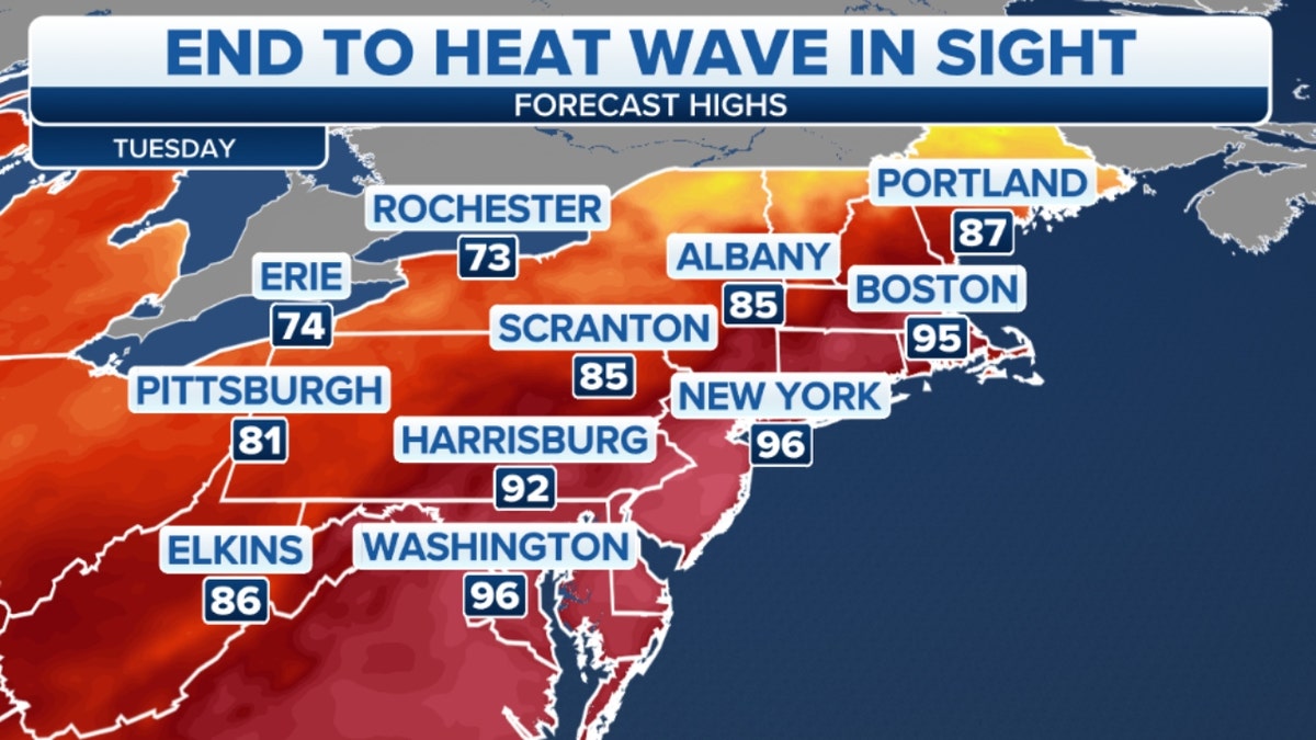
High temperatures in the Northeast on Tuesday (Credit: Fox News)
By Wednesday, most of the region will see daytime highs falling by over 10 degrees, into the lower-to-mid-80s.
The cold front that is ushering in cooler air is also producing showers and thunderstorms as it moves across the country.
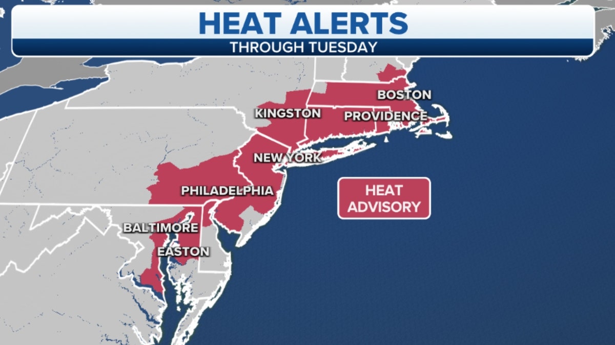
Northeastern heat alerts through Tuesday (Credit: Fox News)
On Tuesday and early Wednesday, those storms will move from the Mississippi Valley through the Appalachian mountains.
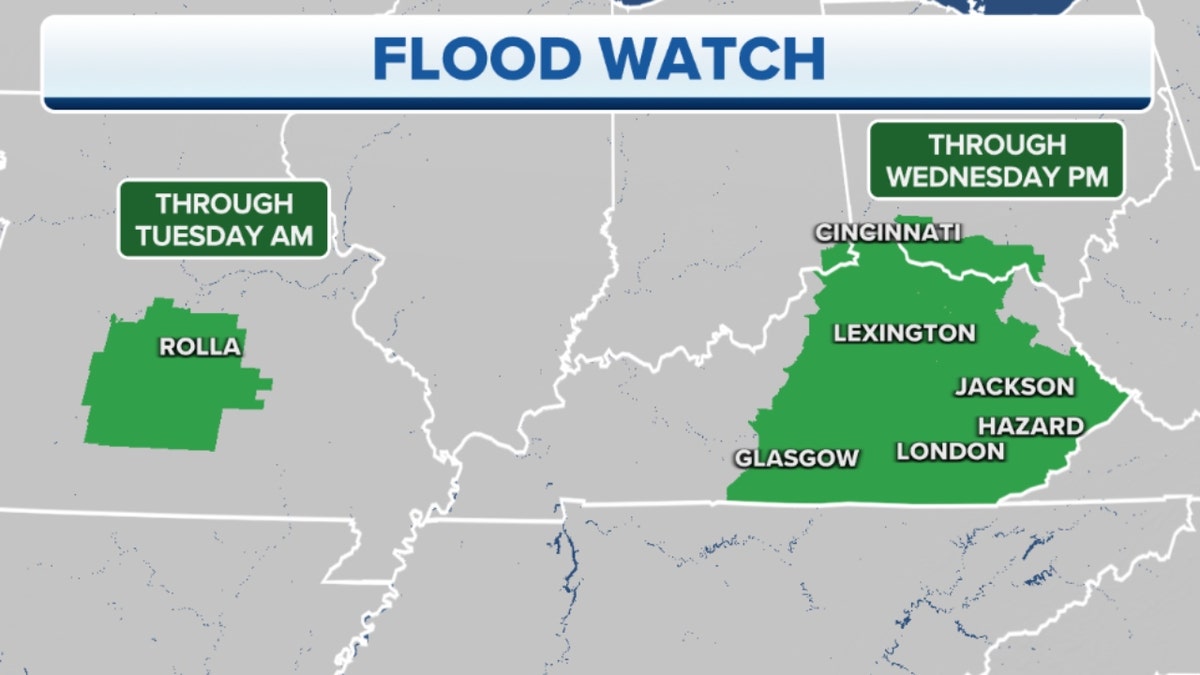
A Flood Watch in eastern Kentucky, the Appalachian mountains (Credit: Fox News)
After weeks of soggy conditions in these regions, additional rainfall on top of saturated ground could cause more flooding.
CLICK HERE TO GET THE FOX NEWS APP
The hardest hit region, eastern Kentucky, is under a flood watch through Wednesday.