


Fox News Flash top headlines for Nov. 5
Fox News Flash top headlines for Nov. 5 are here. Check out what's clicking on Foxnews.com
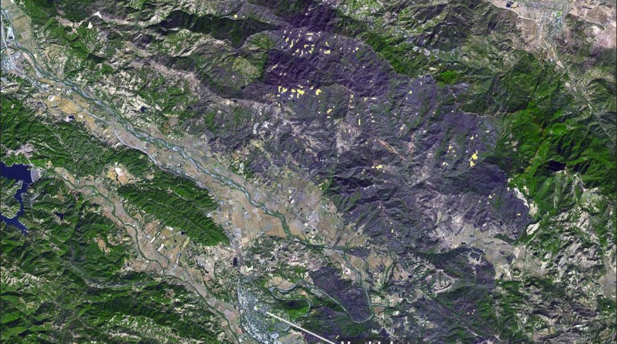
The scope of the damage from California's Kincade Fire can be seen from space in a disturbing new satellite image.
The newly released image was taken on Sunday by NASA's Terra satellite, according to the space agency's press release.
That satellite is equipped with a special instrument that harnesses thermal infrared channels to detect heat on the Earth's surface.
OVER 11,000 SCIENTISTS WARN OF 'CLIMATE EMERGENCY'
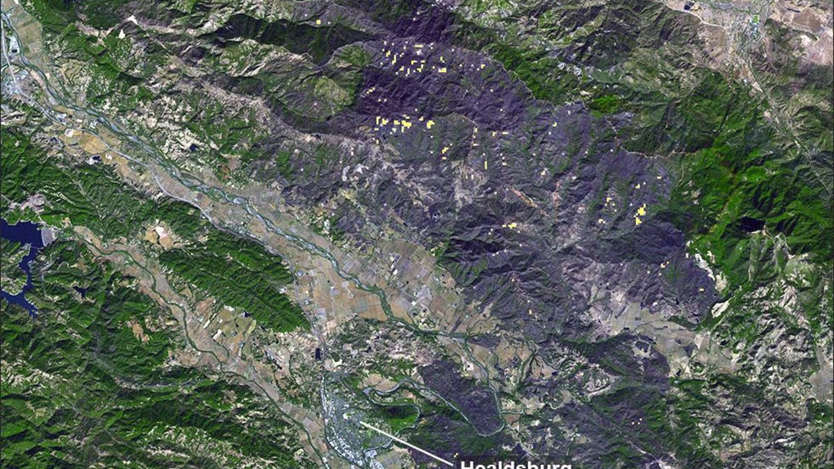
A large burn scar can be seen from space where the Kincade Fire has burned through Sonoma County, Calif. (NASA/JPL-Caltech) (NASA/JPL-Caltech)
The dark grey shows burnt areas, and the yellow dots show smoldering fires, according to NASA.
The town of Healdsburg is seen in the center of the image.
The Kincade fire, which began on Oct. 23, had burned 77,758 acres and destroyed 372 structures by Sunday, according to the California Department of Forestry and Fire Protection. It is now more than 80 percent contained.