


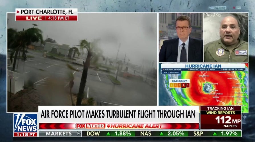
Air Force pilot who flew through Hurricane Ian describes storm as a 'life changer'
Kendall Dunn, the U.S. Air Force Reserve’s 53rd Weather Reconnaissance Squadron commander, detailed what he called the roughest storm of his career on 'Your World.'
An Air Force pilot who flew through the eye of Hurricane Ian as it made its way across Florida's Gulf Coast on Wednesday described it as the worst flight of his career.
A crew from the 53rd Weather Reconnaissance Squadron took off from Keesler Air Force Base in Mississippi in a WC-130J Hercules to collect data for better tracking of the storm’s path and intensity. The flight's commander, Maj. Kendall Dunn, told Fox News that while the initial passes were as expected, the third and fourth passes were "life-changers" for him and his crew.
"We flew into it, 10,000 feet and the first couple passes into the storm, standard stuff for us Hurricane Hunters, seeing 100 mile an hour winds or so," Dunn said in an appearance on "Your World" on Wednesday.
AIR FORCE HURRICANE HUNTERS INSIDE IAN'S EYE CAPTURE EERIE, CALM BLUE SKIES
"But the third and fourth pass, they were life changers," he continued. "Honestly… we were doing what we need to do just to keep the airplane airborne, keep it right side up. It was pretty intense. The eyewall was something I've never seen. The amount of mesocyclones and tornadoes inside the wall. It was an absolute mess."
Dunn said it's hard to emphasize "how big of a deal this is."
"It’s the strongest storm I've ever been in," he said.
Hurricane Hunters, a division of the National Oceanic and Atmospheric Administration and the Air Force Reserve, are tasked with flying into storms to gather critical data used for tropical cyclone forecasting, mapping the surface wind environment below the aircraft and providing enhanced surface wind information.
"The words you don’t want to hear is ‘rapidly intensifying’ as you're heading in there…," Dunn said. The strength of the turbulence, lightening and hail caused visible damage to his aircraft, he added.
HURRICANE IAN MAKES LANDFALL IN SOUTHWESTERN FLORIDA CATEGORY 4 FORCE
"Our radar was showing massive turbulence. The lightning, the hail. The hail itself was unbelievable. To me, it sounded like rocks being poured out of a dump truck. We had paint peeling off the aircraft when we got back," Dunn said. "It was intense."
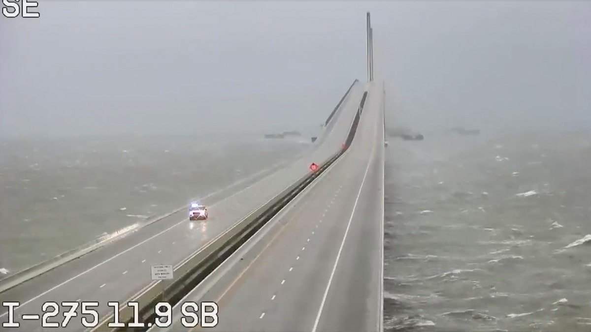
This image provided by FLDOT shows an emergency vehicle traveling on the Sunshine Skyway over Tampa Bay, Fla., on Wednesday. (FDOT via AP)
The Category 4 hurricane made landfall in Southwestern Florida just after 3 p.m. ET with maximum sustained winds estimated to be near 150 mph and outages topping 1 million.
Florida Gov. Ron DeSantis told residents Wednesday that the window to evacuate has passed.
"If you are in any of those counties, it's no longer possible to safely evacuate. It's time to hunker down and prepare for this storm," he said.
CLICK HERE TO GET THE FOX NEWS APP
The National Hurricane Center said Wednesday that Ian would cause catastrophic storm surge, winds and flooding in Florida.