


National forecast for Wednesday, May 13
Fox News senior meteorologist Janice Dean has your FoxCast.
Get all the latest news on coronavirus and more delivered daily to your inbox. Sign up here.
Tens of millions of Americans are threatened by severe weather Wednesday as a pattern change bringing warmer temperatures to the chilly East is setting the stage for strong storms in the central U.S.
As a storm system moves out of the Rockies and into the Plains Wednesday, severe thunderstorms are forecast across the central and southern Plains, before the threat shifts to the Midwest Thursday.
"We have a severe threat today," Fox News senior meteorologist Janice Dean said Wednesday on "Fox & Friends First." "Across the central U.S, large hail, damaging winds, and tornadoes will be possible over some of these same areas that we have seen hit over and over again this season."
HURRICANE SEASON MAY START EARLY WITH TROPICAL SYSTEM BREWING OFF FLORIDA, BAHAMAS
The National Weather Service (NWS) Weather Prediction Center (WPC) said that moisture from the Gulf of Mexico will funnel northward, leading to severe weather from the southern and central Plains to the Great Lakes.
The best chance for severe storms on Wednesday will be from west Texas through Oklahoma, and into Kansas.
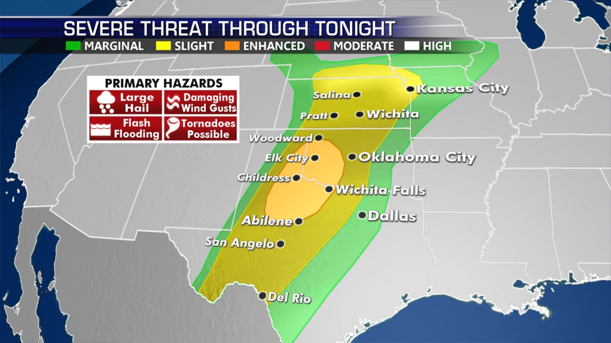
An enhanced risk of severe weather is for northwest Texas into western Oklahoma on Wednesday. (Fox News)
The NWS' Storm Prediction Center said severe weather on Wednesday threatens more than 26 million Americans in areas including San Antonio, the Dallas/Fort Worth Metroplex up into Oklahoma City, and Kansas City, Mo.
"A few tornadoes will be possible with the more dominant supercells as well," the SPC said.
WHERE ARE TORNADOES MOSTLY LIKELY TO HAPPEN IN MAY?
According to forecasters, the greatest threat from the storms on Wednesday will be severe wind gusts and possible "very large hail" during the late afternoon and early evening.
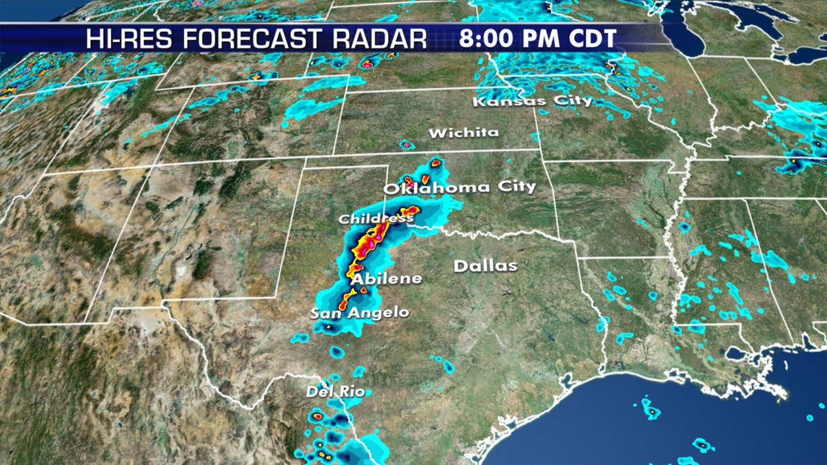
Severe thunderstorms are forecast to fire up into the afternoon and evening hours across the region on Wednesday. (Fox News)
Further north, hail is also possible across Kansas, according to forecasters.
Besides the severe weather, there is also the risk of excessive rainfall from the Plains into the Great Lakes by Thursday.
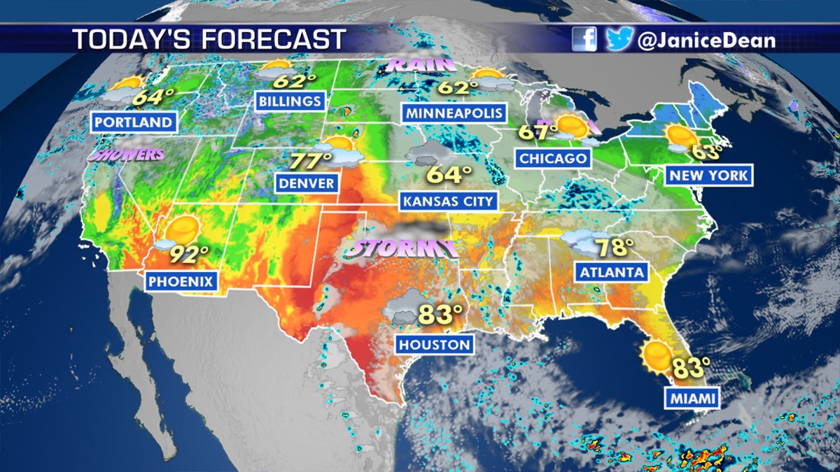
Stormy conditions are forecast across the central and southern Plains on Wednesday. (Fox News)
"Rainfall totals could range between 1 to 2 inches with locally higher amounts possible," the SPC said.
CLICK HERE FOR MORE WEATHER COVERAGE FROM FOX NEWS
Most tornadoes occur when cold dry air from Canada collides with warm, moist air from the Gulf of Mexico.
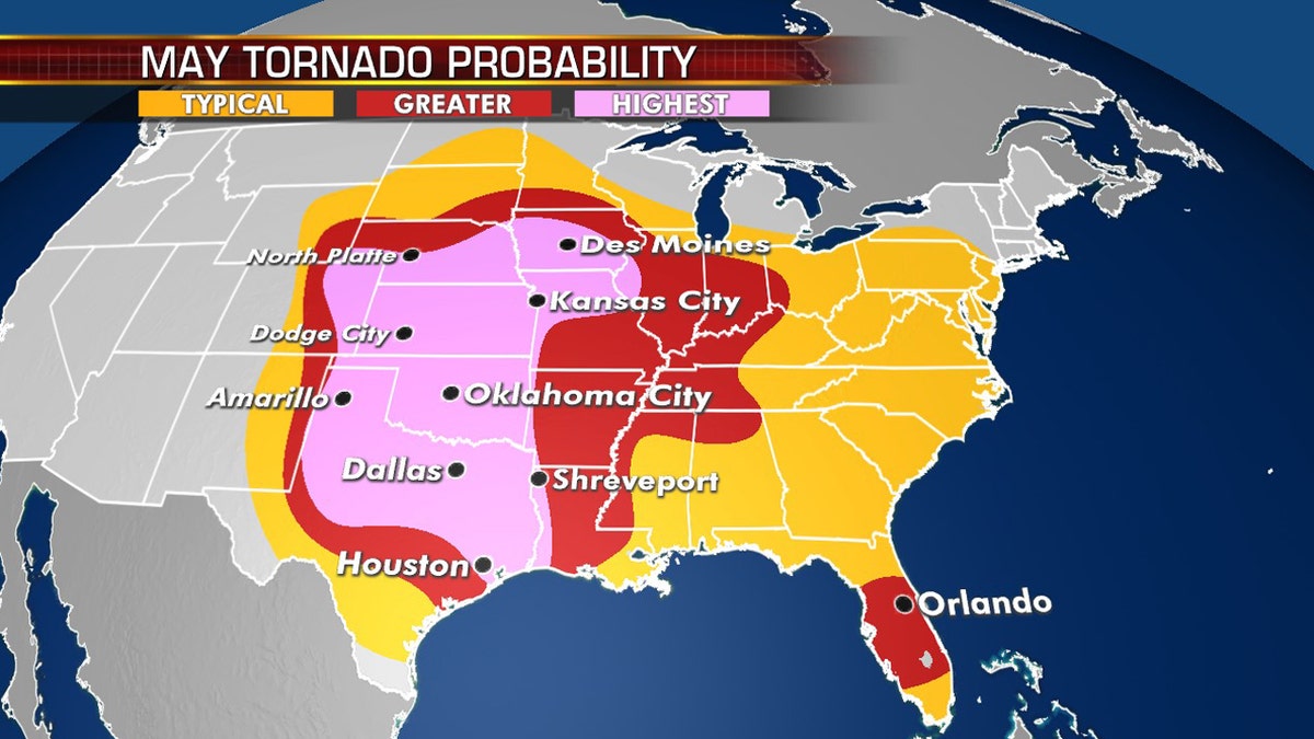
The most active areas for tornadoes in May are in the Plains. (Fox News)
From May to June, the Plains are an ideal location for large supercell thunderstorms and tornadoes due to the combination of those weather factors.
By May, still very cold and dry air mixes with even warmer air over the vast flat landscapes of the Plains, allowing for some of the biggest and most frequent storms of the year.
CLICK HERE FOR THE FOX NEWS APP
Tornado season typically peaks in May when more than 250 twisters are reported.
On average, around 1,200 tornadoes are reported in the U.S. every year, more than any country in the world.
Fox News' Adam Klotz contributed to this report.

True Crime
The hottest stories ripped from the headlines, from crime to courts, legal and scandal.
By entering your email and clicking the Subscribe button, you agree to the Fox News Privacy Policy and Terms of Use, and agree to receive content and promotional communications from Fox News. You understand that you can opt-out at any time.
