


A strong 6.2 magnitude earthquake was reported off the coast of Ecuador early Sunday, but there were no immediate reports of damage or injuries.
The United States Geological Survey said the temblor occurred around 3 a.m. ET about 16 miles north of Santa Elena along the coast.
The quake struck at a depth of about 11 miles, according to the agency. The European-Mediterranean Seismological Center reported that there were also numerous aftershocks following the initial quake.
7.5 MAGNITUDE EARTHQUAKE STRIKES NEAR ECUADOR-PERU BORDER, USGS SAYS

The 6.2 magnitude earthquake was reported about 16 miles north of Santa Elena along the coast, according to the USGS. (USGS)
No damage has been reported so far, but some people reported being awakened from sleep by the shaking.
7.1-MAGNITUDE EARTHQUAKE HITS SOUTHERN PERU
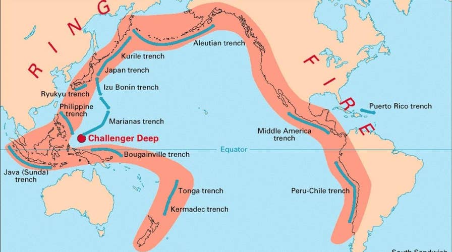
Ecuador lies along the Pacific's so-called "Ring of Fire," a 25,000-mile horseshoe-shaped ring, accounting for approximately 90 percent of the world's earthquakes, according to the USGS.
The region is the location of most of Earth's subduction zones, where oceanic plates slide under the lighter continental plates. Earthquakes tend to happen when those plates scrape or subside underneath each other, and when that happens at sea it can spawn tsunamis.
CLICK HERE FOR THE FOX NEWS APP
The region also contains 452 volcanoes, more than 75 percent of the world's active and dormant volcanoes.
Fox News' Chris Ciaccia contributed to this report.