Just days into the 2019 Atlantic hurricane season, a tropical threat may be brewing in the Gulf of Mexico that could bring more rain to parts of the U.S. that are already seeing record flooding.
The National Hurricane Center said that showers and thunderstorms have increased since Sunday in an area over the Bay of Campeche off Mexico.
The NHC said that as of Monday afternoon there was a 60 percent chance the system will develop into a tropical cyclone before it moves slowly northwestward toward the northeastern coast of Mexico within the next two days.
2019 ATLANTIC HURRICANE SEASON TO BE 'NEAR-NORMAL' WITH 9 TO 15 NAMED STORMS, NOAA SAYS
"Regardless of development, the disturbance will likely produce heavy rainfall over portions of southern and eastern Mexico during the next few days," the NHC said.
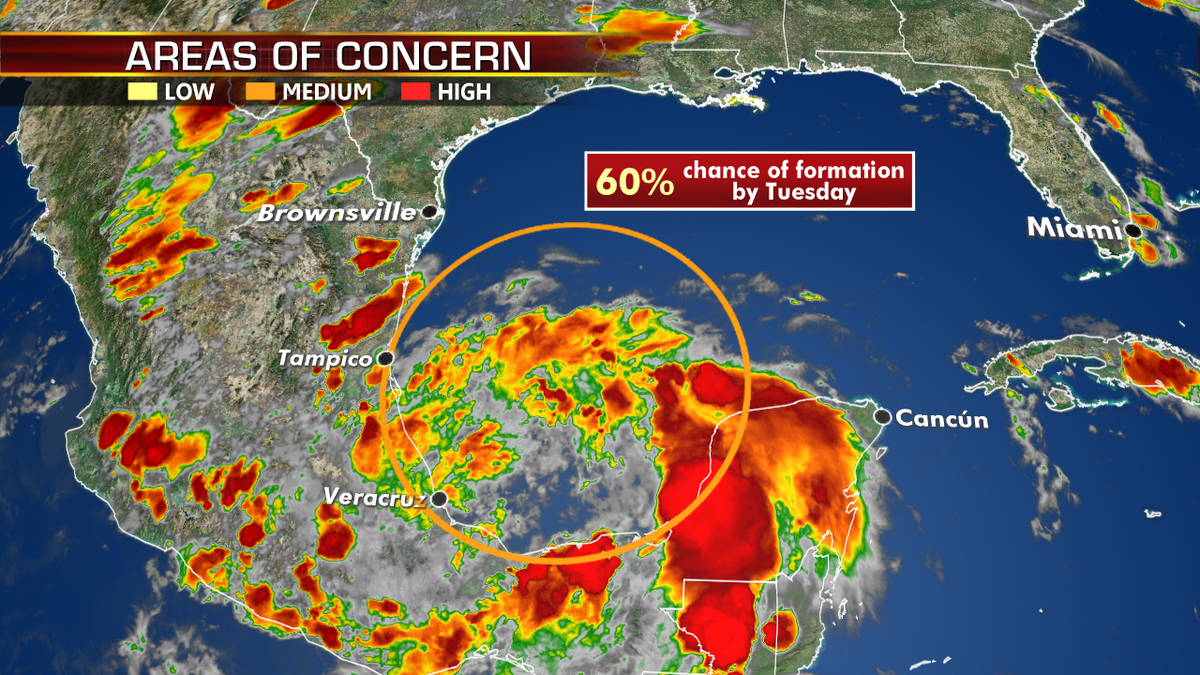
There is about a 60 percent chance a tropical system develops off the coast of Mexico over the next few days, according to the National Hurricane Center. (Fox News)
An Air Force Reserve reconnaissance aircraft mission for Monday afternoon has been canceled, but another aircraft has been scheduled to investigate the disturbance on Tuesday, if necessary, the NHC added.
"Heavy rainfall is also likely to spread over southeastern Texas and Louisiana through Thursday," forecasters said.
If it becomes a tropical storm, it will be the second of the season, with the name "Barry."
"Interests along the Gulf coast of Mexico should monitor the progress of this system," the NHC said.

The system is expected to move northwest towards the northeastern coast of Mexico, and effect south Texas by later this week. (Fox News)
Fox News Senior Meteorologist Janice Dean said on "FOX & Friends" that even if the "tropical mess" doesn't develop into a named storm, it still will have an impact.
"Regardless of whether it gets a name or not, it's going to mean the potential for more heavy rain across the coast," Dean said.
FLORIDA PANHANDLE STILL RECOVERING FROM CAT 5 STORM AS HURRICANE SEASON GETS UNDERWAY

Historic flooding breaches levee forcing evacuations in Northwest Arkansas
Arkansas Republican Rep. Steve Womack weighs in on relief efforts following historic flooding.
The National Weather Service Weather Prediction Center said that the tropical moisture will start to affect parts of south Texas by Tuesday.
"This moisture will spread north and eastward beyond the short-range period, with heavy to excessive rainfall a concern especially across regions with current and ongoing moderate to major flooding," the NWS said.
Heavy rains from the system could affect inland areas of Texas, even stretching into the central U.S, according to AccuWeather.
"The moisture from the tropical feature may combine with a non-tropical storm from Texas and Louisiana to parts of Kansas, Missouri, Illinois and Iowa, during the middle to latter part of this week," AccuWeather Senior Meteorologist Alex Sosnowski said.
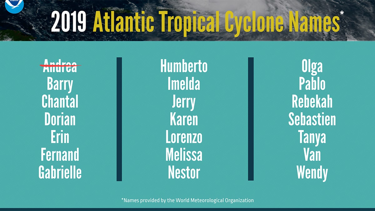
The list of names for the 2019 Atlantic hurricane season. (NOAA)
The 2019 Atlantic hurricane season runs from June 1 to Nov. 30, and this year includes the names: Andrea, Barry, Chantal, Dorian, Erin, Fernand, Gabrielle, Humberto, Imelda, Jerry, Karen, Lorenzo, Melissa, Nestor, Olga, Pablo, Rebekah, Sebastien, Tanya, Van, and Wendy.
CLICK HERE FOR THE FOX NEWS APP
Forecasters from the National Oceanic and Atmospheric Administration are calling for nine to 15 named storms with winds of 39 mph or higher, of which four to eight could strengthen into hurricanes. Of those storms, there will be two to four major hurricanes, which are classified as Category 3, 4, and 5 with winds of 111 mph or higher.
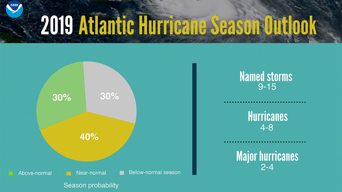
The 2019 Atlantic hurricane season outlook. (NOAA)
An average hurricane season produces 12 named storms, of which six become hurricanes, including three major hurricanes, according to NOAA.

The hottest stories ripped from the headlines, from crime to courts, legal and scandal.
