
Fox News Flash top headlines for August 21
Fox News Flash top headlines are here. Check out what's clicking on Foxnews.com.
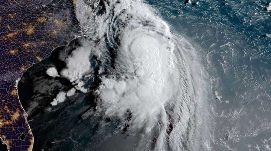
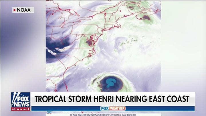
Tropical Storm Henri is expected to strengthen into a hurricane on Saturday bringing danger to the Northeast.
The storm was swirling around 200 miles southeast of Cape Hatteras, North Carolina and moving toward the north-northeast near 12 mph, according to the National Hurricane Center.
TROPICAL STORM HENRI BRINGS DANGEROUS BEACH CONDITIONS TO EAST COAST
Henri, with maximum sustained winds near 70 mph and tropical-storm-force winds extending outward up to 115 miles, is anticipated to veer northward to north-northeastward on Saturday with a turn to the north-northwest overnight.
The storm is forecast to make landfall in Long Island, New York or southern New England on Sunday and hurricane conditions are likely in the hurricane warning area and possible in the hurricane watch area late Saturday and into Sunday in addition to tropical storm conditions there as well as in the tropical storm warning area.
The Hurricane Warning is set for New Haven, Connecticut to west of Watch Hill, Rhode Island, the South Shore of Long Island from Fire Island Inlet to Montauk Point and the North Shore of Long Island from Port Jefferson Harbor to Montauk Point.

A marina worker watches as a sailboat is hauled out of the water onto dry land in advance of an expected storm, Friday Aug. 20, 2021, in Plymouth, Mass. New Englanders, bracing for their first direct hit by a hurricane in 30 years, are taking precautions as Tropical Storm Henri barrels toward the southern New England coast. (AP Photo/Phil Marcelo)
The Hurricane Watch area includes Block Island and Watch Hill, Rhode Island to Westport, Massachusetts.
A Tropical Storm Warning is in effect for Port Jefferson Harbor to west of New Haven, Connecticut, the South shore of Long Island from west of Fire Island Inlet to East Rockaway Inlet, Watch Hill, Rhode Island to Woods Hole, Massachusetts including Block Island and Martha's Vineyard and coastal New York and New Jersey west of East Rockaway Inlet to Manasquan Inlet, including New York City.
The Hurricane Center also cautioned that a tornado or two could occur over New England on Sunday.
Heavy rainfall from Henri could result in considerable flash, urban and small stream flooding, in addition to the potential for widespread minor and isolated moderate river flooding.
The storm is projected to produce rainfall amounts of 3 to 6 inches with isolated maximum totals of nearly 10 inches over parts of Long Island, New England, southeast New York and northern New Jersey from Sunday into Monday.
Beachgoers were warned that life-threatening storm surge would impact shorelines and the Hurricane Center said that the storm surge and the tide would cause normally dry areas near the coast to be flooded.
Storm surge from 3 to 5 feet was possible from Flushing, New York, to Chatham, Massachusetts and parts of the North Shore and South Shore of Long Island.
A Storm Surge Warning included Flushing, New York to Chatham, Massachusetts, Nantucket, Martha's Vineyard, Block Island portions of the North Shore and South Shore of Long Island.
CLICK HERE TO GET THE FOX NEWS APP
The Storm Surge Watch area includes Cape Cod Bay, East Rockaway Inlet to Mastic, New York and north of Chatham, Massachusetts to Sagamore Beach, Massachusetts.
New York has not had a direct hit from a major hurricane season storm since Superstorm Sandy in 2012 and New England hasn't seen a hurricane since Hurricane Bob in 1991.
The Associated Press contributed to this report.

The hottest stories ripped from the headlines, from crime to courts, legal and scandal.
