


Fox News Flash top headlines for July 9
Fox News Flash top headlines are here. Check out what's clicking on Foxnews.com.
Tropical Storm Fay is making its way up the East Coast, holding off of North Carolina’s shores as it heads for the mid-Atlantic and New England, where it is expected to make landfall Friday.
It was about 70 miles northeast of Cape Hatteras as of Thursday night, heading north at about 8 mph, according to forecasters.
The sixth named storm of the Atlantic hurricane season is expected to bring 3 to 5 inches of rain to mid-Atlantic states, southeast New York and southern New England, according to the National Hurricane Center (NHC).
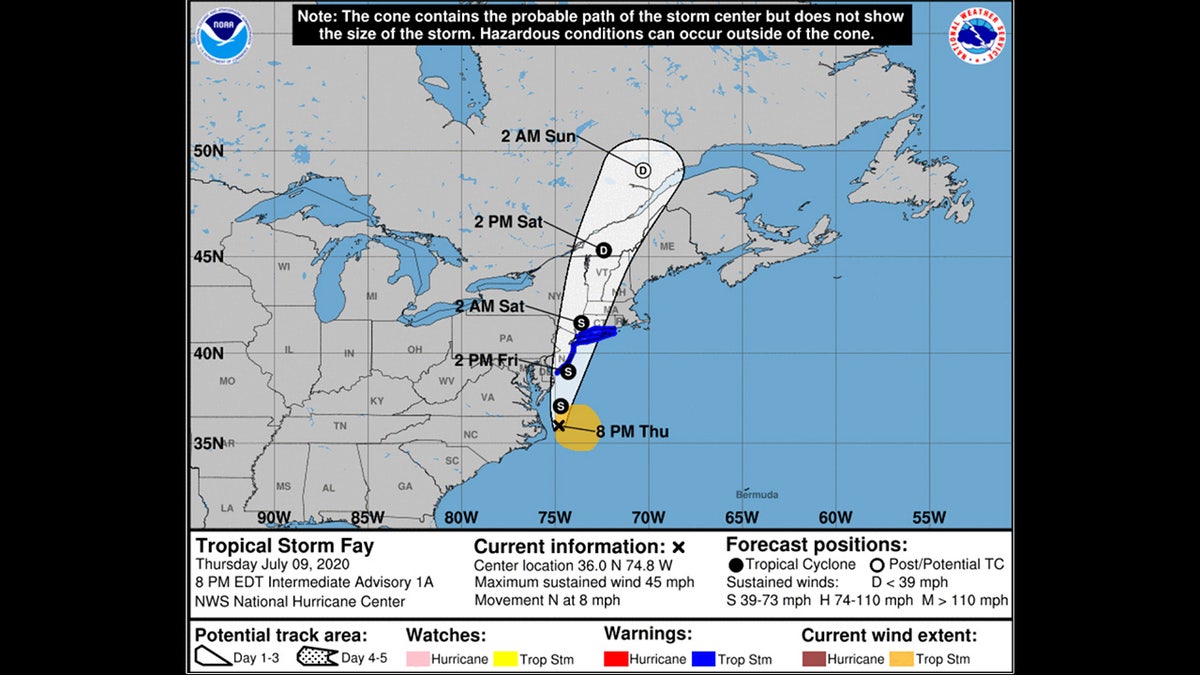
(According to forecasters, Fay will undergo slight strengthening into Friday before the center moves inland and weakens as the storm moves north. (NOAA/NHC))
Authorities said there could be some flash flooding, but river flooding was not expected as of Thursday evening.
TROPICAL SYSTEM LIKELY TO BRING HEAVY RAIN, WIND ALONG EAST COAST; SEVERE WEATHER IMPACTS MIDWEST
The NHC issued a tropical storm warning Thursday evening from Cape May, New Jersey, to Watch Hill, Rhode Island. The warning area includes Long Island and the Long Island Sound in New York, forecasters said.
Maximum sustained winds were hovering around 45 mph, with stronger gusts, but forecasters said the strongest winds primarily extend offshore.
1 DEAD IN 'PRETTY DESTRUCTIVE' MINNESOTA TORNADO; STORM CHASER CAPTURES IT ON CLOSE-UP FOOTAGE
According to forecasters, Fay will undergo slight strengthening into Friday before the center moves inland and weakens as the storm moves north.
Fay's formation Thursday means it is the earliest sixth-named storm on record, according to Colorado State University hurricane researcher Phil Klotzbach. The previous record was Franklin on July 22, 2005, Klotzbach tweeted.
Two named storms formed before the official June 1 start of the hurricane season. None of this season's previous five named storms strengthened into hurricanes.
CLICK HERE TO GET THE FOX NEWS APP
The Associated Press contributed to this report.