
National forecast for Thursday, July 16
Fox News senior meteorologist Janice Dean has your FoxCast.
Severe weather may impact the lower Great Lakes Thursday, as the heat wave that's been scorching the South heads north.
Strong to severe thunderstorms with the potential for heavy rain will develop throughout the day along a cold front across the Central U.S.
Areas from the eastern Great Lakes to the Tennessee River Valley are at risk Thursday.
SEVERE WEATHER, HEAVY RAIN THREAT FOR CENTRAL US AS HEAT WAVE SHOWS SIGNS OF EASING
Large hail, damaging winds and tornadoes will be possible as these storms develop.
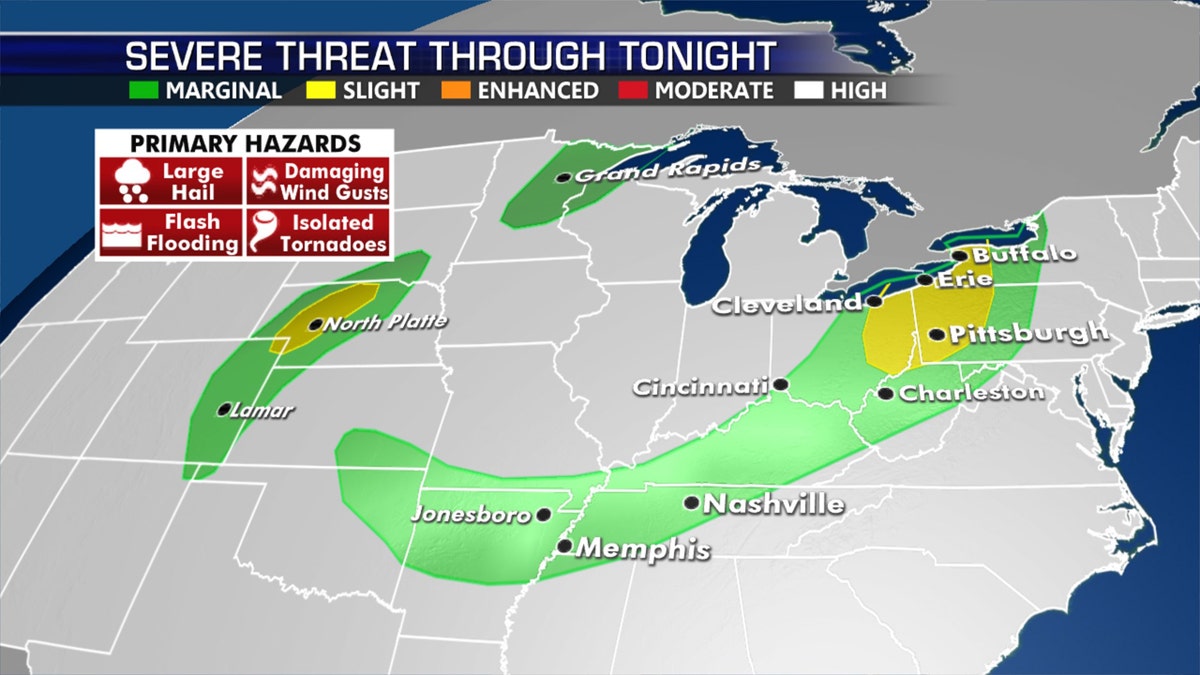
The threat for severe weather on July 16 (Fox News)
Cities under the greatest risk on Thursday include Pittsburgh and Buffalo, as well as portions of northeast Ohio.
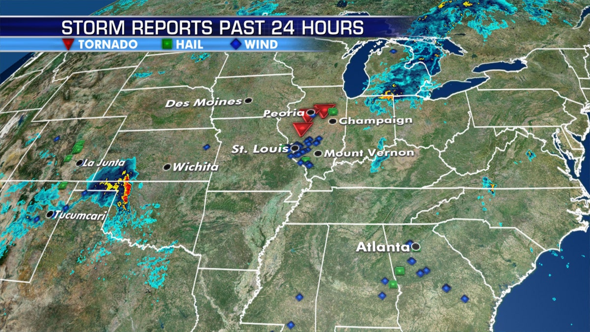
Storm reports for July 15. (Fox News)
According to the Storm Prediction Center (SPC), severe threats should spread into western New York state in the early evening before weakening after dark.
The focus for the stronger storms will persist Thursday from the northern Great Plains into other portions of the Midwest.
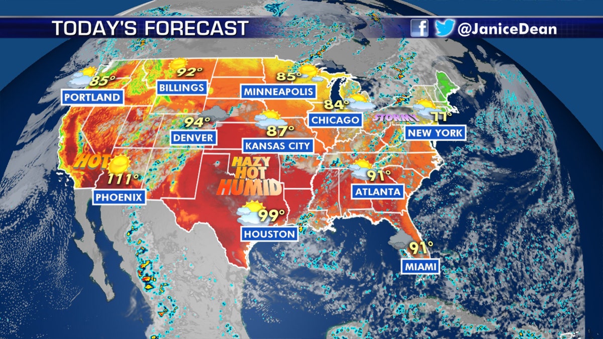
The national forecast for July 16. (Fox News)
Showers and thunderstorms also will pop up over South Florida.
LIGHTNING STRIKE IN MAINE SETS TREE ON FIRE AS SEVERE WEATHER STRIKES REGION
The northern Plains will be the target for severe storms Friday. Monsoonal showers will also move into the Central and Southern Rockies this weekend.
Heat from South begins to spread North

Forecast heat indices for July 16, 2020. (Fox News)
Much of the country is feeling summertime heat, and that will only grow in the days ahead.
CLICK HERE FOR MORE WEATHER COVERAGE FROM FOX NEWS
The really oppressive conditions will expand from the South into the Eastern U.S., and then begin to move into the northern and central Plains this weekend.

Forecast high temperatures for Saturday.
Heat advisories were posted across the lower Mississippi River valley.
CLICK HERE FOR THE FOX NEWS APP
Once the heat builds this weekend, it will last well into next week.
Fox News' Travis Fedschun contributed to this report.

The hottest stories ripped from the headlines, from crime to courts, legal and scandal.
