


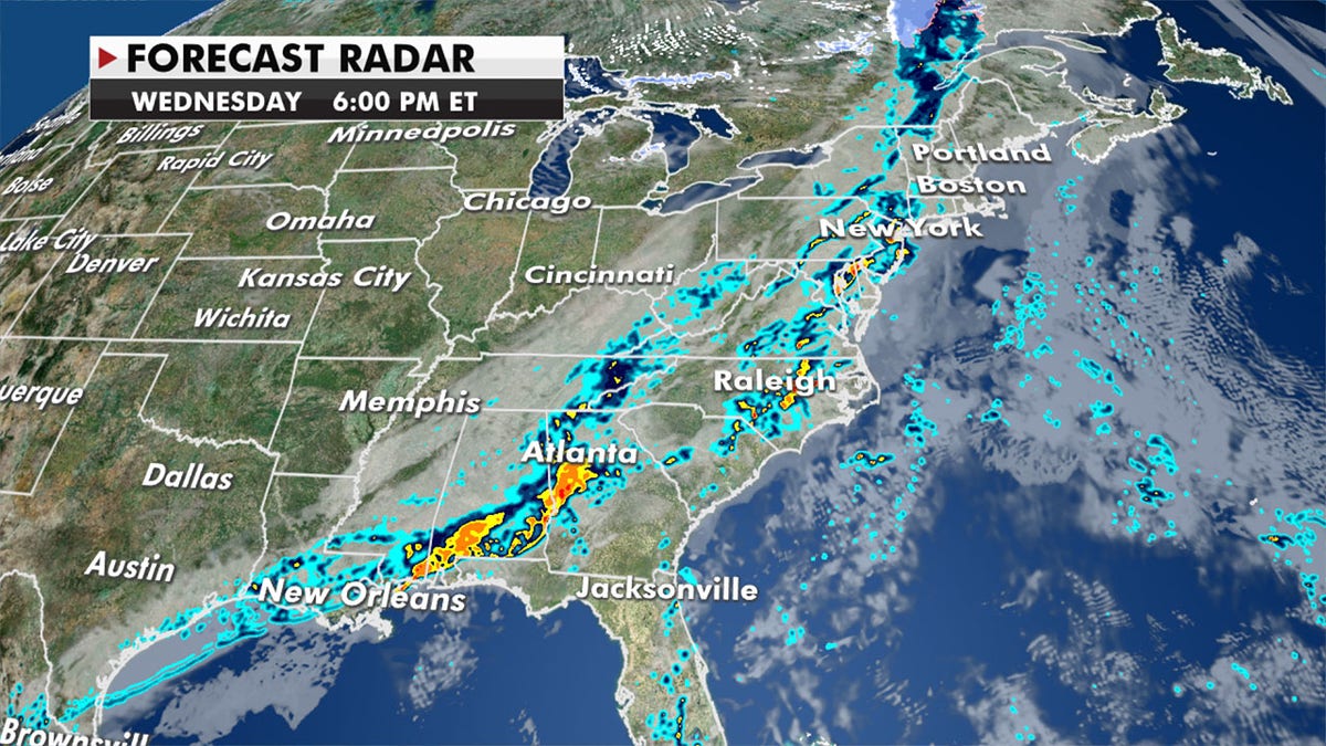
A strong cold front will be the focus of many weather hazards Wednesday and Thursday.
TENNESSEE FLOODING DEATH TOLL GROWS TO 7, OFFICIALS SAY
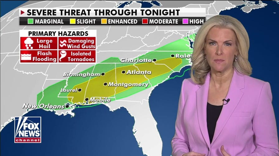
Strong to severe thunderstorms will drench parts of the Southeast up into the mid-Atlantic.
Strong to severe thunderstorms will sweep the Southeast and mid-Atlantic on Wednesday (Fox News)
Hail, damaging winds, isolated tornadoes and heavy rainfall are expected to threaten areas that have an excess of water from storms moving through the same regions with above-average rainfall over the last few weeks.
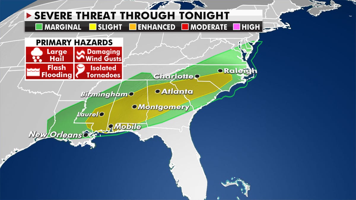
Severe weather including heavy rainfall will hit already saturated areas. (Fox News)
Meanwhile, much colder air will sink in behind the cold front resulting in heavy snow for interior sections of the Northeast.
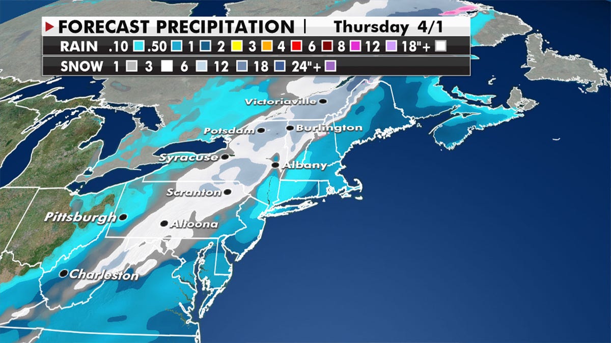
The interior sections of the Northeast will see heavy snow. (Fox News)
Over a foot of snow will be possible across the mountains of New York and Vermont.
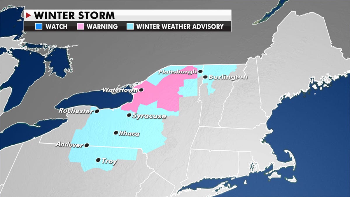
More than a foot of snow is possible across New York and Vermont. (Fox News)
That cold air has prompted freeze warnings for parts of the mid-Mississippi and Tennessee Valleys.
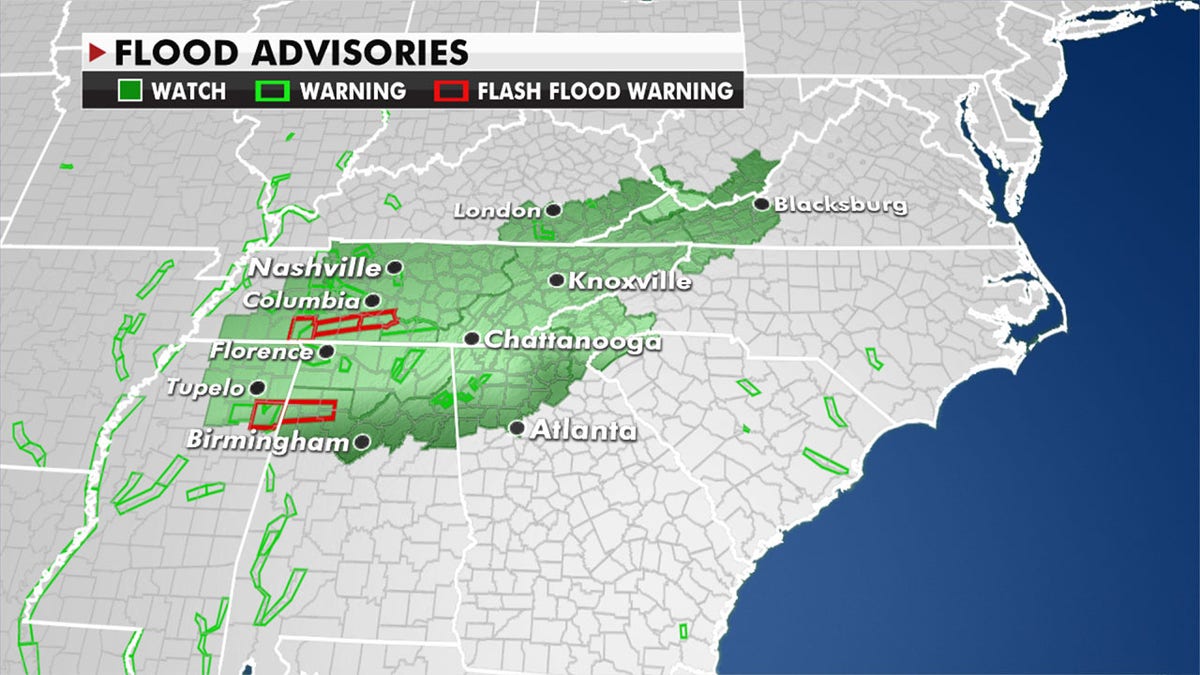
Tennessee remains under flood advisories and cold air has prompted freeze warnings across the Tennessee Valley (Fox News)
Temperatures will run 15 to 25 degrees below average, which could lead to early-season crop damage.
Record lows will be possible.
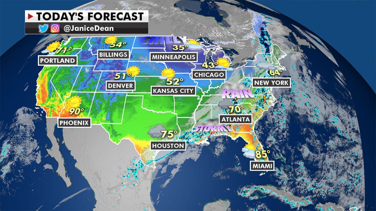
Frigid temperatures are expected to rebound. (Fox News)
CLICK HERE FOR THE FOX NEWS APP
Temperatures will rebound over the weekend for much of the country.