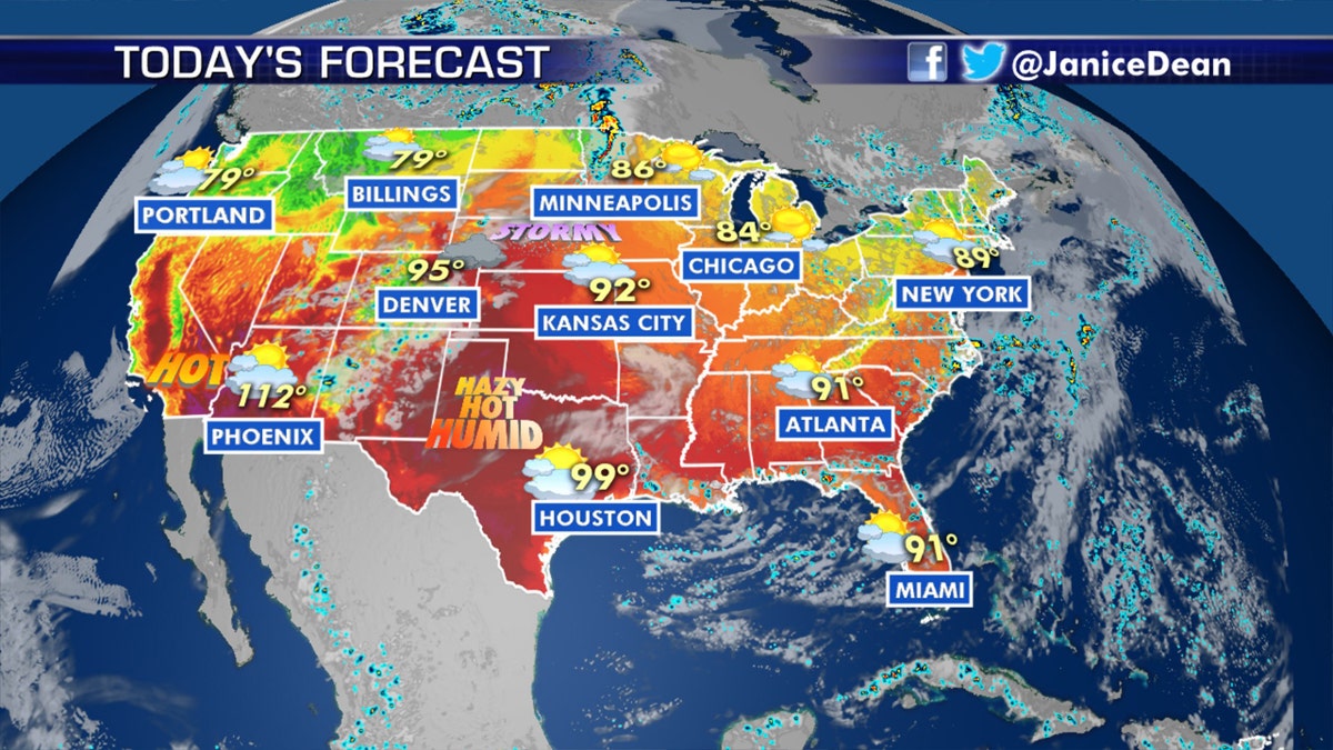
National forecast for Monday, July 13
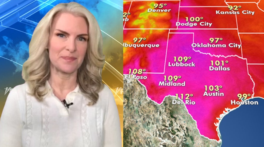
Fox News senior meteorologist Janice Dean has your FoxCast.
Hot temperatures from over the weekend will linger to start the week as the threat for severe weather develops on Monday across the central part of the country.
Record-breaking heat and dangerous humidity as part of an intense heat wave will persist over a widespread area of the U.S, from Southern California all the way to parts of the Southern Plains and Gulf Coast.
Extreme heat warnings are posted for several states over the next few days.
HEAT WAVES HAVE BECOME MORE FREQUENT AND INTENSE IN MOST OF THE WORLD SINCE 1950S: STUDY
According to the National Weather Service (NWS), over 19 million Americans are under excessive heat warnings across the Southwest and into parts of Texas and Louisiana
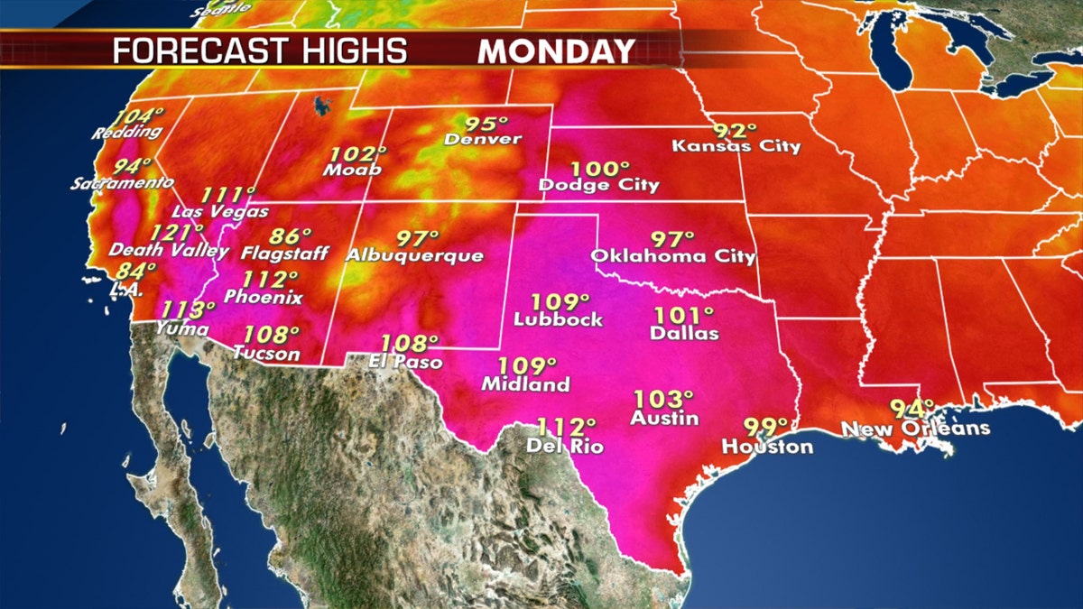
More intense heat can be expected on Monday across the Southwest to the Gulf Coast. (Fox News)
Phoenix Sky Harbor International Airport saw a temperature of 116 degrees Fahrenheit on Sunday, breaking the previous record of 115 degrees set in 2009, the NWS office in Phoenix said.
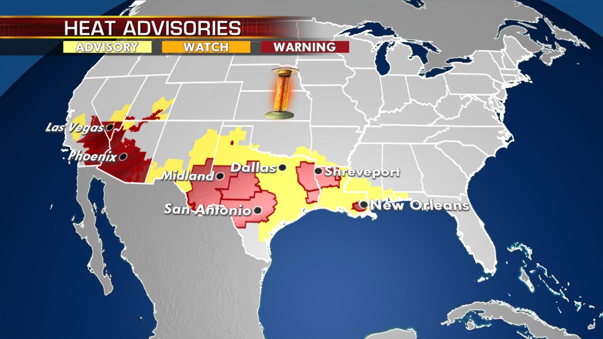
Heat warnings and advisories on Monday as an intense heat wave conditions. (Fox News)
Some 25.5 million Americans are under heat advisories in areas such as the Dallas/Fort Worth metroplex and into Houston.
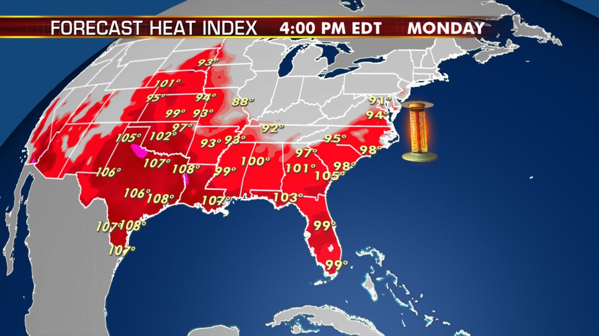
Forecast heat indices for Monday afternoon. (Fox News)
Many in the Central U.S. and Southern Plains will also deal with humidity and dangerous heat indices, especially through Tuesday.
Along with the heat, critical fire danger exists with dry conditions and gusty winds for parts of the Great Basin.
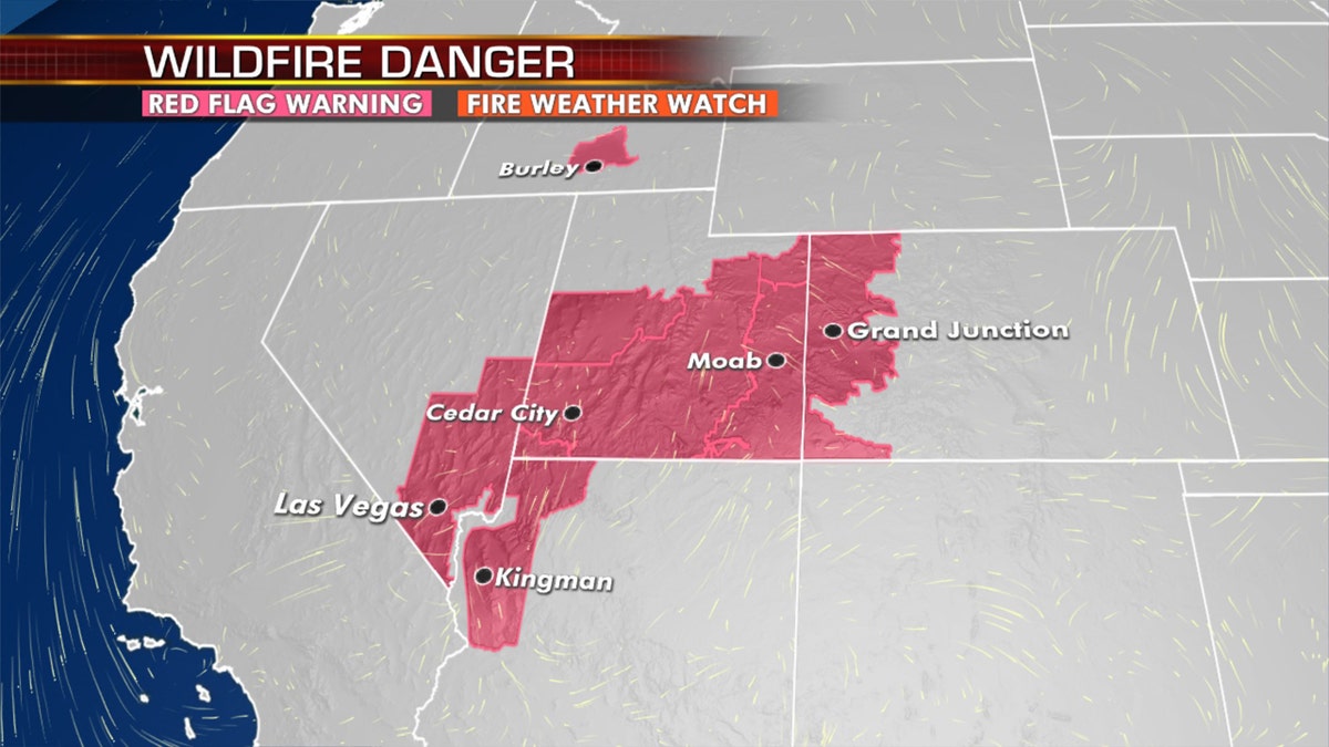
Red flag warnings stretch across the West on Monday. (Fox News)
Red flag warnings also stretch from Nevada into Utah and western Colorado.
The prolonged heat is adding to the existing drought conditions out West.
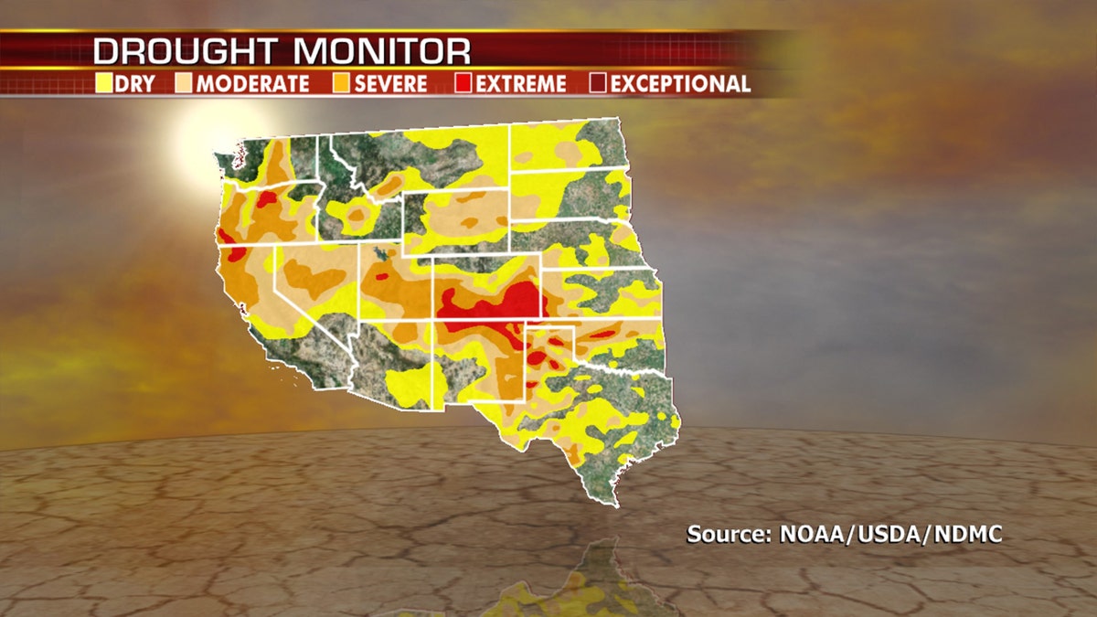
Current drought conditions across the West. (Fox News)
Severe weather threat across Central U.S.
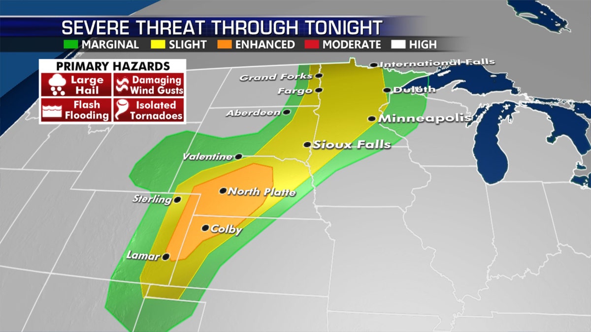
The severe weather threat for Monday, July 13, 2020.
Strong to severe thunderstorms will develop Monday along and ahead of a cold front that’s charging across the Northern and Central Plains.
CLICK HERE FOR MORE WEATHER COVERAGE FROM FOX NEWS
Large hail, damaging winds and tornadoes will be possible along with heavy rain and flash flooding in some isolated pockets.
The national forecast for July 13, 2020.
Storms will develop from Monday afternoon into the evening across the region.
CLICK HERE FOR THE FOX NEWS APP
A slow-moving front will also bring the potential for scattered showers and thunderstorms from the mid-Atlantic down into the Carolinas and back through the Gulf Coast.

The hottest stories ripped from the headlines, from crime to courts, legal and scandal.
