


Fox News Flash top headlines for August 10
Fox News Flash top headlines are here. Check out what's clicking on Foxnews.com.
Cooler air will finally replace the extreme heat wave experienced by millions of Americans at the end of the week.
A slow-moving cold front is cooling off large portions of the country, while also bringing showers and storms that will enhance the flood threat from the Ohio Valley to New England.
Flood advisories have been issued from eastern Kentucky across West Virginia.
Already saturated ground from weeks of damaging rains and floods will again be hit hard in eastern Kentucky.
GEORGIA WEATHER-RELATED INCIDENT KILLS TWO FORT BENNING SOLDIERS, ARMY SAYS
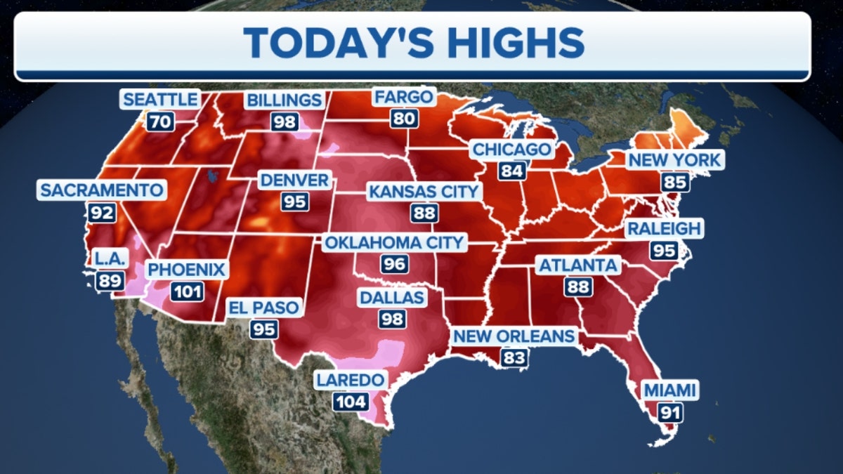
Wednesday's high temperatures across the U.S. (Credit: Fox News)
Widespread rainfall of 1-3" is forecast with isolated areas getting 5 inches of rain.
While heavy rain is likely, the chance for severe thunderstorms is low.
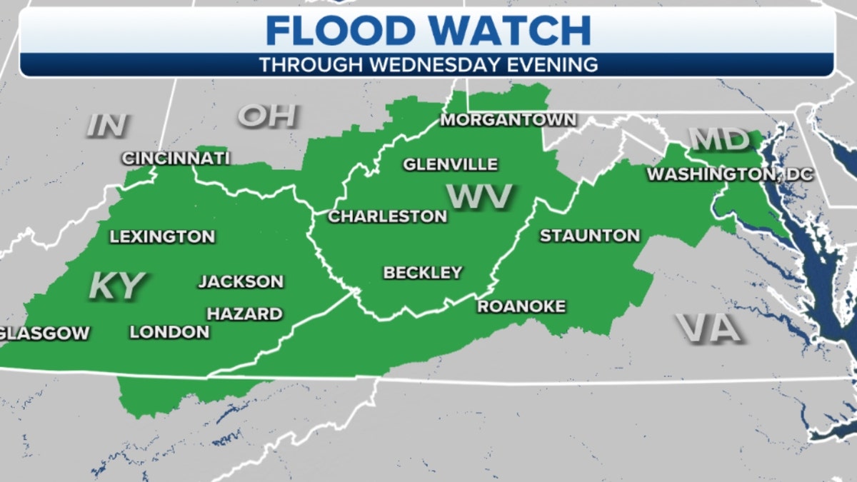
A Flood Watch is in place through Wednesday evening from eastern Kentucky across West Virginia (Credit: Fox News)
Behind this rain-making cold front, cooler and drier air will move in.
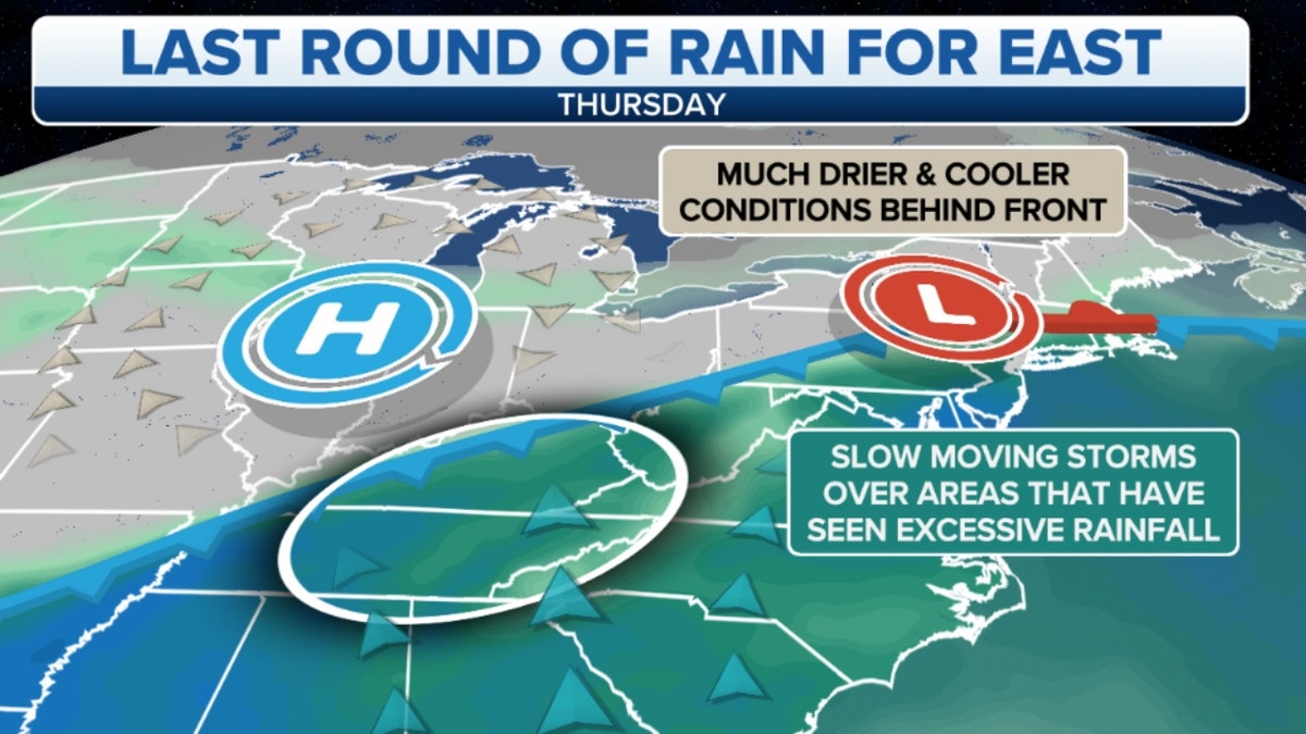
Rainfall forecast on Thursday in the eastern U.S. (Credit: Fox News)
CLICK HERE TO GET THE FOX NEWS APP
Daytime high temperatures fall from the middle 90s to the middle 80s across much of the eastern U.S. on Wednesday.