Fox News Flash top headlines for July 22
Fox News Flash top headlines are here. Check out what's clicking on Foxnews.com.
A Colorado woman was found dead around 100 miles northwest of Denver after a mudslide triggered by heavy rain and flooding sent a large amount of debris into the winding Poudre Canyon on Tuesday night.
Three others were declared missing in the area – which had been burned by the 2020 Cameron Peak Fire – and drones were deployed to aid in the search, according to the Larimer County Sheriff’s Office.
WHY DID THE AIR QUALITY IN THESE STATES PLUMMET ON TUESDAY?
At least five houses were destroyed and a private bridge was damaged in the flooding and six mudslides were triggered along a stretch of Highway 14.
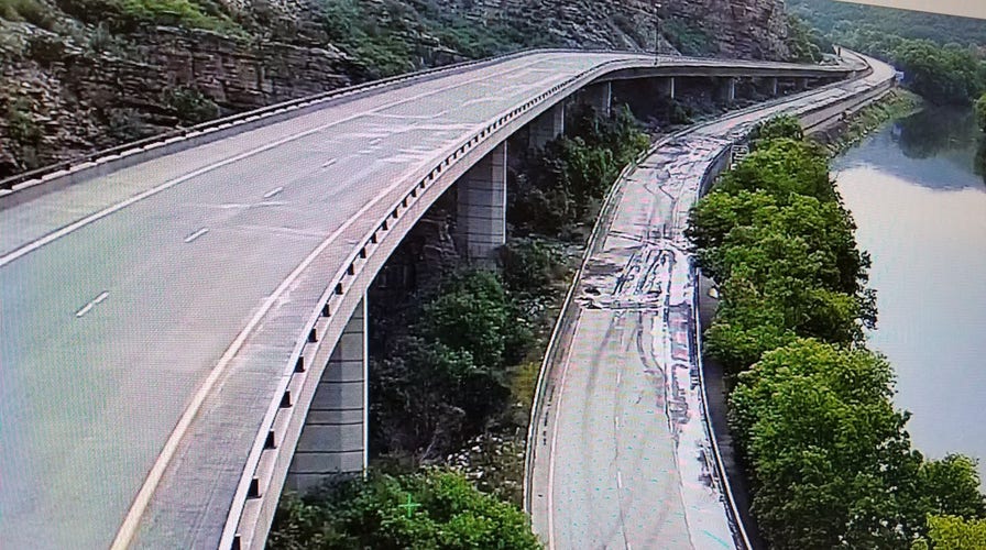
The Colorado Department of Transportation (CDOT) said in tweets on Wednesday that several roads were impacted.
"CLOSURES due to flooding & mudslides – Several roadways are affected this morning. Motorists should check http://cotrip.org for closure information and road conditions before traveling. Roads affected at this time are #I70 Glenwood Canyon, CO 14 and CO 133. #cowx," it tweeted, adding that "travelers should prepare for weather-related disruptions and road closures through at least next week."
But, the threat was not over as more rain was expected over the next week.
Additional mudslides occurred in areas torched by other wildfires, including the Greezly Creek wildfire.
In a news release, the CDOT said Wednesday that an ongoing monsoon weather pattern had increased the severe weather risks throughout the state.
WILDFIRE THREAT IS ELEVATED, CRITICAL IN THESE PARTS OF THE WESTERN US
The agency said it was coordinating statewide to respond to the mudslides, clean up debris and manage traffic impacts.
Debris from the floods included propane tanks, stovepipes, lawn chairs, dishes and an American flag.
A car was also swept into the Cache la Poudre River, according to The Colorado Sun.
Poudre Valley REA tweeted that power had been restored for around 30 buildings, though 101 members were still without power on Wednesday.
"There are currently 101 members without power. For those members, we are expecting extended outages that could last multiple days," the utility company said.
"Between the unrelenting weather forecast and the impacts we are seeing throughout Colorado, CDOT is asking travelers to take extra precautions, plan for additional time and double-check conditions before traveling," CDOT Executive Director Shoshana Lew said in a statement. "Our crews will continue to monitor conditions closely and take what steps we can to keep people safe and return to normal as the weather allows. Once weather passes and crews can evaluate the impacts to the roadway, we are removing rocks and debris and making sure the road surface is safe before reopening."
While slow-moving storms are expected, the National Weather Service (NWS) warned of more flash flooding and activity increasing on Friday with a "significant risk of burn scar flooding" on Saturday before a drying trend on Sunday through Wednesday.
Flooding has been impacting other parts of the country.
The NWS noted Thursday that the Southwest Monsoon had been "very active," but that a "notable increase in intensity" was still forecast, with widespread rainfall amounts reaching over an inch through Friday across parts of Arizona, New Mexico and southwest Colorado.
It warned of dangerous flash flooding – especially near burn scars – and said that a slight risk of excessive rainfall had been issued in addition to flash flood watches.
To the southeast and in the Florida Panhandle, the NWS cautioned that thunderstorms and isolated instances of flash flooding were possible.
CLICK HERE FOR THE FOX NEWS APP
In Alabama, heavy rains caused major sewage overflows near Mobile as another round of rainfall prompted flash flood alerts.
Residents were warned to stay away from standing water in Prichard, though flash flood watches and warnings covered most of the northern part of the state.
On Monday, flooding in Vestavia Hills caused flooding, felled trees and power lines, forced road closures and led to multiple water rescues, according to WIAT.
The rain threat is expected to continue through the weekend and areas in central Alabama have already received more than 5 inches.


