


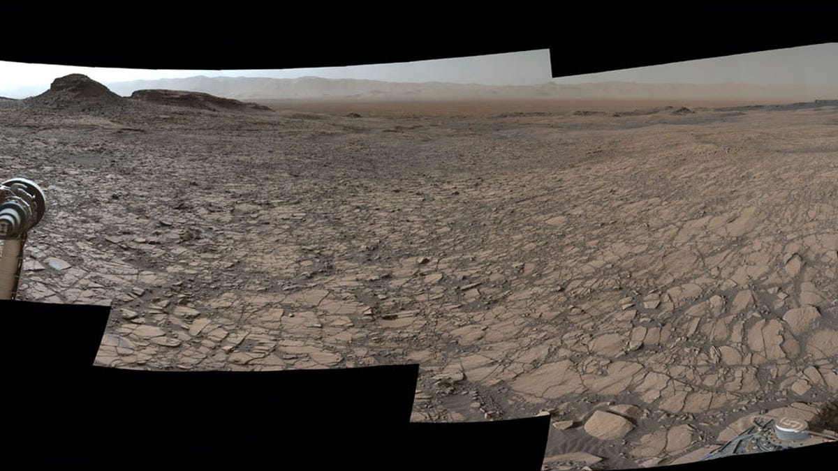
Murray Buttes, a series of sandstone features on the surface of Mars, was imaged by the Curiosity Rover on Aug. 5, 2016. (NASA/JPL-Caltech/MSSS)
A panoramic view from the surface of Mars shows brown and copper-colored plateaus and buttes, reminiscent of desert regions in the southwest United States.
NASA's Curiosity Rover took this panorama on Aug. 5, the fourth anniversary of its nail-biting landing on the Red Planet. The view is comprised of more than 130 images taken by the rover's Mast Camera (Mastcam), according to a statement from NASA.
The flat region in the foreground of the image is known as the Murray formation, while the collection of buttes a little further ahead is informally known as Murray Buttes. The region was named after planetary scientist Bruce Murray, a former director of NASA's Jet Propulsion Laboratory (JPL), who passed away in 2013. (The Curiosity mission is managed by JPL).
The buttes are eroded sandstone formations that sit on top of lower Mount Sharp (the distant bump on the left-side of the image is upper Mount Sharp). The formations are now covered in a layer of rock that keeps them fairly well preserved, the statement said. Curiosity studied the softer layer of sandstone, called the Stimson formation, earlier this year. The flat Murray formation, formed from "lakebed mud deposits," according to the statement.
More From Space.com
For a sense of scale, the wide plateau to the left of Curiosity's robotic arm is about 300 feet from the rover. The mesa is about 50 feet tall, while the horizontal ridge that runs horizontal across the top is about 200 feet long. To see the rover's location when this image was taken, check out this aerial map of its route.
Curiosity's primary mission goal was to study the surface of Mars and look for signs that it may have once been hospitable to life. In its extended mission, the rover is looking for clues as to how this portion of lower Mount Sharp evolved from a (possibly) hospitable water environment to its current, inhospitable condition.
Original article on Space.com.