


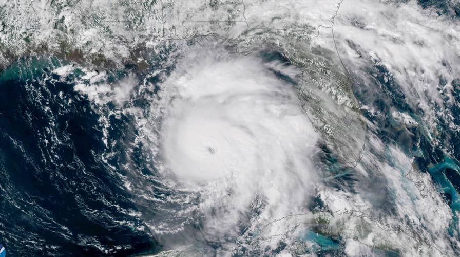
2019 Atlantic Hurricane season expected to pack some punch
The United States may get hit by two to four major hurricanes before the end of the 2019 hurricane season. Forecasters are calling this year's season near normal.
Hurricanes are known for strong winds and the potential to bring heavy rainfall — but do you understand the workings of the meteorological phenomena?
Here's what you need to know as Tropical Storm Barry makes landfall on the Lousiana coast.
Storms in the making
The National Oceanic and Atmospheric Administration (NOAA) has detailed online how hurricanes take shape.
“These violent storms form over the ocean, often beginning as a tropical wave — a low-pressure area that moves through the moisture-rich tropics, possibly enhancing shower and thunderstorm activity,” the agency explains.
Warm air is another important factor.
“As this weather system moves westward across the tropics, warm ocean air rises into the storm, forming an area of low pressure underneath,” the NOAA adds. “This causes more air to rush in. The air then rises and cools, forming clouds and thunderstorms. Up in the clouds, water condenses and forms droplets, releasing even more heat to power the storm.”
However, not every storm like this is a hurricane: NOAA explains they must have winds of at least 74 miles per hour.
What else should I know?
There are steps you can take to prepare for a hurricane as it approaches, depending on how many hours away it is from your area. If you have pets, you can get your furry companions ready, too, by taking several simple steps.