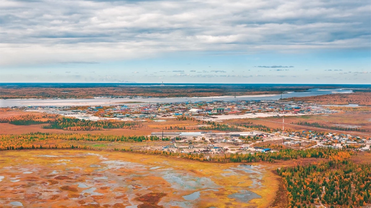
Melting permafrost on the Jamal region of Russia. New research suggests that permafrost in the Canadian Arctic is melting rapidly, and large swaths of permafrost worldwide are vulnerable to this accelerated thawing Credit: Georgy Golovin/Getty
In the Canadian Arctic, layers of permafrost that scientists expected to remain frozen for at least 70 years have already begun thawing. The once-frozen surface is now sinking and dotted with melt ponds and from above looks a bit like Swiss cheese, satellite images reveal.
"We were astounded that this system responded so quickly to the higher air temperatures," said Louise Farquharson, a co-author of the study and postdoctoral fellow at the Permafrost Laboratory at the University of Alaska Fairbanks.
Permafrost is ground that remains frozen for at least two years. It underlies about 15% of the unglaciated Northern Hemisphere and serves a critical role in the transfer of carbon from living things to the atmosphere, Farquharson said. [Photos: Perfectly Preserved Baby Horse Unearthed in Permafrost]
Farquharson is part of an international team of researchers monitoring environmental variables on three islands in the Canadian Arctic. The data they analyzed in this study, which was published Monday (June 10) in the journal Geophysical Research Letters, was gathered between 2003 and 2016.
The researchers recorded permafrost thawing to depths that were not expected until air temperatures reached levels the Intergovernmental Panel on Climate Change has predicted will occur after 2090, according to one of its "moderate" climate change models. The IPCC, which is a body of the United Nations, provides scientific information to help guide countries' climate policies.
The researchers believe higher summer temperatures, low levels of insulating vegetation and the presence of ground ice near the surface contributed to the exceptionally rapid and deep thawing.
The most striking evidence is visible to the naked eye. As upper layers of permafrost thaw and ice melts, the land settles unevenly, forming what is known as thermokarst topography. Landscapes in the Canadian Arctic that had been defined by gently rolling hills are now pockmarked with ditches and small ponds. The ground at the northernmost study site sank by about 35 inches (90 centimeters) over the course of the study.
"We had this flat terrain when we started monitoring," Farquharson told Live Science. "In 10 or so years, we saw the landscape transform."
Their data allowed the researchers to interpret the topographical changes happening before their eyes.
"We were able to tie together air temperature and ground temperature with the formation of this thermokarst terrain," Farquharson said.
Global implications
The thawing has climatic implications for the globe and immediate ecological ramifications for the region. Thawing caused by higher air temperatures threatens to exacerbate global climate change.
"Permafrost is like a giant freezer that contains a lot of really delicious plant material and organics that aren't being decomposed by microbes," Farquharson said. "Thawing opens the freezer door" and allows the microbes to start converting that organic material into CO2.
In changing the physical makeup of the landscape, thermokarst also affects local ecosystems and waterways by inviting new plant growth, disrupting stable nutrient cycles and allowing for the sedimentation of streams and possibly coastal systems.
Determining the extent of new thermokarst development is difficult, but there is little doubt the problem is widespread. Farquharson and her team guess that about 231,000 square miles (600,000 square kilometers) of permafrost, or about 5.5% of the zone that is permafrost year-round, is vulnerable to rapid surface thawing.
- The Reality of Climate Change: 10 Myths Busted
- In Photos: The Vanishing Ice of Baffin Island
- Images of Melt: Earth's Vanishing Ice
Originally published on Live Science.


