


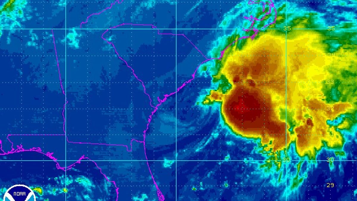
Radar image of Julia. (National Weather Service)
Julia has weakened to a tropical depression off South Carolina after bringing steady rains, but not the torrential downpours and widespread flooding that had been feared, to the coast of the Southeast from Florida to the Carolinas.
The depression's maximum sustained winds early Thursday had decreased to near 35 mph with little change in strength forecast over the next two days. The National Weather Service forecast that most of the rain would now remain out at sea.
As of 5 a.m. EDT, Julia was centered about 60 miles south-southeast of Charleston. The storm was forecast to meander and then dissipate offshore in the next few days.
Flood watches were dropped for the South Carolina coast Thursday although forecasters issued a small craft advisory for waters near the shore and said there was a danger of rip currents along the coast through Thursday evening.
Street flooding that came about the time of high tide late Wednesday caused a handful of downtown streets in Charleston to be closed. All the streets had reopened by rush hour Thursday morning and the pavement on major arteries leading into town were dry.
Many areas along the South Carolina coast saw more than 2 inches of rain during the storm on Wednesday, but nowhere near the 6 to 8 inches that had earlier been forecast.
Forecasters had issued flood watches, concerned about additional rains coming less than two weeks after Tropical Storm Hermine sloshed across the state. That storm brought from 3 to 6 inches of rain but mainly in areas of the Midlands farther inland.
Meanwhile, a new tropical depression formed far out over the Atlantic and is moving west. The depression's maximum sustained winds are near 35 mph with little change in strength expected over the next two days. It's centered about 365 miles west-northwest of the Cabo Verde Islands.
Elsewhere, Tropical Storm Ian is moving north in the central Atlantic but is no threat to land.