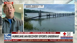
Hurricane Ian intensifies as it barrels toward Florida
The storm intensified into a hurricane Monday morning as it moves toward the state while nearly every county remains under a state of emergency.
Tropical Storm Ian strengthened into Hurricane Ian on Monday morning as coastal residents brace for major impacts from the storm as the week progresses.
Hurricane status was declared at around 5 a.m. as the storm's winds strengthened to 75 miles per hour, according to the National Hurricane Center.
The National Weather Service warned later Monday morning that a life-threatening storm surge was possible along much of the Florida west coast, with the highest risk from Fort Myers to the Tampa Bay region.
"With Hurricane Ian fast approaching, it's imperative that Floridians prepare NOW to protect themselves and their families," Florida Commissioner of Agriculture Nikki Fried tweeted Monday, urging residents to listen to local authorities and prepare.
Hurricane Ian is expected to become a significant hurricane within the next 48 hours. A hurricane watch was issued for Florida's Gulf Coast, including Tampa Bay.
Hillsborough County, which contains Tampa, ordered a mandatory evacuation for residents living in the city's coastal area. It also announced a voluntary evacuation for most of the rest of the county.
The storm is currently approaching western Cuba, which has suspended national train departures, according to local media.
FLORIDA KEYS UNDER TROPICAL STORM WATCH AS IAN GAINS STRENGTH IN THE CARIBBEAN
The National Weather Service warned that a life-threatening storm surge, hurricane-force winds, flash floods and possible mudslides are expected in portions of western Cuba beginning Monday evening and continuing into Tuesday.
Florida Gov. Ron DeSantis declared a state of emergency for all 67 counties ahead of the impacts of Hurricane Ian. He urged all Floridians to prepare for the storm.

A map showing Hurricane Ian. (FOX Weather)
The National Weather Service warned that hurricane-force winds are possible in the hurricane watch area in west-central Florida beginning Wednesday morning with tropical storm conditions possible by late Tuesday.
Heavy rainfall was expected to increase across the Florida Keys and south Florida on Tuesday, spreading to central and northern Florida on Wednesday and Thursday, potentially causing flash, urban and small stream flooding, while significant prolonged river flooding is likely across central Florida, the National Weather service warned.
CLICK HERE TO GET THE FOX NEWS APP
The storm is expected to make landfall on Thursday or Friday.
This is a developing situation, check back with us for updates.


