
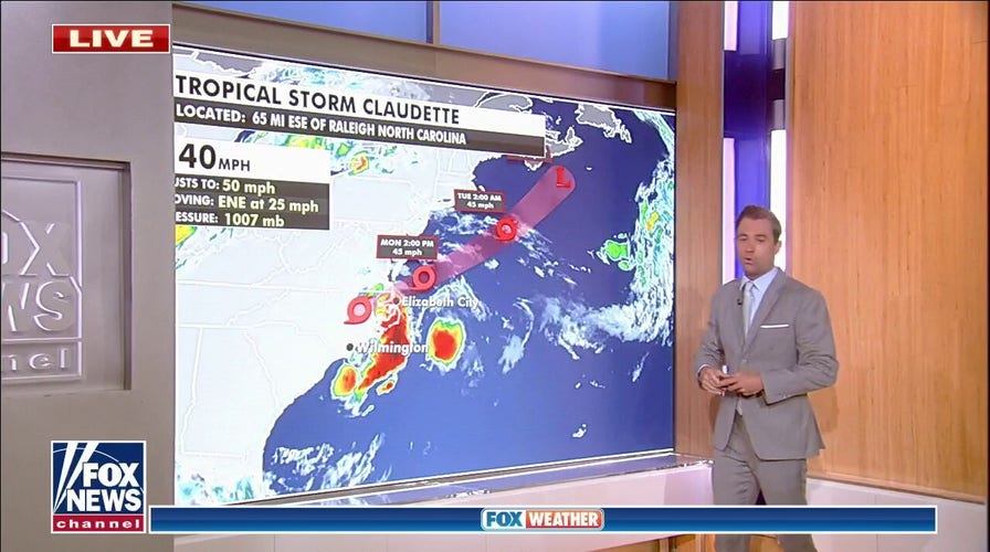
Tropical Storm Claudette is forecast to bring heavy rain and flooding to portions of North Carolina on Monday before moving off the Mid-Atlantic coast.
The storm will then move northeastward and enter the Canadian maritime by Wednesday.
An additional disorganized low-pressure system is being monitored 900 miles east of the Windward Islands. That area has a 20% chance of becoming a tropical system over the next five days.

The current path of Tropical Storm Claudette. (Fox News)
ALABAMA CRASH DURING CLAUDETTE RAINFALL LEAVES 10 DEAD
In the Midwest, a front is stretching from the Great Lakes to the Plains.
The boundary will move into the East Coast by Tuesday, bringing showers and storms along with it.
A slight risk for severe weather has been issued from the Great Lakes into interior New England for Monday. Heavy rain will also increase the risk for localized flooding, especially on roads and in urban areas.
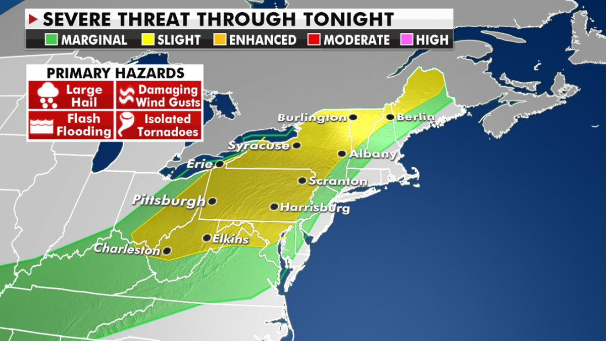
The threat of severe weather for Monday. (Fox News)
In the western U.S., extreme heat will begin to wane on Monday.
CLICK HERE TO GET THE FOX NEWS APP
Record highs across the desert Southwest and portions of California will settle back closer to seasonal averages.

Forecast high temperatures in the western U.S. (Fox News)
However, warmer air is expanding into the Pacific Northwest. Some isolated heat warnings have been issued as temperatures could climb to 100 degrees.

The hottest stories ripped from the headlines, from crime to courts, legal and scandal.
