


Amazing time-lapse video of supercell thunderstorm
Storm chasers capture ominous event in Wyoming
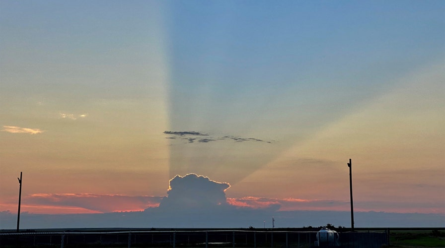
A stunning sunrise in Kansas earlier this month got blocked by an even more spectacular sight in the sky.
The National Weather Service (NWS) office in Goodland said last Tuesday that an isolated thunderstorm in Norton County in the state's northwest cast a 75-mile-long shadow.
The storm's shadow extended southwest all the way to the Goodland forecast office, briefly blocking the sunrise.
A meteorologist snapped a photo just before 6 a.m. as the thunderstorm cloud blocked the rising sun.
A thunderstorm casts a 75-mile shadow that obscured the sunrise in Goodland, Kan., on Aug. 4, 2020. (NWS Goodland)
"The storm in question was ~35,000 ft tall — about 1 mile taller than Mount Everest," the NWS tweeted.
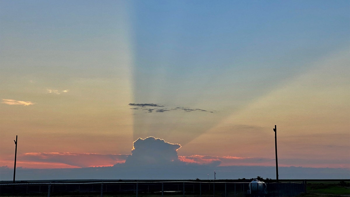
The storm's shadow could be seen extending across the sky in the photo released by the forecast office, which frequently documents stunning weather moments in the Kansas prairies.
DERECHO IN MIDWEST TRAVELED 770 MILES IN 14 HOURS, FLIPPED TRUCKS AND SMASHED A GRAIN ELEVATOR
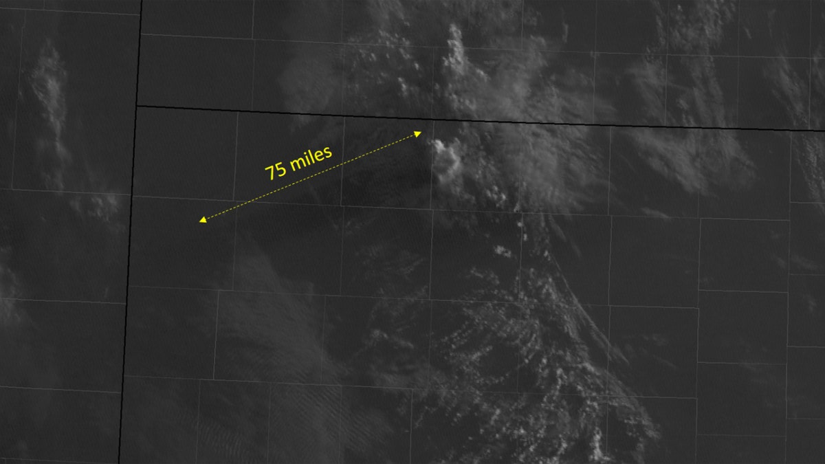
The thunderstorm's shadow could even be seen from space.
The 75-mile-long shadow by a thunderstorm in Kansas can be seen at sunrise on Aug. 4, 2020. (NWS Goodland)
Satellite imagery released by the NWS shows the shadow stretching southward across the state's northwest corner.
CLICK HERE FOR MORE WEATHER COVERAGE FROM FOX NEWS
A meteorologist at the NWS also shared a timelapse of the thunderstorm shadow reaching the Goodland forecast office.
In the video, the shadow can be seen moving across the sky as the sun rises.
Forecasters said the storm "had a little bit of lightning with it" before it moved east and dissipated.
CLICK HERE FOR THE FOX NEWS APP
On the NWS Goodland Facebook page, locals said the photo was "awesome."
"Epic. Thanks for sharing!" one person said.