


Parts of Iowa city under water as heavy rain causes major flooding in Midwest
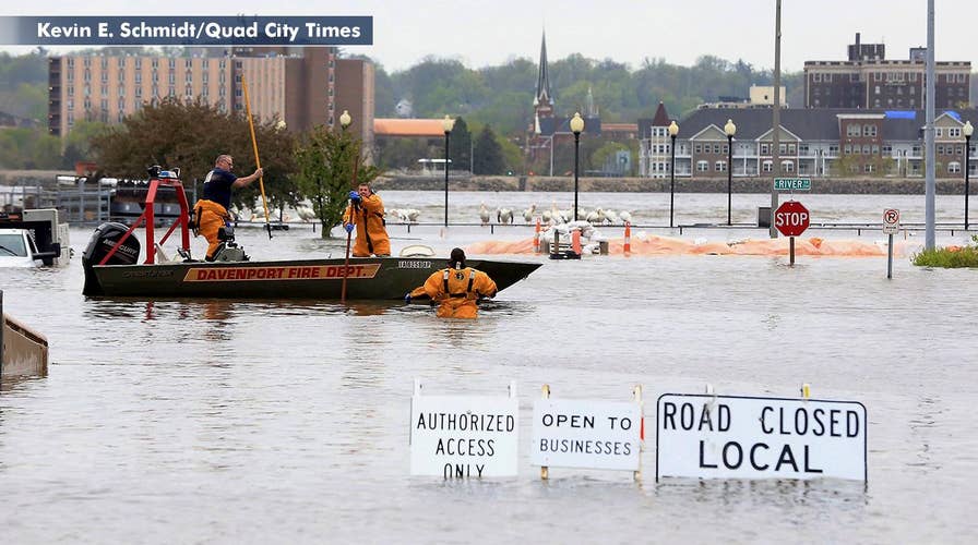
Levee breach along the Mississippi River causes flooding in downtown Davenport, Iowa.
Floodwaters swamped downtown Davenport, Iowa, Tuesday evening after a temporary flood barrier failed, sending people to the rooftops of buildings to seek shelter.
The National Weather Service (NWS) sent an alert around 4 p.m. of a flash flood emergency in Davenport, a city of approximately 100,000 people on the west bank of the Mississippi River The alert urged people downtown to seek higher ground immediately.
"It was just the one barrier, so we're not expecting the flooding to spread beyond what we're seeing now," Davenport Public Works Director Nicole Gleason said. "That could change with heavy rain."
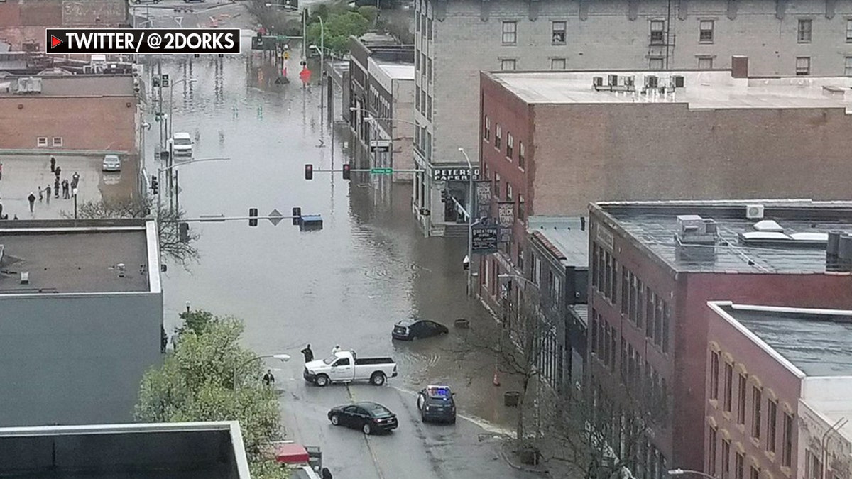
A view of downtown Davenport, Iowa Tuesday
As of 5 p.m. local time, the Mississippi River at Davenport was recorded at 21.88 feet — the fifth highest for the spot ever recorded approaching the record crest of 22.6 feet set in July 1993. The river is expected to crest Wednesday night a few inches short of the record.
The floodwaters had overtaken vehicles and the first floors of some buildings on the river's edge, and rescue crews could be seen launching boats into the floodwaters to retrieve people stranded by the sudden surge.
Davenport Mayor Frank Klipsch said there were no reports of injuries. He asked that people stay away from downtown while officials work to evacuate the area.
"This is a couple blocks of one part of our city. It's fortunately a relatively small area being flooded," Klipsch said.

Historic floods in the Midwest have farmers worried about their future
President of Farm Rescue Bill Gross says flooding in the Midwest has been a 'historic disaster.'
The gauge in nearby Muscatine showed the river just under 3 feet below the July 1993 record of 25.6 feet. It's expected to crest a little more than a foot under the record at Muscatine, where officials have placed new berms and are diverting downtown traffic.
FUTURE OF NEW ORLEANS IN PERIL AS $14B FLOOD PROTECTION STARTS SINKING
The Davenport breach came as communities in Iowa, Illinois and Minnesota have prepared for record or near-record crests along the river. The NWS already issued flood warnings for areas directly on either side of the river in 10 states, from Minnesota and Wisconsin south to Louisiana and Mississippi.
"It's pretty much the entire river, all the way to the Gulf of Mexico," Mike McClure, a meteorologist with the National Weather Service in Davenport, said Tuesday.
CLICK HERE TO GET THE FOX NEWS APP
Flood watches have been issued for larger tracts around in the river in Iowa, Illinois and Missouri, as well as sections of Kansas, Oklahoma and Arkansas, as heavy rain that began in some places Monday was set to continue into Wednesday.
In suburban St. Louis, the river is expected to reach 9 to 10 feet above flood stage Saturday at several locations in northeast Missouri and at Quincy, Ill. With up to 4 inches of rain possible in the region through Friday, the weather service cited a high risk of flash flooding and warned that river forecasts could rise even higher.
The Associated Press contributed to this report.