


National weather forecast for January 5
Fox News senior meteorologist Janice Dean has your FOX Weather forecast.
The Northwest is getting socked with more heavy rain and mountain snow as several storm systems push inland over the next few days.
Some areas could get 4 feet of new snow in the higher elevations across the Cascades into the northern and central Rockies.
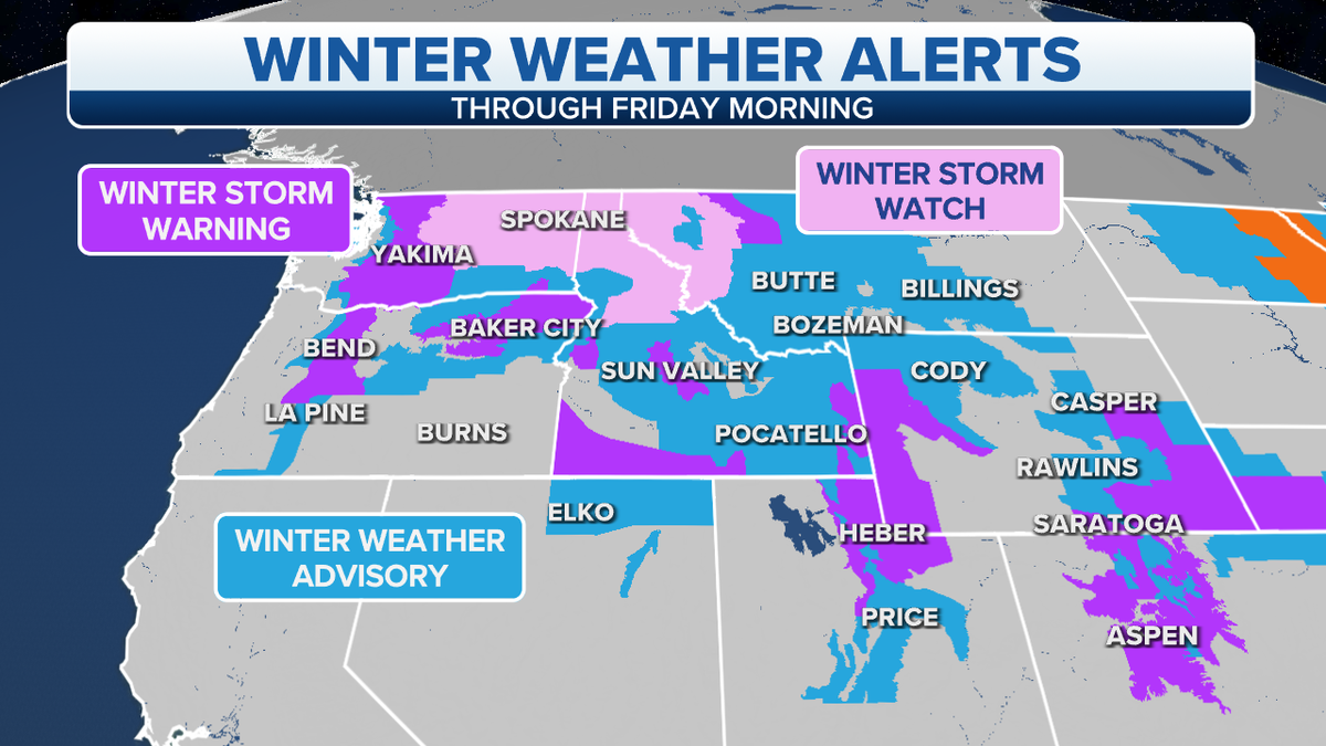
Winter weather alerts for Northwest (Credit: Fox News)
A separate storm strengthening over the northern Plains will bring a quick hit of snow and strong winds into the Midwest and Great Lakes.
Blizzard conditions are expected for the Dakotas into Minnesota.
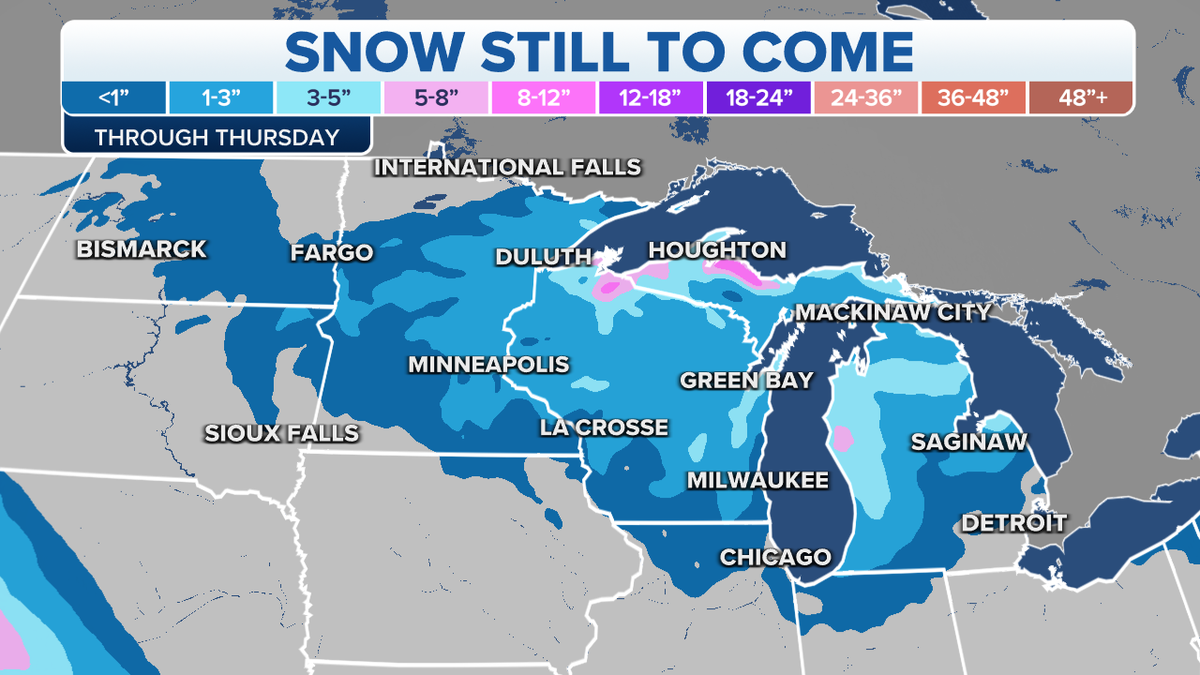
Snow still to come for Dakotas into Minnesota (Credit: Fox News)
Dangerous cold air will arrive behind this system with sub-zero daytime temperatures for the Plains and that will spread south and east.
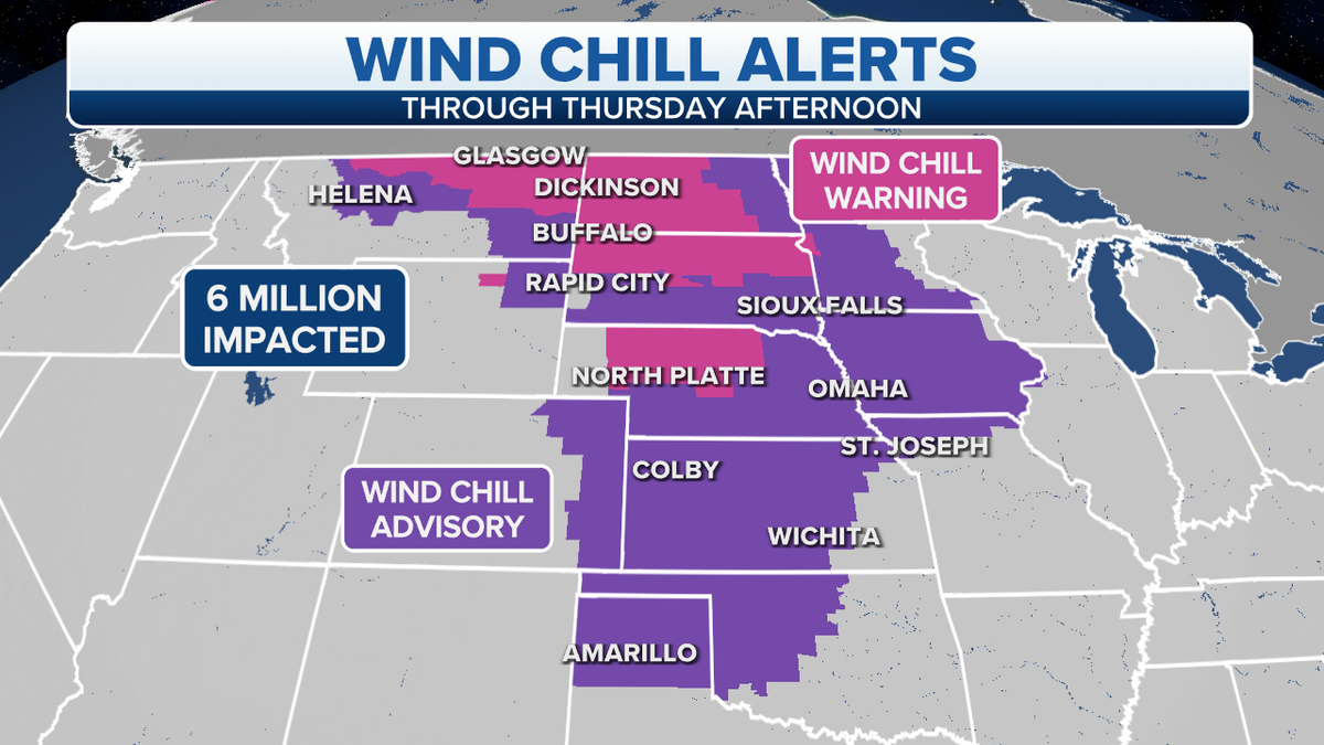
Wind chill alerts through Thursday afternoon (Credit: Fox News)
Meanwhile, a new storm is forecast to develop along that arctic cold front in the South.
This will become a pretty impressive storm and track along the East Coast bringing the risk for heavy snow, ice, strong winds and very cold temperatures.
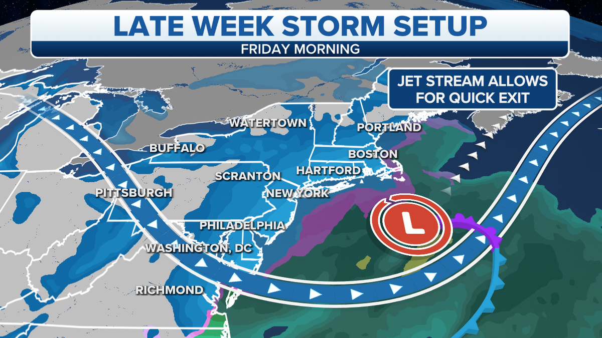
Northeast late week storm set-up (Credit: Fox News)
CLICK HERE TO GET THE FOX NEWS APP
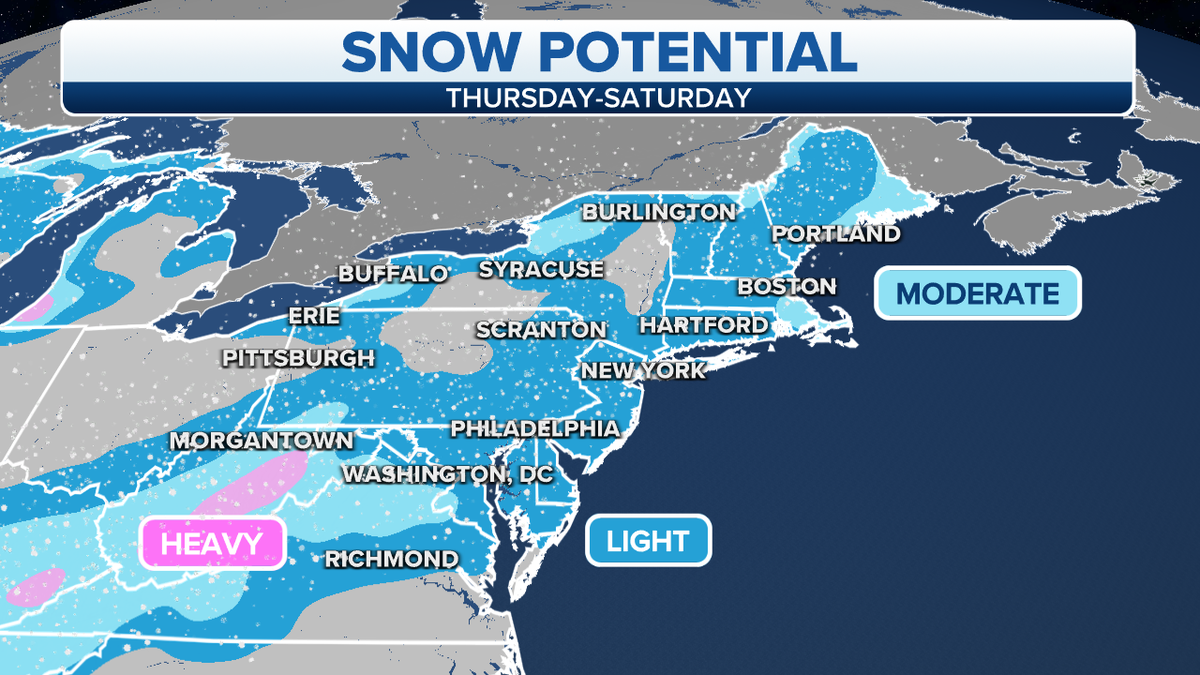
Northeast snow potential (Credit: Fox News)
This will also impact areas that are still digging out from over a foot of snow in the Mid-Atlantic.