


The active weather pattern in the center of the U.S. continues over the next several days.
Scattered showers and thunderstorms will persist across the Central and Southern Plains into Tuesday night.
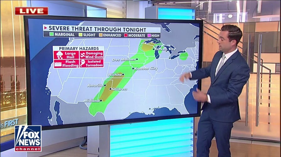
The Storm Prediction Center has highlighted a line from west Texas to Wisconsin as areas for potentially severe thunderstorms, while there is an enhanced risk for severe weather in portions of Kansas and Nebraska.
BIDEN DOUBLING FEMA FUNDING FOR THIS YEAR’S EXTREME WEATHER SEASON
The primary concerns are large hail, damaging winds, heavy rain and isolated tornadoes.
Furthermore, on Wednesday, a separate system of isolated and sometimes severe storms will move across the Midwest into the Northeast and Mid-Atlantic regions.
Heat across the eastern U.S. also is forecast to intensify Tuesday.
Mid-Atlantic states will be challenging record highs over the next several days.
CLICK HERE TO GET THE FOX NEWS APP
After one more cool day Tuesday, the Northeast will join the rest of the East on Wednesday with near record highs. Temperatures are expected to be in the 80s and 90s across the eastern U.S.
In contrast, cooler than normal temperatures continue for much of the western U.S.